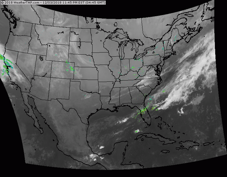
Satellite/radar shows basically cold dry pattern. System approaching west coast will head east and likely turn into a wintry storm for the south.
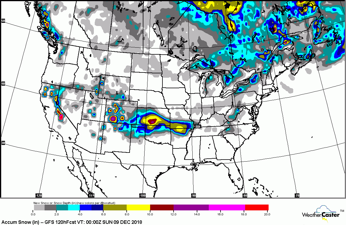
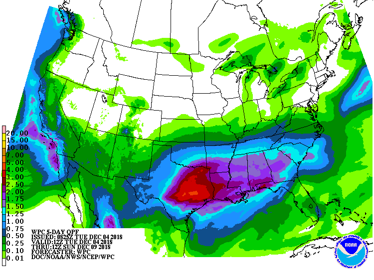
By this weekend the storm will be over the SOutheast. Most models say it will continue east and not up the coast....but there is another shot of energy in the Pacific that models are not picking up on yet. This system could merge with the southern one and turn it up the coast early next week. We will watch it. Below...expected snowfall for next 5 days...followed by expected rainfall for next 6 days.
By this weekend the storm will be over the SOutheast. Most models say it will continue east and not up the coast....but there is another shot of energy in the Pacific that models are not picking up on yet. This system could merge with the southern one and turn it up the coast early next week. We will watch it. Below...expected snowfall for next 5 days...followed by expected rainfall for next 6 days.
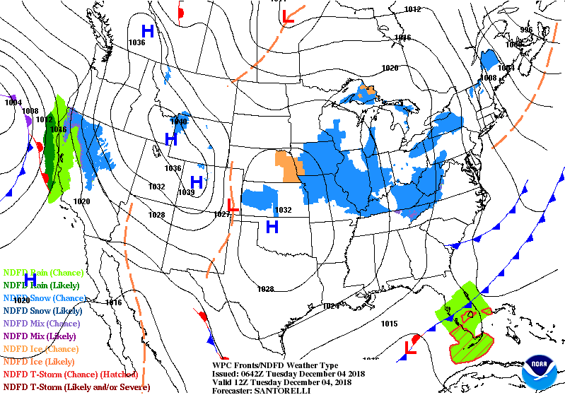
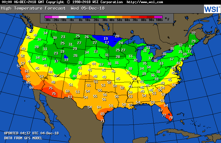
Below- animated maps for the next 2 days followed by high temperatures for Wednesday. Be safe.

 RSS Feed
