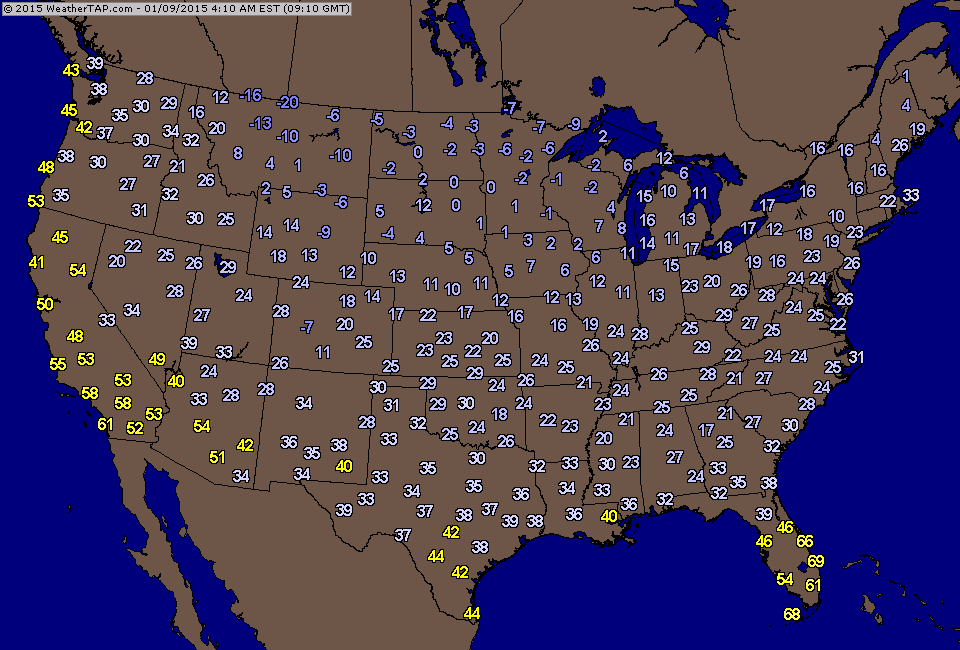
Above...temperatures as they stood at 4am this morning. On the average....some 10 to 20 degrees warmer than yesterday.

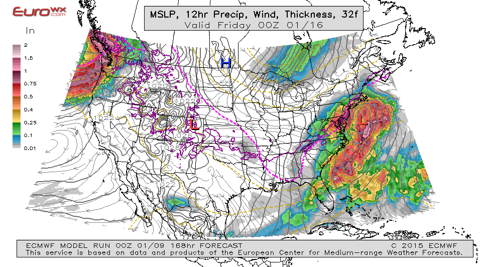
Satellite shows the next reenforcing surge of arctic air moving across The Northeast. Notice the swirl in the southwest. That upper air feature can and will play an important role in next week's weather which will be anything but nice.
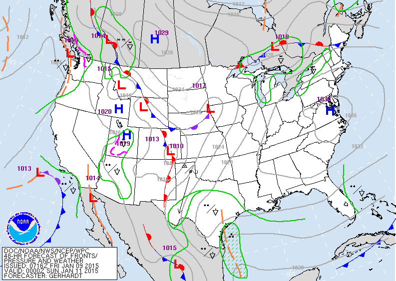
Map above is for Saturday nite. Cold High over the east...no problems. Some snow over Lakes. Moisture in Texas will be taken northeast and will likely result in a band of light wintry mix for mid Atlantic and Northeast Monday. Models stretch this system out...and then move it offshore...but the Euro is grabbing onto the shortwave coming out of southwest to make a bigger storm next Thursday. As I pointed out yesterday....it's on the right track. Today's GFS model is seeing this but as it's usual bias...keeps the storm off the East Coast. By Monday...there should be a better grab on the situation.

 RSS Feed
