Metro Weather Inc. Services
Like us, follow us, link to us, contact us!
  • Home
    • Daily Weather Discussion
  • Weather Prepared for You
    • Film and TV Production
    • Radio & Television
    • Government and Industry
    • Forensic Services >
      • Weather Record Request Form
    • Metro Morning Monitor
  • About Metro Weather
    • Senior Staff
  • Your Weather Images
  • Contact Us

Cold Wave Breaks...For How Long ?

1/8/2018

0 Comments

 
Picture
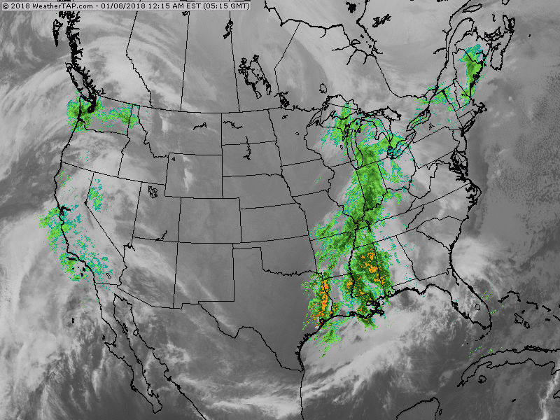
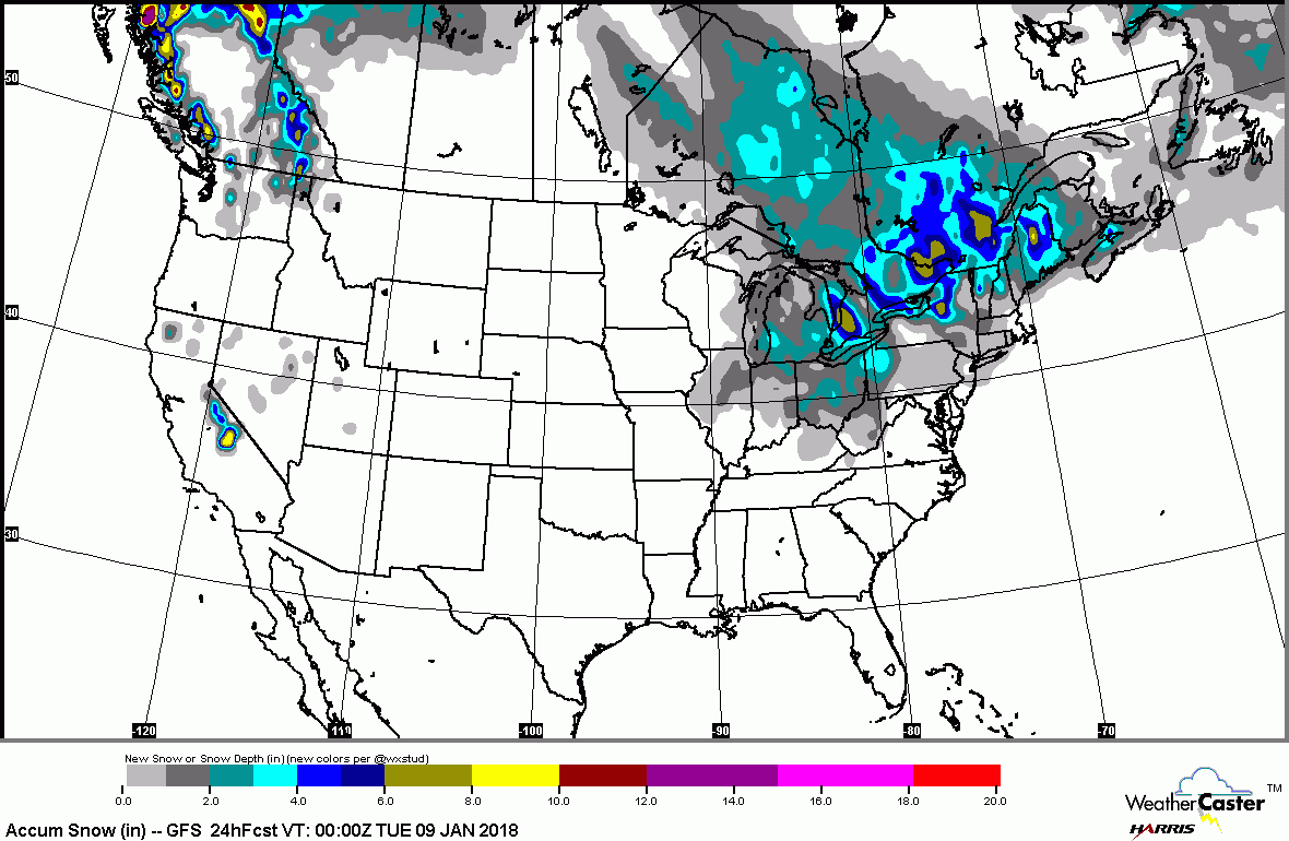
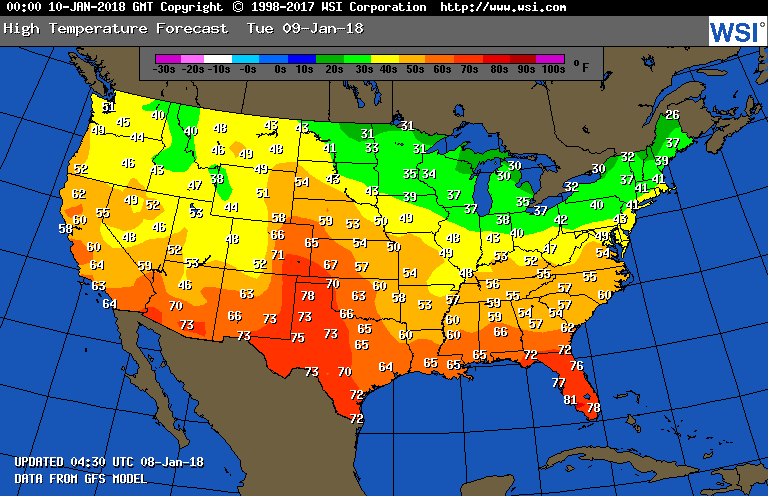
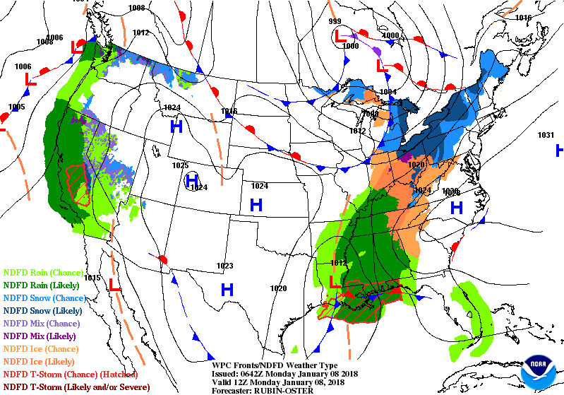
Satellite + radar shows a north-south area of snow..freezing rain and rain from Ohio Valley to Gulf. All moving to east coast by late today and out tonight. Southern rains will head north again late this week as it turns even milder. Colder air tries to return this weekend and depending upon how far south it reaches...ice could be a problem.  Below - totals snowfall accumulation forecast......followed by temperatures for Tuesday.
Picture
Picture
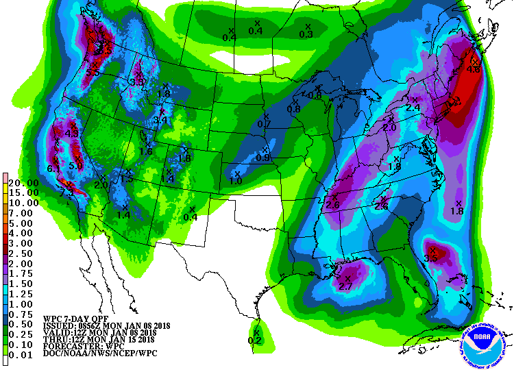
Below - animated maps for the next couple of days followed by amounts of precipitation over the next 7 days.
Picture
Picture
​Lastly - how temperatures will average over the next 7 days. Looks like the coldest weather Central....but will be headed eastbound.  For now..be safe.
0 Comments


Leave a Reply.

    Genesis of a Tornado
    We'll have daily weather discussions, talking about major systems on the horizon along with anything noteworthy that pops up on our radar.

    Pat Pagano,
    Mike Merin

    Follow us on Twitter and like us on Facebook to get updates whenever we post a new entry!

    RSS Feed

Powered by Create your own unique website with customizable templates.