Small storm seen off The Georgia coast will moving northeast and should stay in Ocean. Cold front moving across The Great Lakes will usher in colder air late week for The East but not as bad as Central sections.
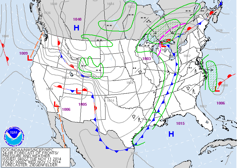
Map above shows cold front by late today...most of the snow north - Great Lakes into Canada.
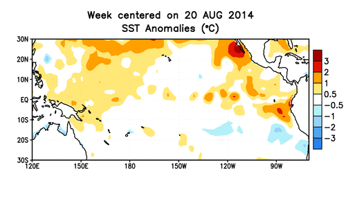
Map above shows sea surface temperatures. Far right you will see Mexico and Central America. This shows a band of warmer temps. which could be a weak el nino....could be a big factor in the winter ahead.
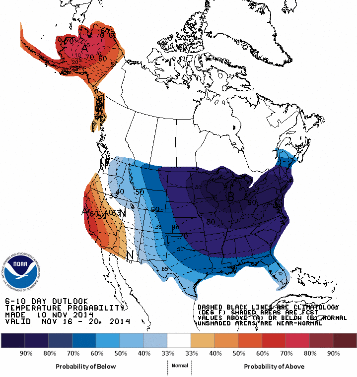
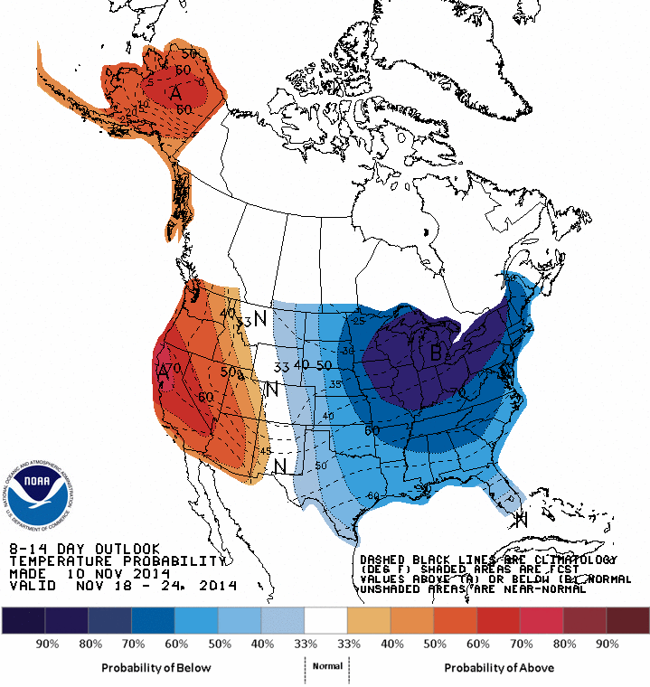
Map above shows how temperatures will average Nov. 16-20.....blue = cold / red = warm, below map for Nov. 18- 24.
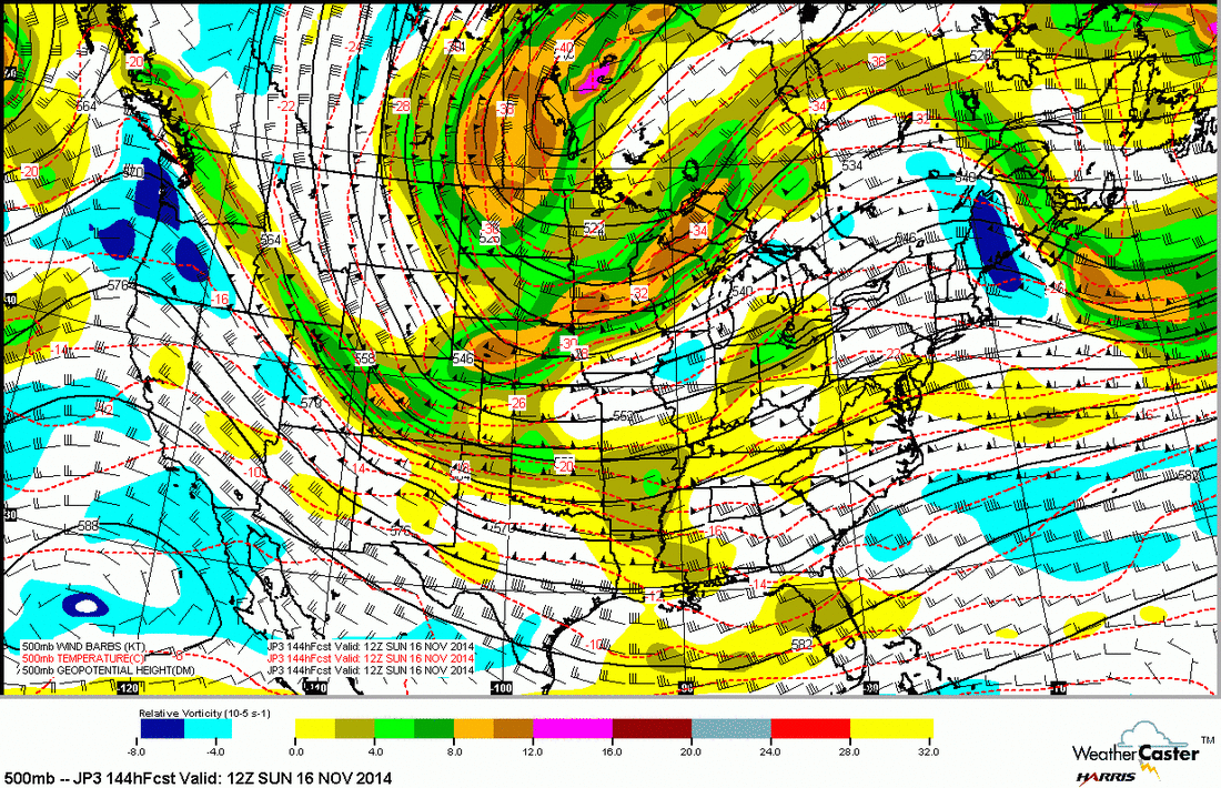
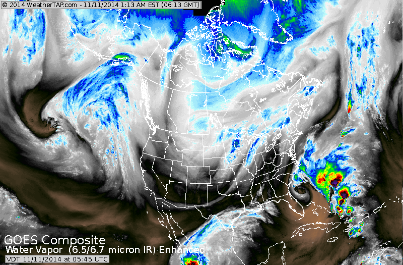
Above, upper air map for Sunday. Jet stream flows down The Rockies and back up The Appalachians. The dip represents where the coldest air will be (center)...all of which should change and shift east next week. Until then...be safe.

 RSS Feed
