
Cold air covers much of the Nation...and just how intense it is by this weekend will determine who gets the big snows. Two jet streams..one you can see swirling away off California....the other firing down the Rockies. These 2 will phase and a storm heads into Ohio Valley Saturday and then transfers off the coast as a nor'easter. To add wood to the fire...the northern jet will jump in and help to explode the storm off New England...who will likely get the biggest punch.
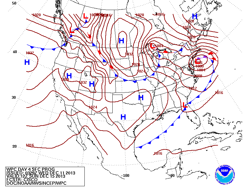
This map shows the exploding storm south of Long Island Sunday...and the arctic low ready to dive in. These systems do not always behave as you would want...and often can bring as much ice...rain...as snow. Where that line sets up is hard to call right now...but if you are at least
75 miles aways from the shore..you could almost bet on more snow and ice than rain.
75 miles aways from the shore..you could almost bet on more snow and ice than rain.
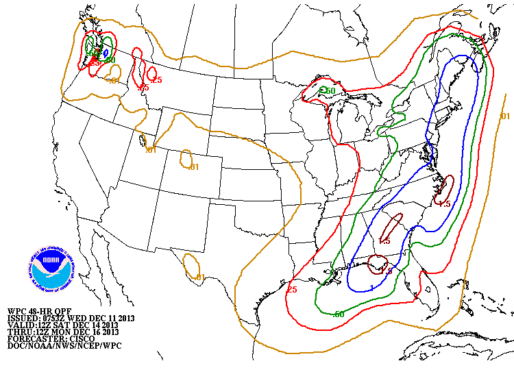
This map shows how much liquid could fall this weekend. General...I mean general...rule....10" of snow for every 1" of liquid....you do the math.
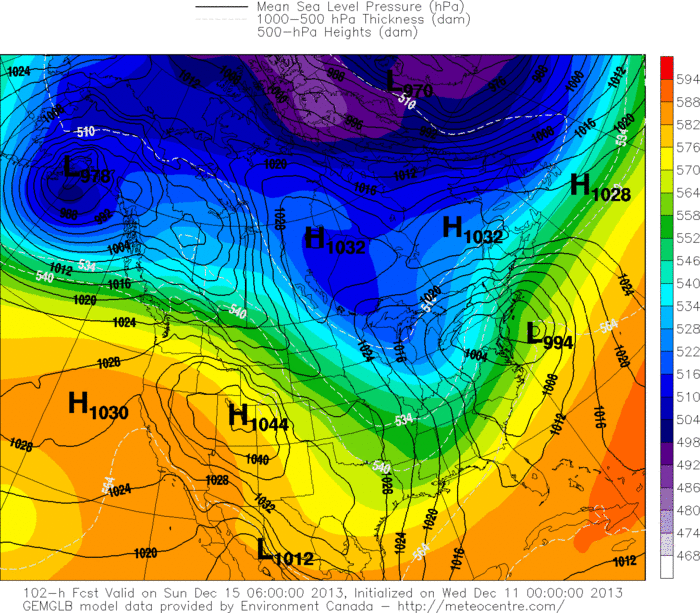
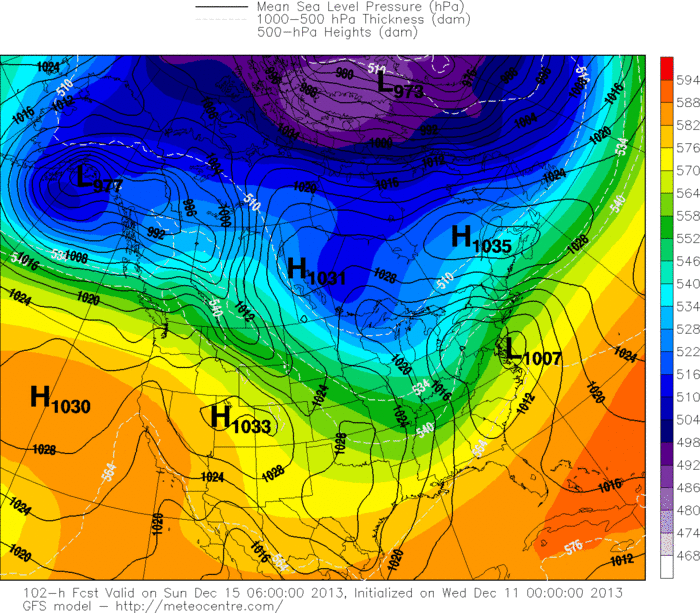
Above....Canadian model...then GFS Model. It's 5 days in advance of a storm and they are amazingly in same ball park. More on this tomorrow. Later.

 RSS Feed
