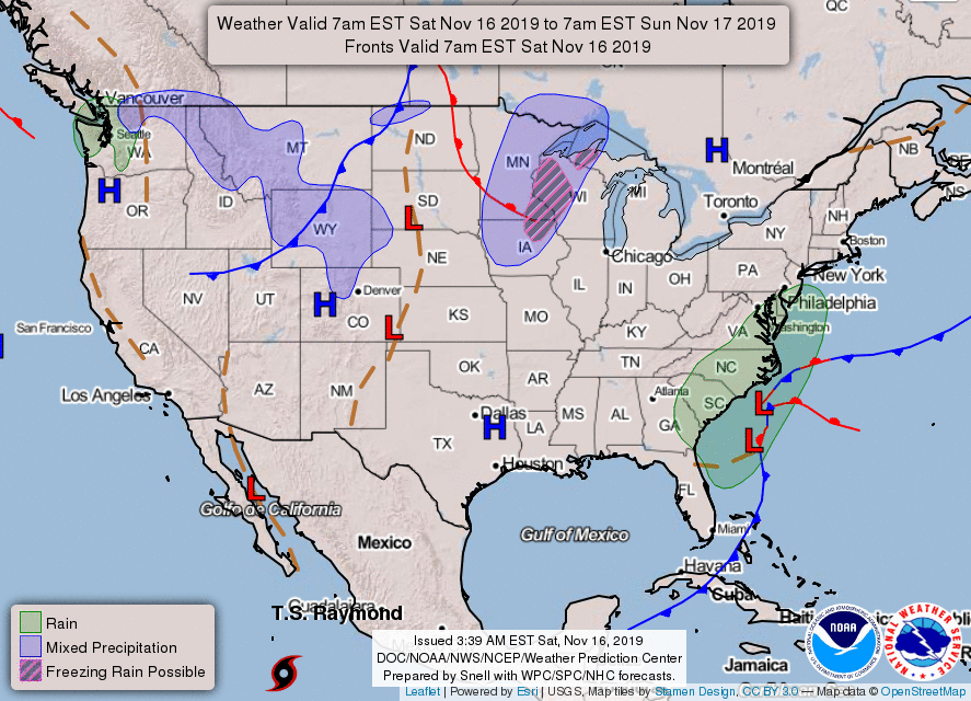
A coastal storm will bring heavy rains, high winds and rough surf to the Outer Banks this weekend. A developing low will deepen and move northward over the next few days. Very localized flash flooding may be possible as well, although the majority of the heaviest rainfall looks to occur offshore. It will finally begin lifting away from the coast late Sunday before affecting parts of the Northeast with showers on Monday.

High pressure moving into the eastern U.S. as the coastal storm departs will allow cooler air to settle into the region. High temperatures may be 10 to 20 degrees below average this weekend and that general trend looks to continue over the next 7-10 days.
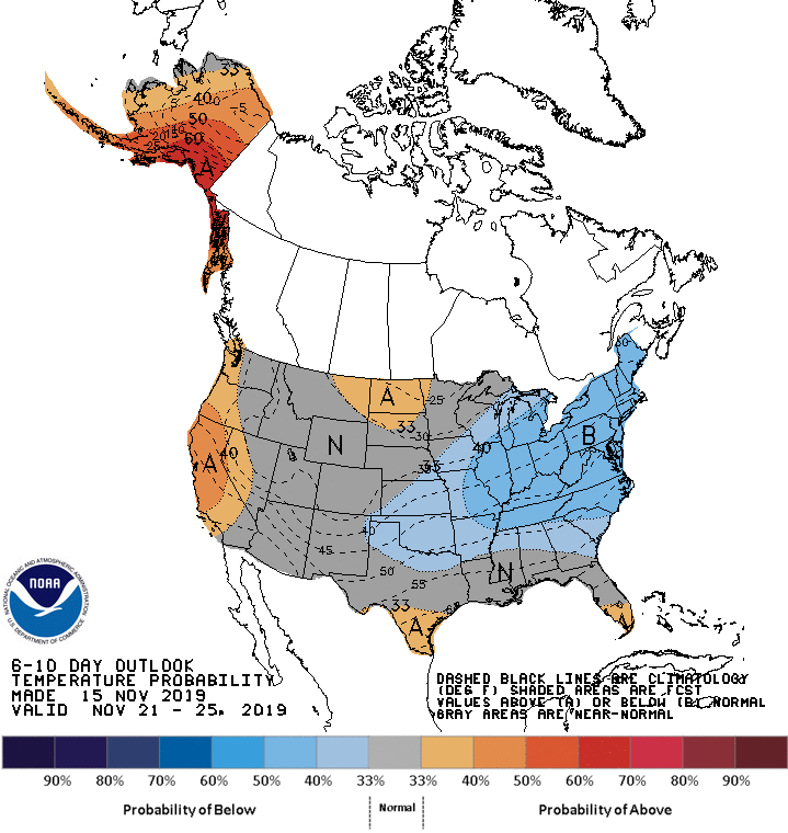
As for Western parts of the country, most places will continue to experience above average temperatures courtesy of a high pressure ridge.Some rain can be expected across the immediate Pacific Northwest Coast which in turn will bring snow to areas of higher elevation inland. Periods of scattered rain and snow showers can be expected from the Northern Rockies, High Plains and into the Great Lakes region. Any accumulations here will be on the light side.
Have a great weekend!
Have a great weekend!

 RSS Feed
