
EARLY A.M. SATELLITE SHOWS MOISTURE STREAKING NORTHEAST ACROSS THE APPALACHIANS...AND ALTHOUGH THE STORM WILL BE OFFSHORE...IT WILL BE CLOSE ENOUGH TO BRING HEAVY SNOW FROM COASTAL CAROLINA TO SE VA., TO SOUTHERN DELMARVA. THOSE PLACES WILL GET 4-8". SOUTHERN N.J. COULD SEE 4"...WHILE LONG ISLAND WILL GET 1"-4"....INCLUDING SE NEW ENGLAND COAST.
ALL OF THIS HAPPENING LATER TODAY AND TNTE.
ALL OF THIS HAPPENING LATER TODAY AND TNTE.
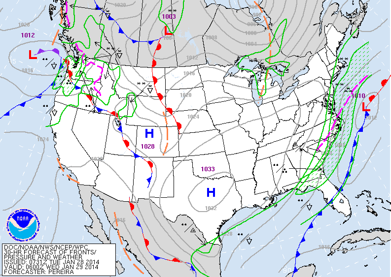
THE MAP ABOVE SHOWS THIS STORM WELL OFFSHORE...BUT THE VEIL OF SNOW HUGS THE COAST. TRICKY...SOMETIMES COASTAL AREAS CAN GET ALOT MORE THAN WE ARE FORECASTING. SEE THE MESS OUT WEST...THAT'S WEATHER FOR THE EAST LATE SATURDAY..SATURDAY NITE...HOPEFULLY GONE BY SUPERBOWL.
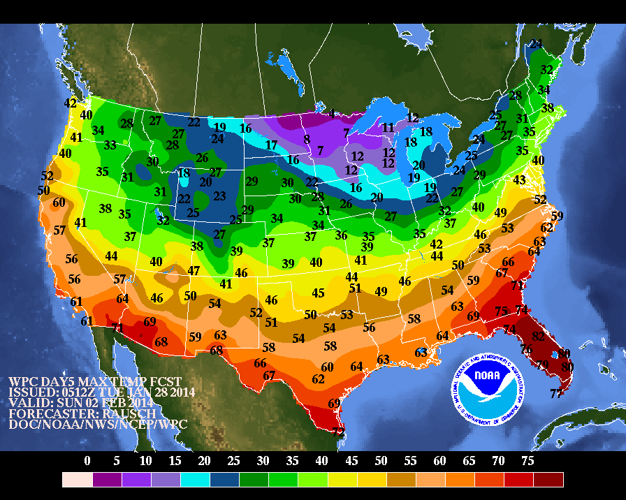
THESE ARE PROJECTED HIGHS FOR SUPERBOWL SUNDAY. MID 30S FOR NEW JERSEY. QUESTION TODAY.....IS: WILL THE SATURDAY NIGHT SYSTEM KICK OUT EARLY ALLOWING ANY CLEAN UP..TO TAKE PLACE.....OR WILL THERE BE A SECOND LOW FORMING ON FRONT TO
INTRODUCE ANOTHER ROUND OF PRECIP. STAY TUNED.
INTRODUCE ANOTHER ROUND OF PRECIP. STAY TUNED.

 RSS Feed
