Metro Weather Inc. Services
Like us, follow us, link to us, contact us!
  • Home
    • Daily Weather Discussion
  • Weather Prepared for You
    • Film and TV Production
    • Radio & Television
    • Government and Industry
    • Forensic Services >
      • Weather Record Request Form
    • Metro Morning Monitor
  • About Metro Weather
    • Senior Staff
  • Your Weather Images
  • Contact Us

Christmas Weekend - Bitter Cold Central - Wet East and South - Dry West

12/19/2017

0 Comments

 
Picture
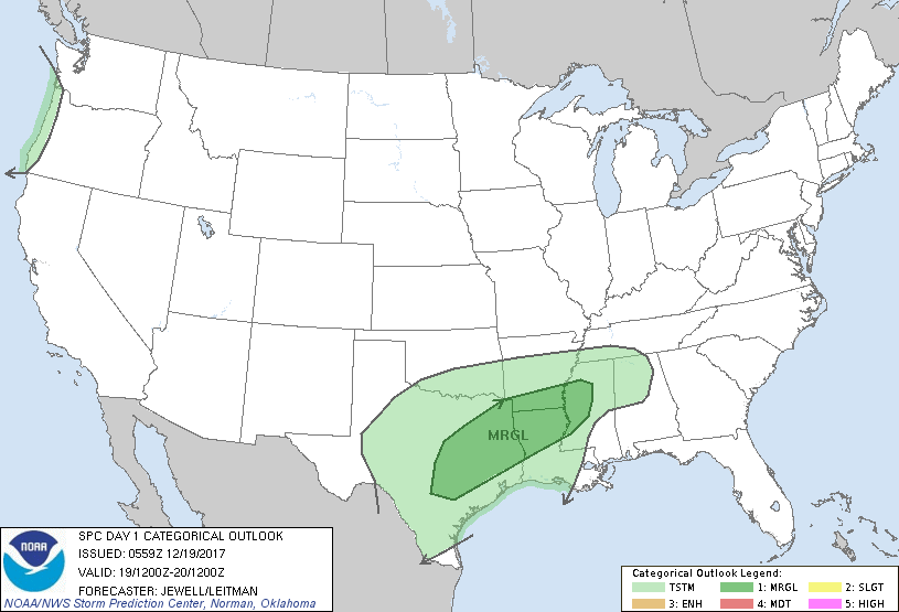
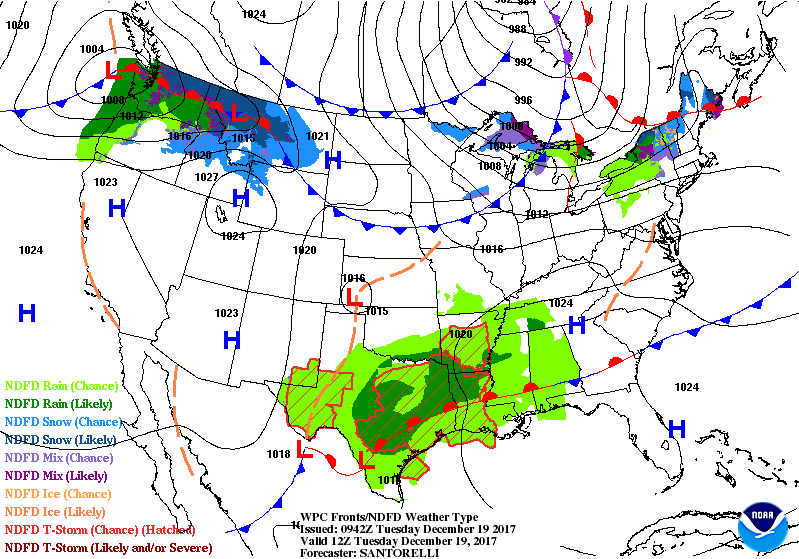
Satellite - radar still showing 2 jet streams. Southern jet will head north over weekend to bring wetness north...northern jet will bring bitter cold air to Northern Plains. Below - today's outlook for severe weather...in dark green.
Picture
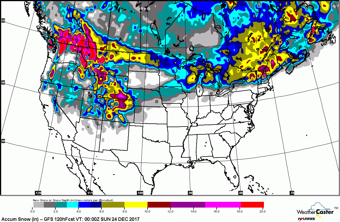
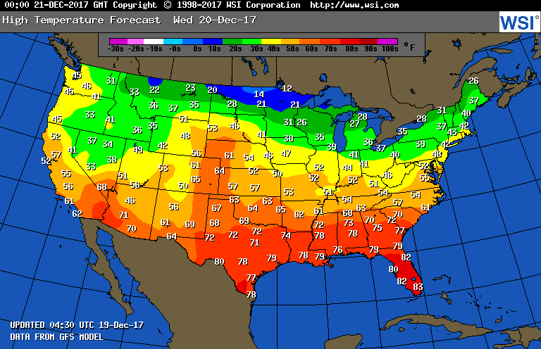
​Below...forecast for snow accumulations over the next 5 days...followed by temperatures for Wednesday.
Picture
Picture
Below - GFS Model for Christmas Day.
Picture
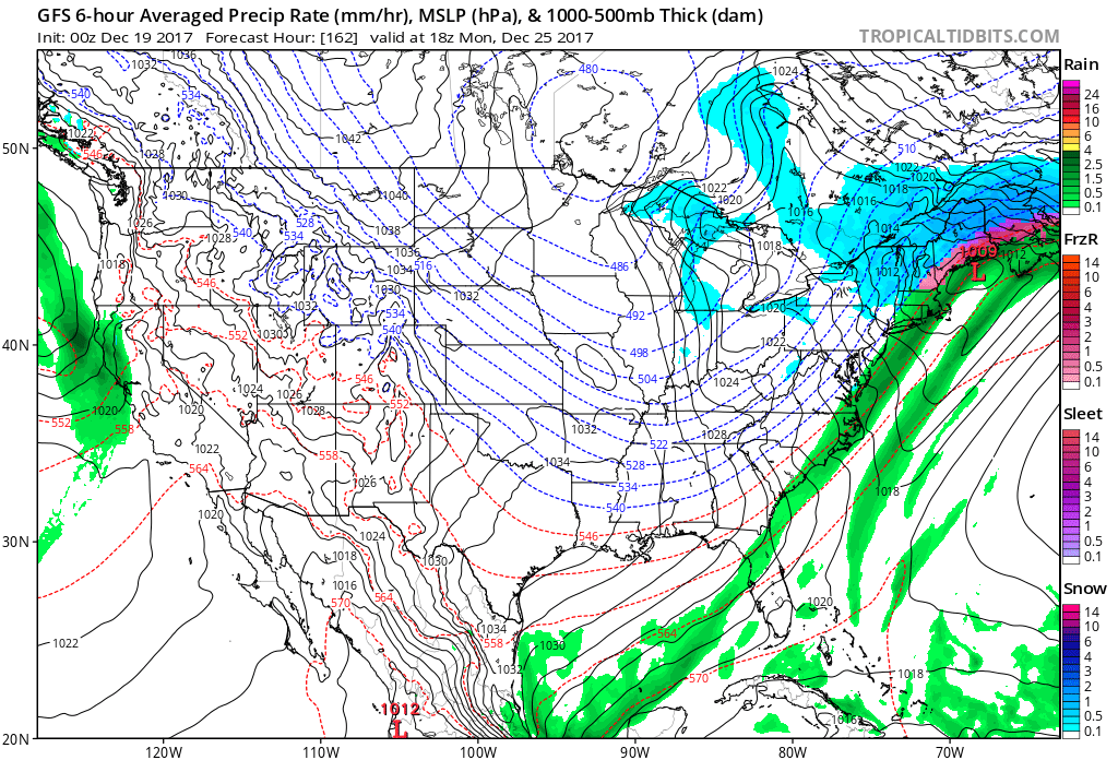
Totally based on above...snow from Great Lakes into Northern New England....rain from Central New England down the coast.  It will change. Below...animated maps for next 2 days.  Be safe.
Picture
0 Comments


Leave a Reply.

    Genesis of a Tornado
    We'll have daily weather discussions, talking about major systems on the horizon along with anything noteworthy that pops up on our radar.

    Pat Pagano,
    Mike Merin

    Follow us on Twitter and like us on Facebook to get updates whenever we post a new entry!

    RSS Feed

Powered by Create your own unique website with customizable templates.