Metro Weather Inc. Services
Like us, follow us, link to us, contact us!
  • Home
    • Daily Weather Discussion
  • Weather Prepared for You
    • Film and TV Production
    • Radio & Television
    • Government and Industry
    • Forensic Services >
      • Weather Record Request Form
    • Metro Morning Monitor
  • About Metro Weather
    • Senior Staff
  • Your Weather Images
  • Contact Us

Changing Patterns....

9/2/2015

0 Comments

 
Picture
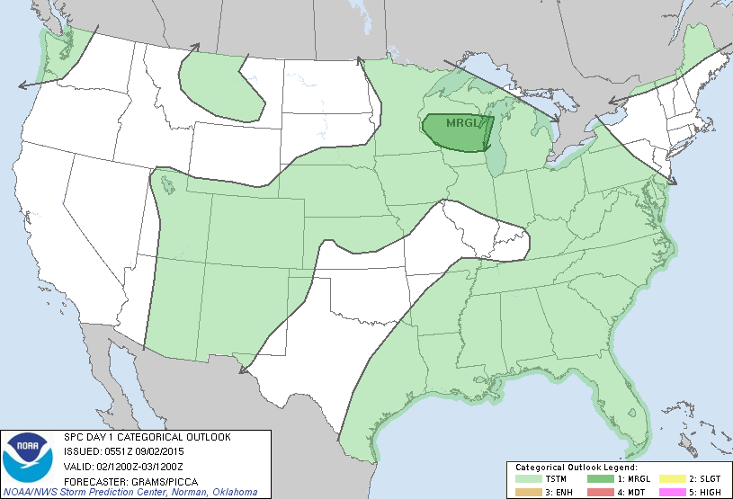
Strong storms in upper Midwest....across Louisiana...otherwise wetter and cooler for Pacific Northwest. Below....severe threat today....dark green.
Picture
Below...weather map for late today.  Cold front coming down from Canada will bring a break in heat and humidity to Northeast and Mid Atlantic this weekend.
Picture
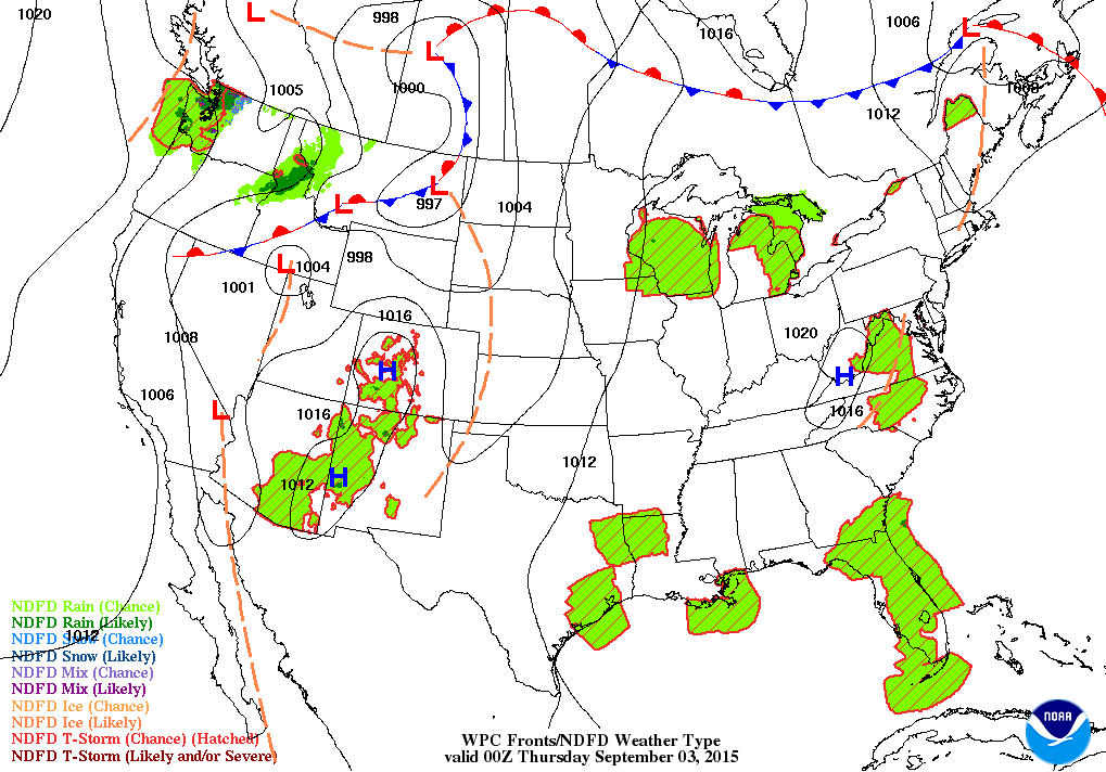
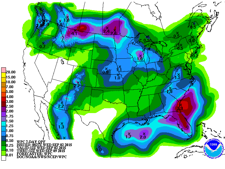
Chart below shows rainfall amounts over the next 7 days.

Picture
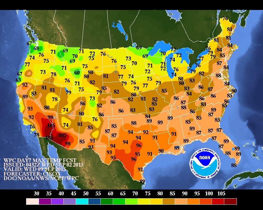
Below...high temperatures for next Wednesday....announcing a cool down.
Picture
Picture
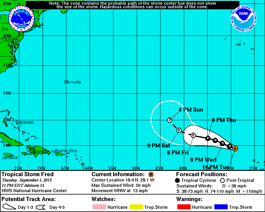
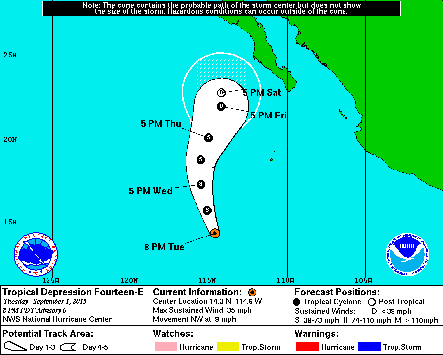
Above...Fred is still a tropical storm and will stay in the Atlantic. Below....tropical depression south of Baja Ca.,
will head north. Will it bring needed rain to California....need to wait and see.   Be safe.
Picture
Picture
0 Comments


Leave a Reply.

    Genesis of a Tornado
    We'll have daily weather discussions, talking about major systems on the horizon along with anything noteworthy that pops up on our radar.

    Pat Pagano,
    Mike Merin

    Follow us on Twitter and like us on Facebook to get updates whenever we post a new entry!

    RSS Feed

Powered by Create your own unique website with customizable templates.