Metro Weather Inc. Services
Like us, follow us, link to us, contact us!
  • Home
    • Daily Weather Discussion
  • Weather Prepared for You
    • Film and TV Production
    • Radio & Television
    • Government and Industry
    • Forensic Services >
      • Weather Record Request Form
    • Metro Morning Monitor
  • About Metro Weather
    • Senior Staff
  • Your Weather Images
  • Contact Us

Changes In The Making

11/14/2016

0 Comments

 
Picture
Rain over The Carolinas will head north to affect the East Coast over the next 24-36 hours. System in the Northwest will evolve into a major storm this week as it track slowly east - not reaching East Coast until late weekend.
Picture
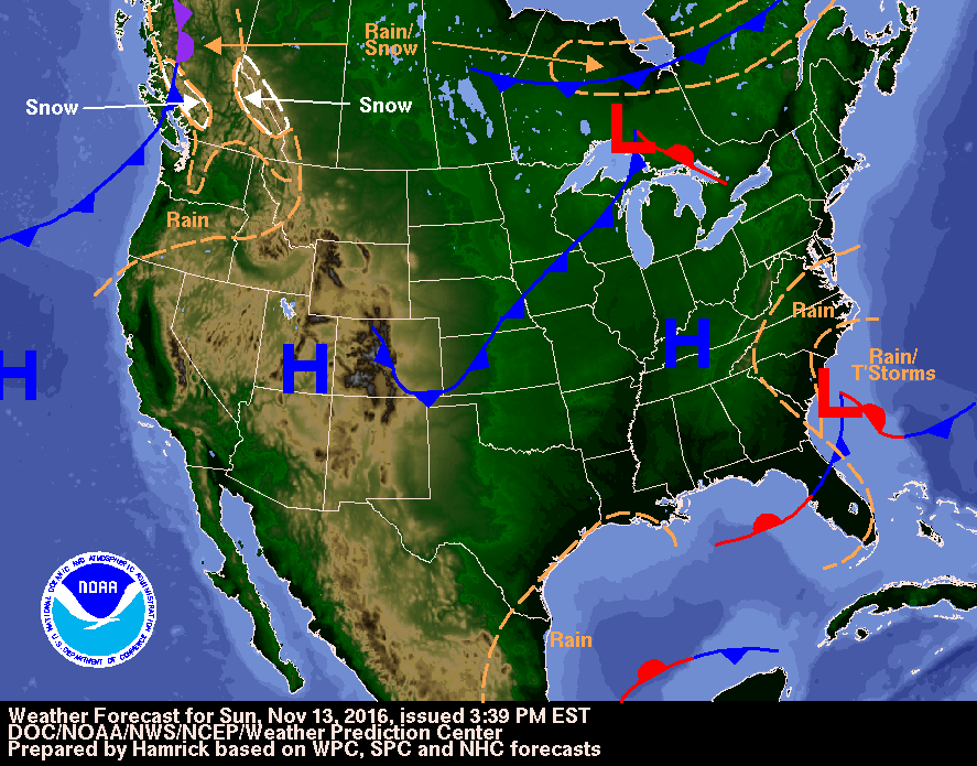
Map for today ...showing two main areas of wetness...Carolinas and Pac. NW.  Below....various models projecting storm now in the NW....arriving in the East for this Sunday. The blue indicated...mean wintry precip...like snow. 
Picture
Picture
Picture
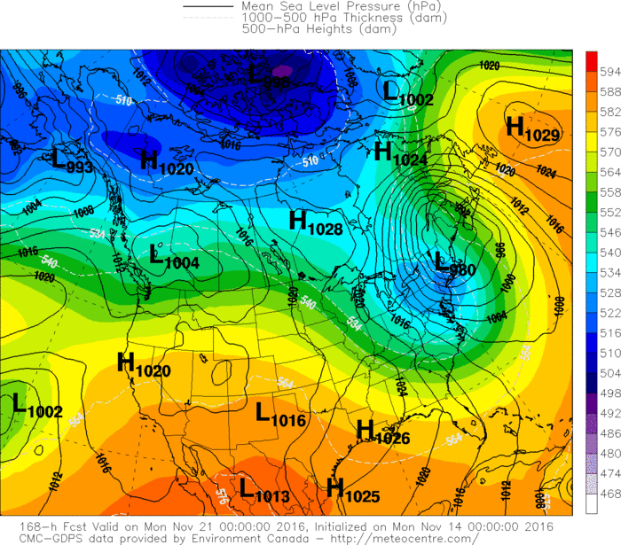
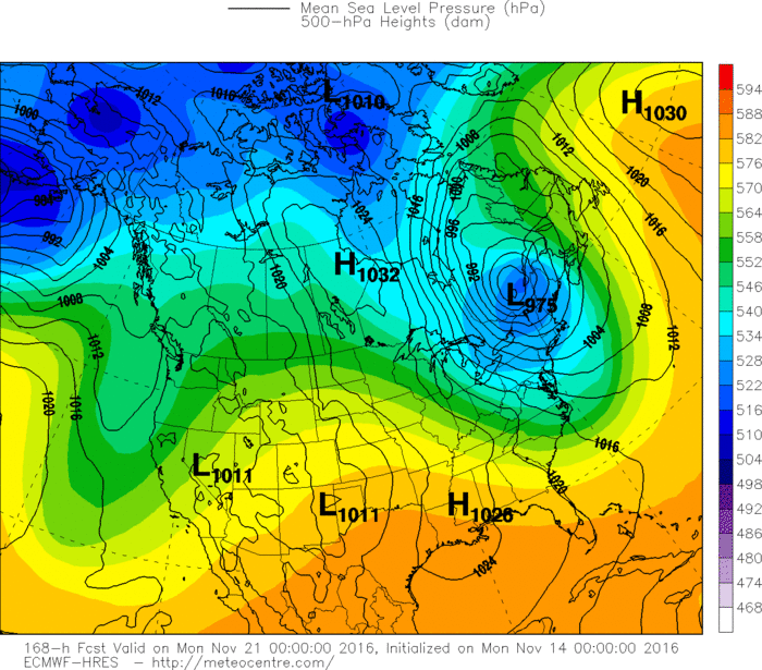
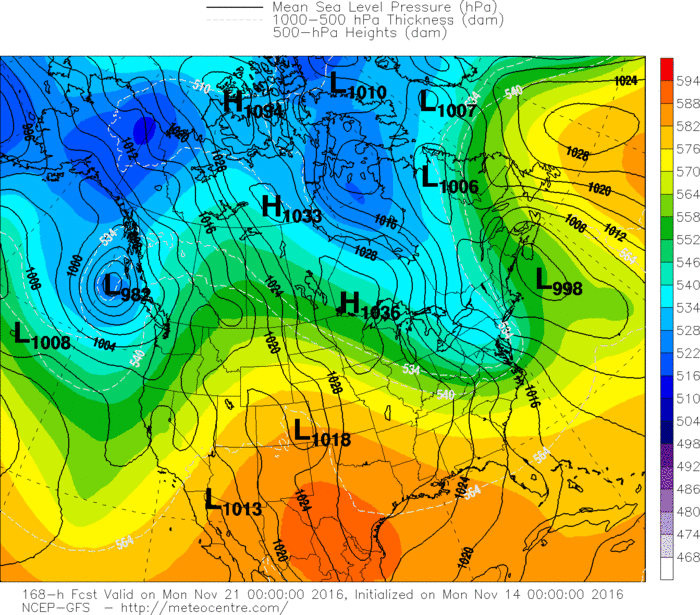
​Sunday's storm in the East could set the stage for a chilly Thanksgiving.  For now...be safe.
0 Comments


Leave a Reply.

    Genesis of a Tornado
    We'll have daily weather discussions, talking about major systems on the horizon along with anything noteworthy that pops up on our radar.

    Pat Pagano,
    Mike Merin

    Follow us on Twitter and like us on Facebook to get updates whenever we post a new entry!

    RSS Feed

Powered by Create your own unique website with customizable templates.