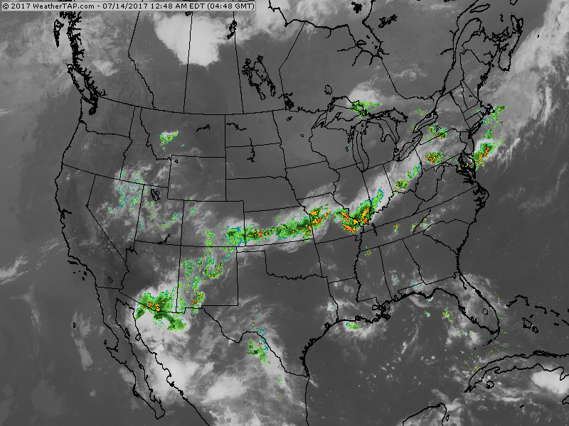
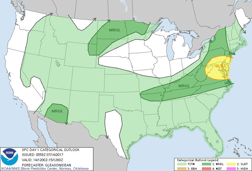
Satellite-radar pix shows storms from the Southwest to Northeast. Areas shifts south over weekend and then back north. Below...today's risk of severe weather in dark green...yellow.
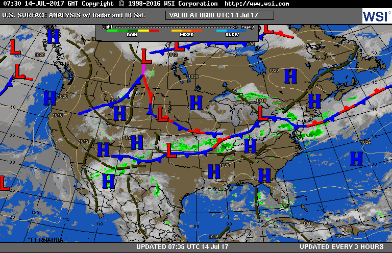
Below....today's weather map....followed by animated maps for the weekend.
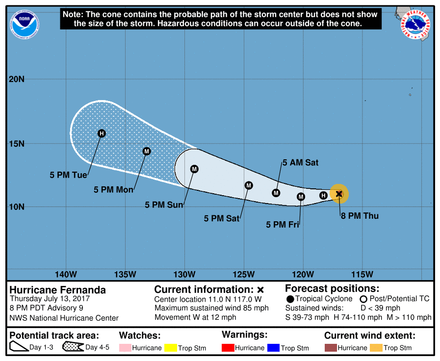
Below- track and satellite picture of Hurricane Fernanda...in Pacific off Mexico.

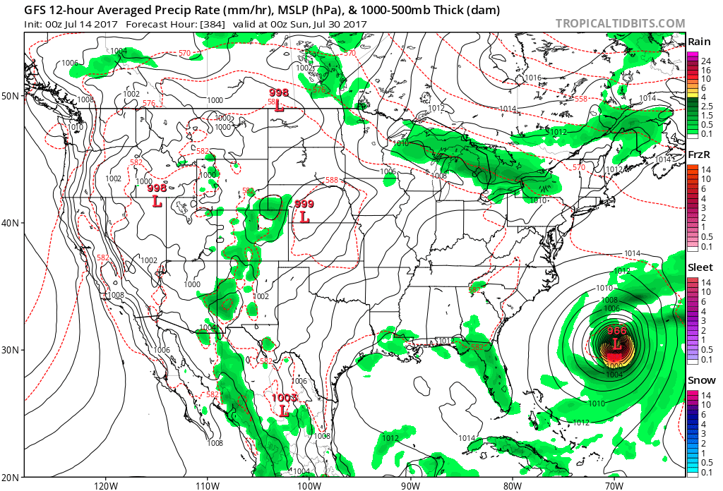
Finally...GFS Model doing it again...trying to boil up a hurricane by end of July. If there is one...anyone's guess where it will be. On vacation next week...see ya then....be safe.

 RSS Feed
