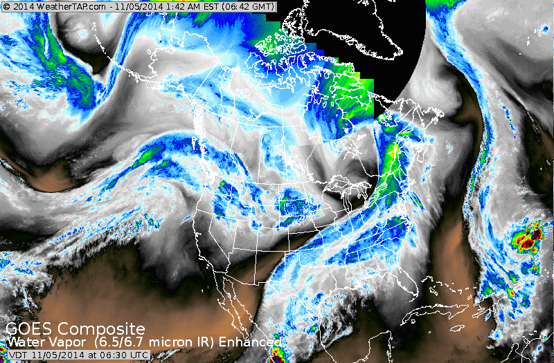
Cold front stretches from Western New York to Texas. The enhanced colors south of Texas is what's left to Vance. His moisture being pulled northeast by cold front. System over The Dakotas will merge with the front and produce wet weather in The East Thursday.....moving out Friday.
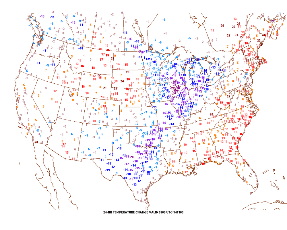
This map shows temperature change in last 24 hours. Click on map to enlarge. You will notice that the blue/purple indicate a turn to colder....which ties in perfect with the front.
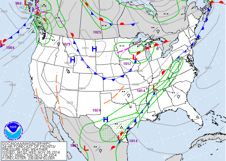
This map is valid for late Wednesday. Wettest weather from
Texas to Appalachians.
Texas to Appalachians.
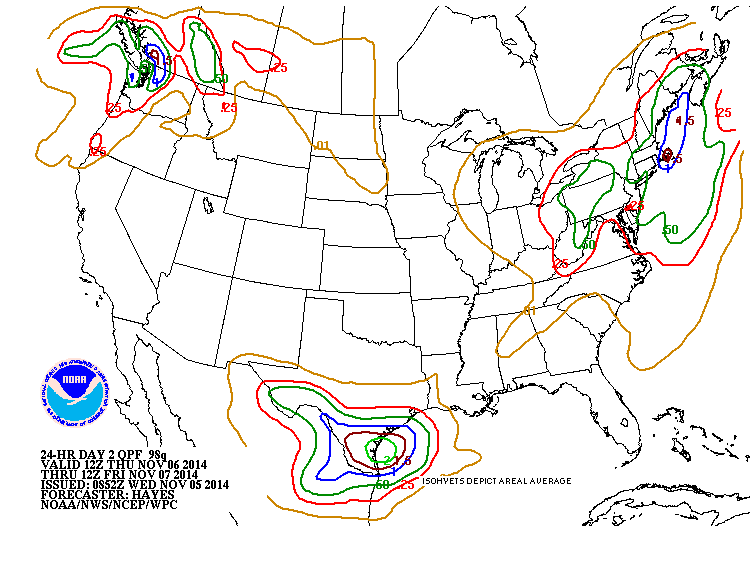
Amounts of rain expected Thursday ----> Friday. Heaviest will be Northeast...Northwest....and So. Texas. There is still a big question as to whether a storm in the Gulf of Mexico will travel up the Eastern Seaboard Sunday with more rain. Next week will see a record breaking cold air mass drop into the mid section of the nation and then move east. Be safe.....later.

 RSS Feed
