EL NIÑO/SOUTHERN OSCILLATION (ENSO) DIAGNOSTIC DISCUSSION issued by CLIMATE PREDICTION CENTER/NCEP/NWS and the International Research Institute for Climate and Society 13 August 2015 ENSO Alert System Status: El Niño Advisory Synopsis: There is a greater than 90% chance that El Niño will continue through Northern Hemisphere winter 2015-16, and around an 85% chance it will last into early spring 2016.
This latest advisory issued by The Climatic Center is alarming as such a prediction could impact weather across the U.S. for along time should it prove accurate.
This latest advisory issued by The Climatic Center is alarming as such a prediction could impact weather across the U.S. for along time should it prove accurate.

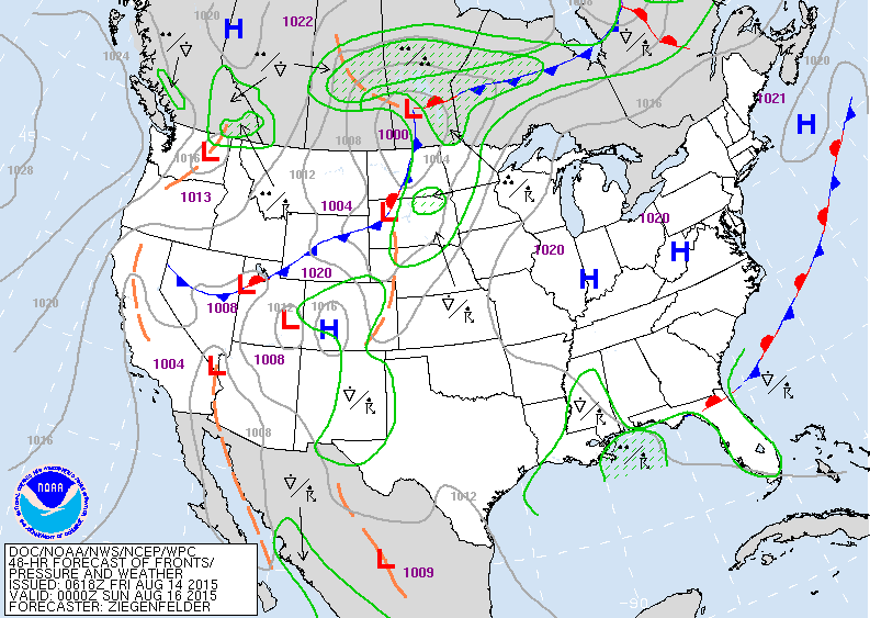
Satellite/radar shows some storms from Great Lakes to Colorado......Florida...Inter-mountains out west. This pattern will change little and more than little only persist through much of next week. Below...map valid for Saturday night...which pretty much speaks for the entire weekend.
Areas of greatest rainfall...upper Midwest and Southeast.
Areas of greatest rainfall...upper Midwest and Southeast.
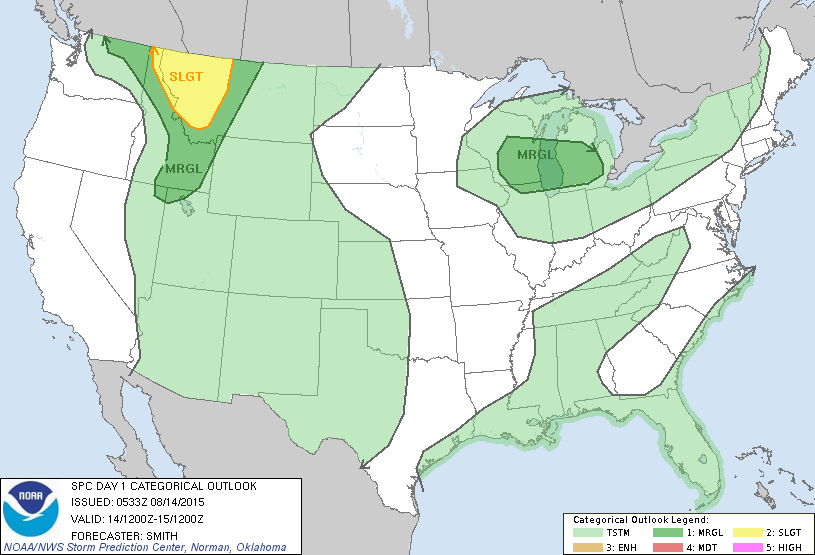
Below....risk of severe thunderstorms today in dark green and yellow.
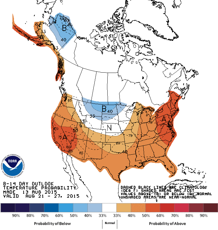
Below...map showing how temperatures will average through August 27th ! Be safe and have a nice weekend.

 RSS Feed
