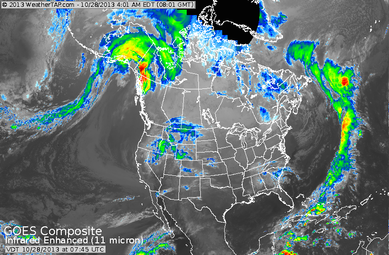
Satellite pictures show the beginnings of a new storm in The Rockies...but elsewhere..not much. Keep you eye on the lower left of the screen...Hurricane Raymond. Turning north then northeast and even though weakening...his moisture will get caught in jet stream and head across the Nation with next storm and cold front. It should bring some much needed rain to a good part of our Nation by late week.
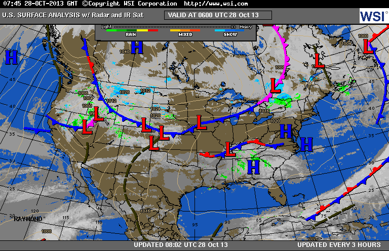
You can see the clouds from Raymond fanning across So. Baja Ca., and Mexico.....while the next storm enters Utah and Wyoming.
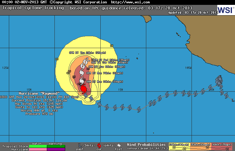

Top map...Raymond and his expected track. Just above...Satellite pix showing Raymond....still a well formed storm.
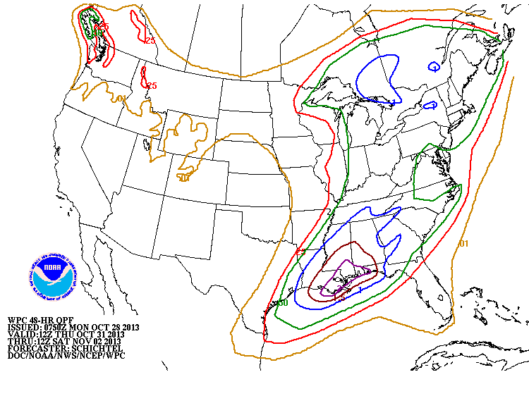
This chart shows amount of precipitation that could fall from Thursday into Saturday morning. Blue indicates 1"....Gulf Coast gets 2".....most other places receive at least 1/2" or more...making it the most generous event in quite some time over a large portion of real estate.
Later.
Later.

 RSS Feed
