
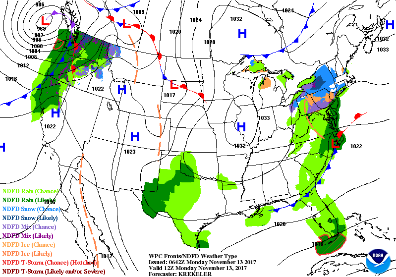
Satellite - radar above shows 1 - area of light rain Northeast and Mid Atlantic. Tropical disturbance south of Cuba.....moisture moving into the Southwest...large storm moving into the Northwest. Below - animated maps showing how these systems will move over the next 2 days
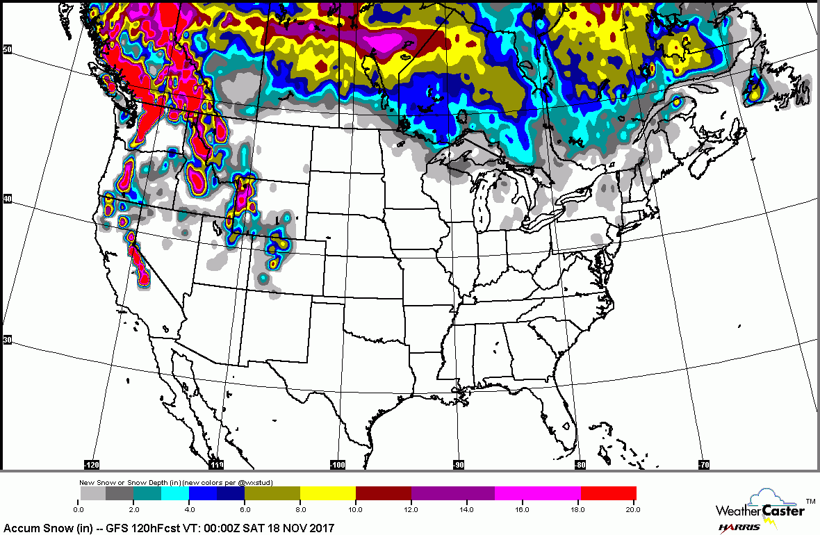
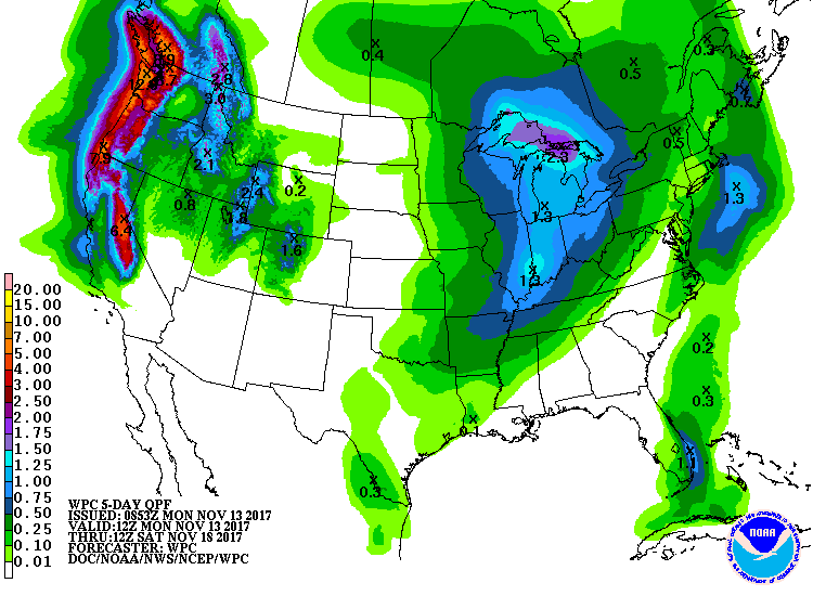
Below - maps show expected snowfall for next 5 days....followed by expected rainfall for next 5 days.
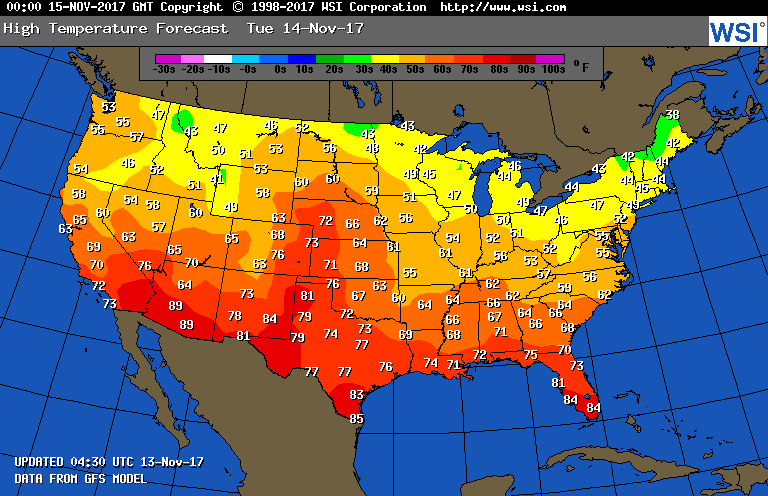
Below - expected high temperatures for today.
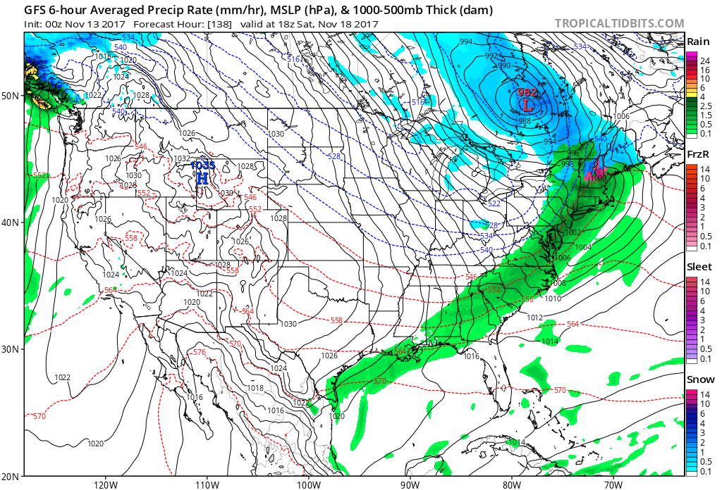
Lastly...GFS Model for this Saturday ...showing deep storm in Lakes with a very wet front down to The Gulf. This system will be a major storm for many parts of the country. More through the week. Be safe,

 RSS Feed
