
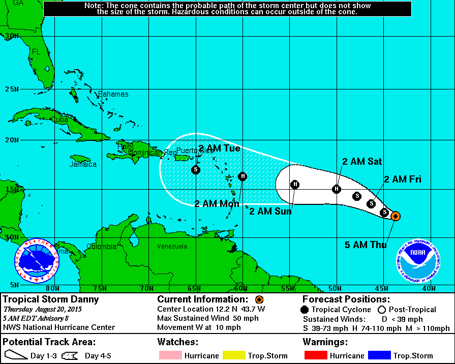
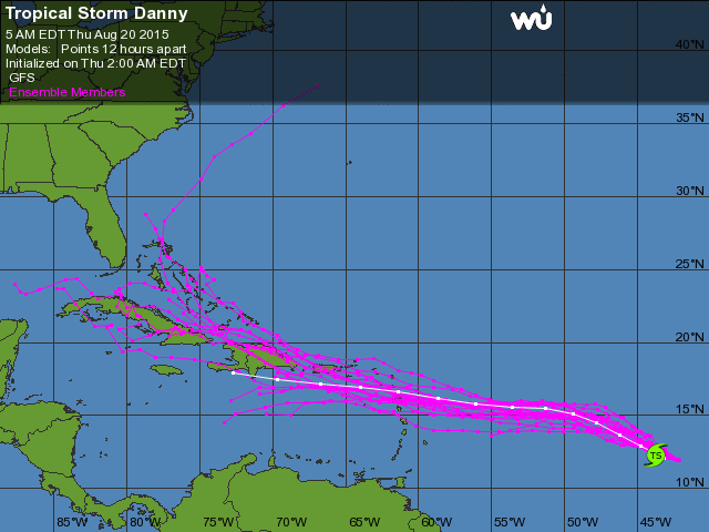
Tropical Storm Danny - south central Atlantic...has good form but a lack of deep convection in the center. Storm has 50 mph winds and moving west. Below...track from Hurricane Center...toward Puerto Rico by early next week and below that...models showing their take into next week.

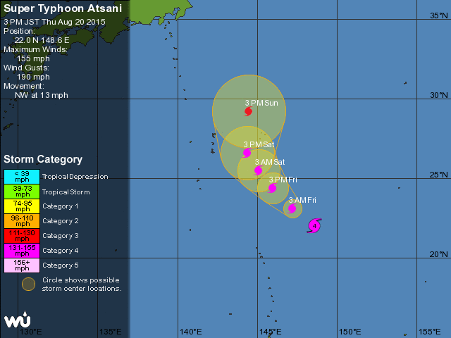
Typhoon Atsani - 155 mph winds - should stay just east of China and Japan - track below.

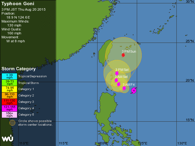
Typhoon Goni - 130 mph winds - will affect China and Japan....it's track just below.
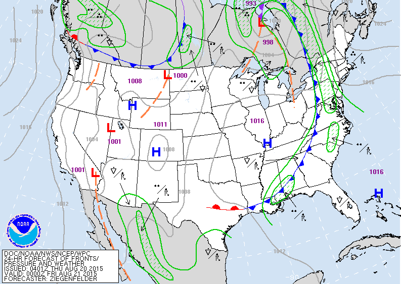
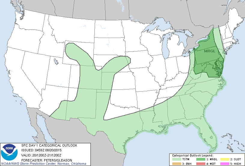
Map for this evening showing cold front over the Appalachians with showers and storms ahead of it. Dry for most of the rest of the Nation. Below...severe risk for thunderstorms today in dark green.
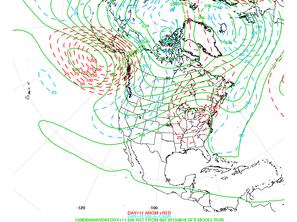
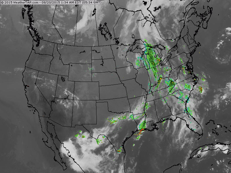
This is a projection of the upper air for the start of September. If this turns out right...unseasonably warm for the Eastern Half of the Nation...cool western half. Below...early satellite and radar showing cold front with storms. Be safe.

 RSS Feed
