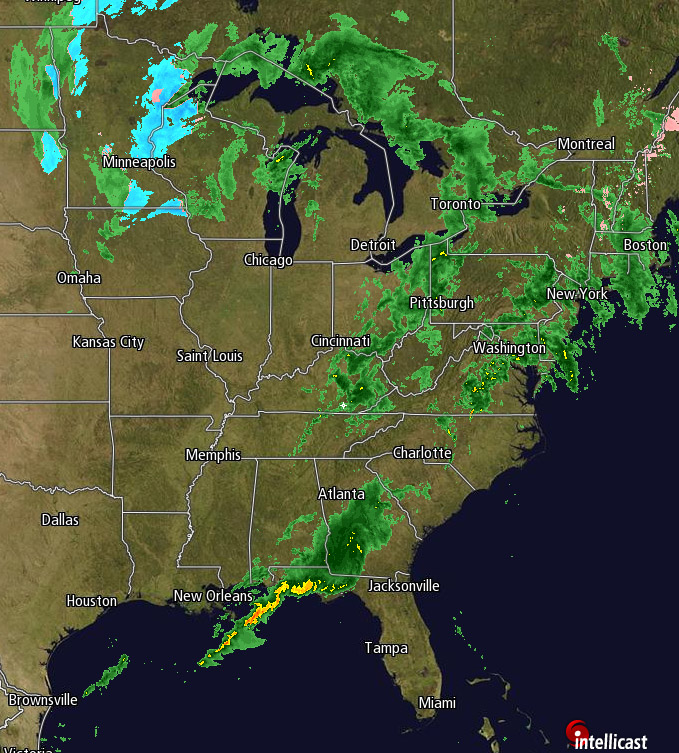
There's no shortage of precip in the northeast, the Deep South, Great Lakes; well the map above speaks for itself. For the NY metro area there will be wave after wave of precip moving through, and come nighttime they'll only get heavier, with possible thunderstorms forming and having a chance of dropping even more rain if they hit. We'll see 3-5" total from NY through Long Island, 2-3 in CT, and less as you go north.
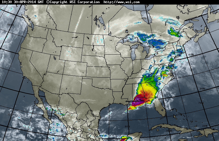
If you think that's a lot though, just keep in mind that yesterday, 24 inches of rain fell in almost a 24 hour period in the Deep South and into the Florida panhandle. The IR satellite below also speaks for itself.
If you think that's a lot though, just keep in mind that yesterday, 24 inches of rain fell in almost a 24 hour period in the Deep South and into the Florida panhandle. The IR satellite below also speaks for itself.
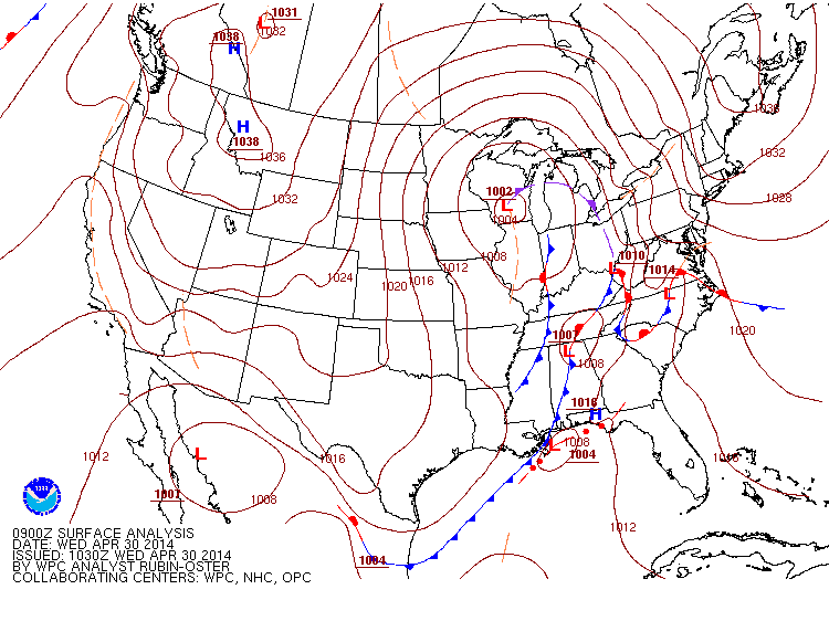
Warm moist air from the Gulf, colder dry air from the Great Plains, add in the low pressure system off of New Orleans as well as high winds and you have all the formulas for severe weather and possible tornadoes and unfortunately that's what we saw yesterday, and may continue to see today in the Deep South. Good news for them though is that there is more instability today than yesterday so there's a smaller chance of severe weather occurring.
Elsewhere the Northern Plains are still seeing nighttime snow mixing into their rain, and it's supposed to be the last day of April. So with all that said, in the NY metro area 3-5" of rain isn't too bad in comparison. Just keep an umbrella handy, maybe a poncho as well.
-Mike Merin
Elsewhere the Northern Plains are still seeing nighttime snow mixing into their rain, and it's supposed to be the last day of April. So with all that said, in the NY metro area 3-5" of rain isn't too bad in comparison. Just keep an umbrella handy, maybe a poncho as well.
-Mike Merin

 RSS Feed
