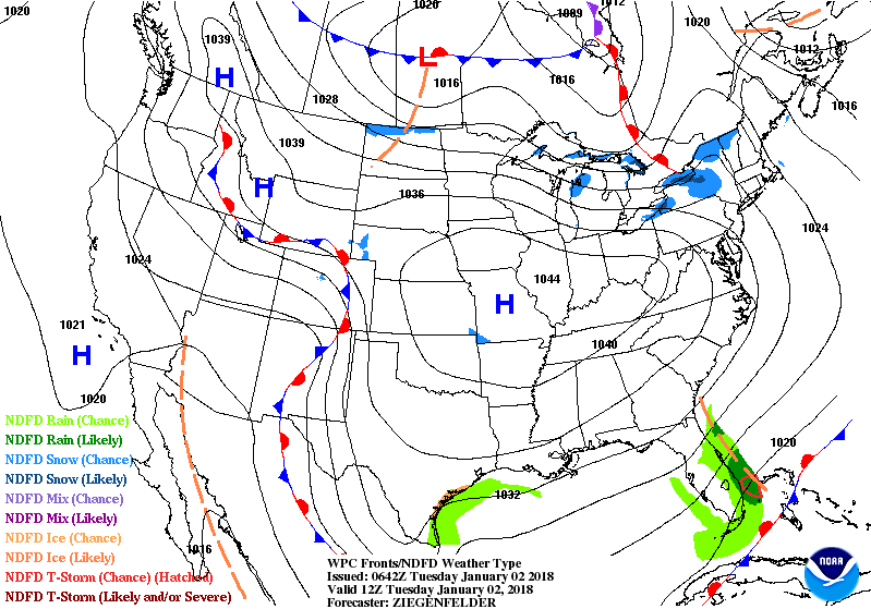
Animated maps above show how 2 weather system will combine to bring a huge storm in the Atlantic Ocean by Thursday. Right now...best chance of heavy snow extends from DelMarVa to Eastern New England. Storm shifts west....that could affect I 95 corridor. Behind it on Friday...icy winds and more arctic air. Below...satellite and radar....reflecting little in the way of any weather but cold.

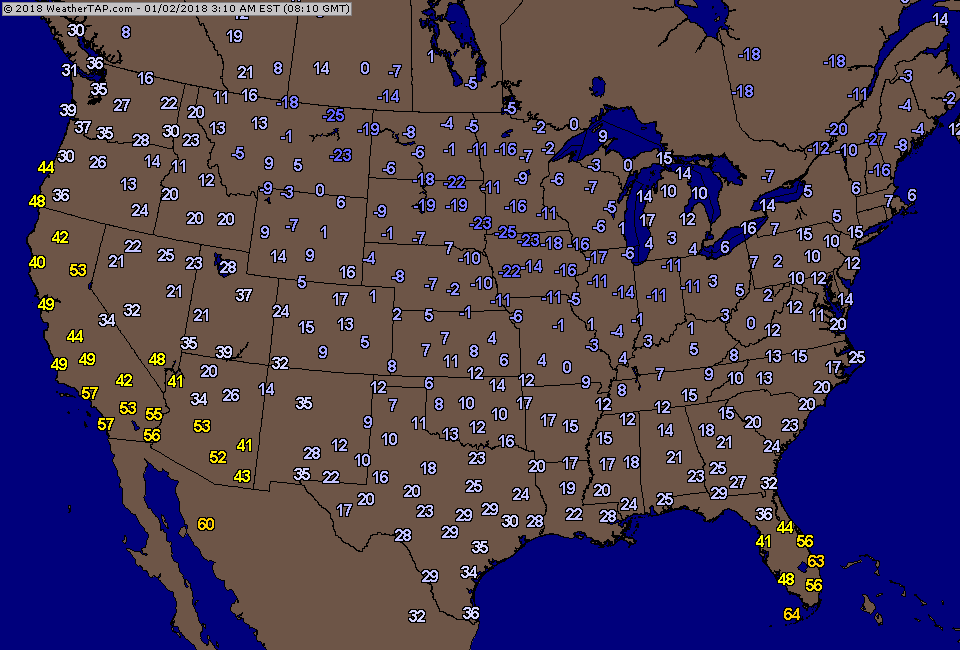
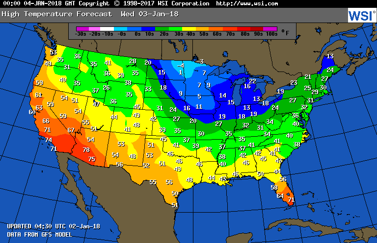
Below - current temperatures...followed by projected highs for Wednesday.
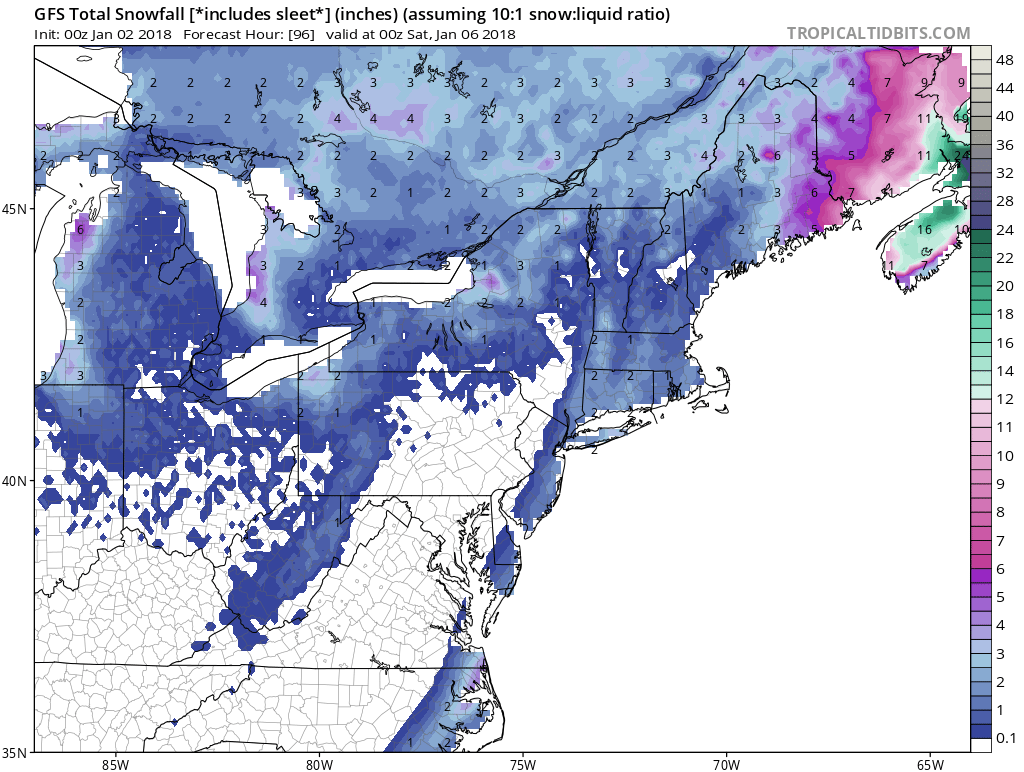
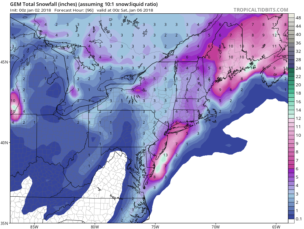
Finally a look at the models projections for snowfall with Ocean Storm for Northeast this Thursday. Be safe. The order...GFS - Canadian - Euro.


 RSS Feed
