The frontal disturbance is moving off the coast today after a wet and muggy weekend for many. The week will start with sunshine for most with spotty precipitation affecting isolated areas in the Northeast Monday.
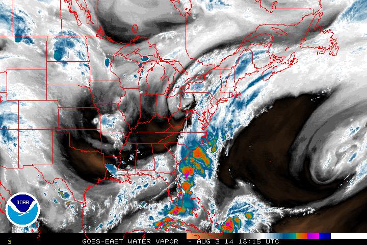
As this trough moves on, dry air behind will provide some comfort into the start of the work week, though the temperatures will climb back up to normality for the season.
Looking towards the south in the Caribbean on the map above, the signature of Tropical Storm Bertha can be seen as it continues its journey north. It looks to avoid land but that doesn't mean it won't have any impact on shore waters as it progresses. For now, we'll wait and let Bertha continue it's movement.
As for the rest of the world... They've gotten much further than just 2 tropical systems. The Pacific has been very active, both in the Eastern Pacific and Western Pacific.
As for the rest of the world... They've gotten much further than just 2 tropical systems. The Pacific has been very active, both in the Eastern Pacific and Western Pacific.
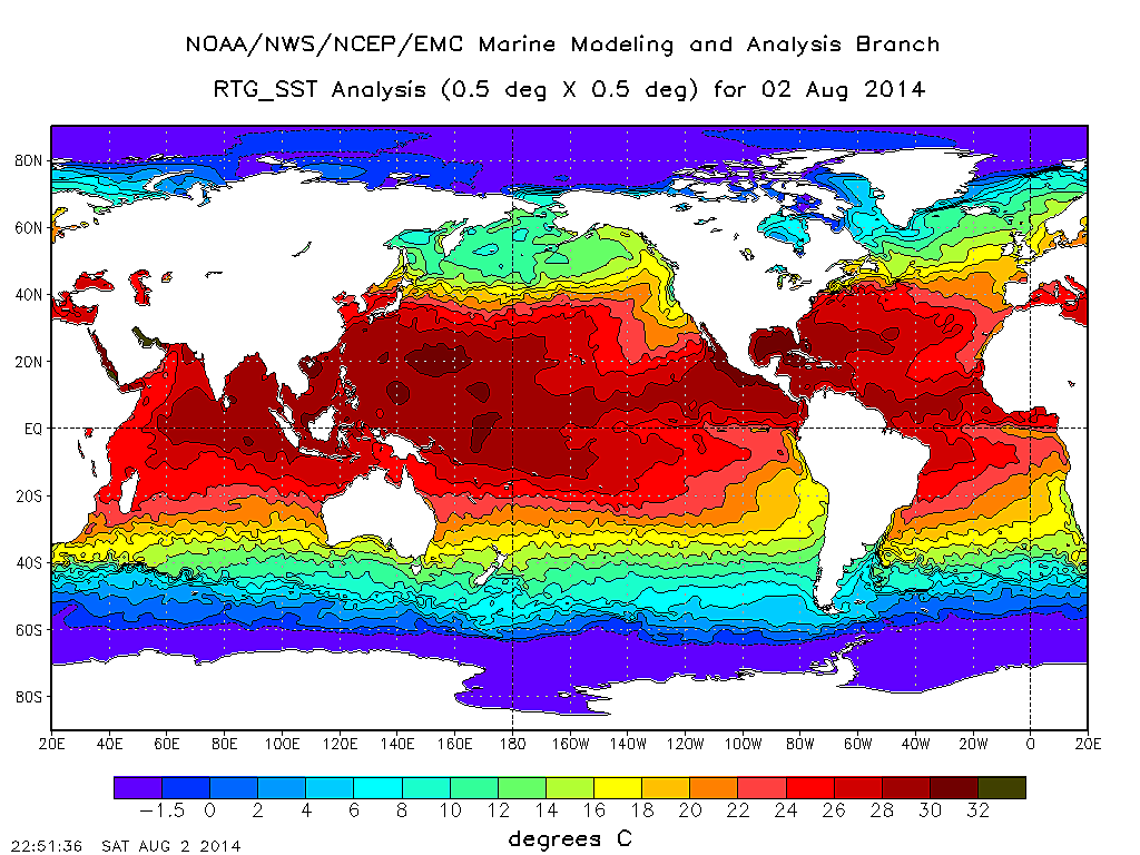
The above map shows analysis of sea surface temperatures across the globe from this Saturday. One of the requirements to help a tropical cyclone form is warm water. The most widely known number used is 80° F or about 26-27° C. The western Pacific has had plenty of warm water to fuel tropical systems and it shows in the 17 storms that have formed (including 3 super typhoons). The Eastern Pacific which follows the English alphabet system is up to Hurricane Iselle (9) and it is currently on a path that potentially leads to a collision with Hawaii at the end of this week. Developments will continue to be monitored throughout the week...
- JL
- JL

 RSS Feed
