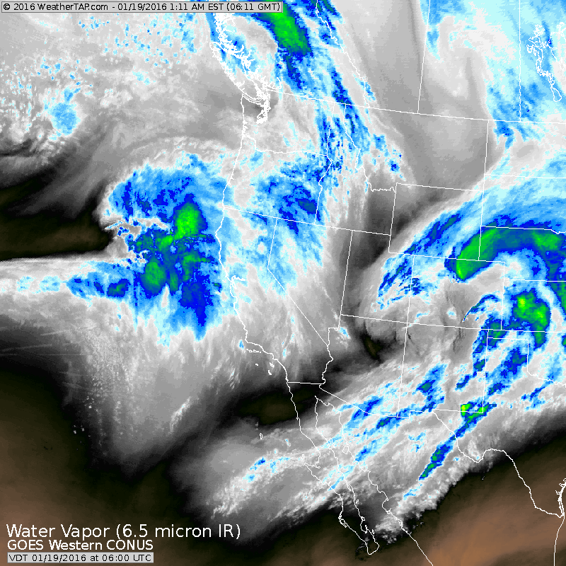
Thois western satellite shows 2 disturbances ready to hit the west coast and it is the first one that should bend the jet stream and result in a major winter storm for the Eastern States from Friday into the weekend. Since there are 2 systems out there...models have to see them before they can accurately take them and move them along...and this leads us to think that there may be more changes in the evolution of this storm in the next few days.
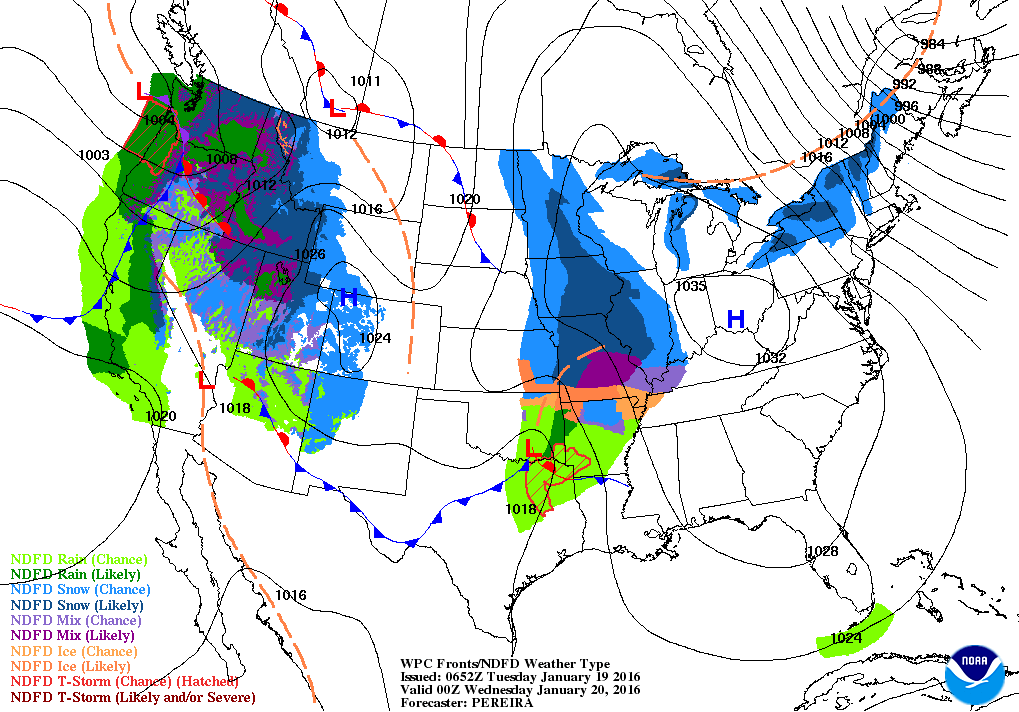
Current map shows cold high pressure in the east. "The Head Scout" in Mississippi Valley will head east and fall apart as trhe biggest storm along the west coast organizes. Below...amounts of precip. expected with eastern storm. 2" cover the Eastern corridor....and if all snow...2 feet ? Sounds a bit high at this time.
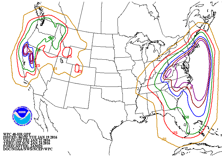
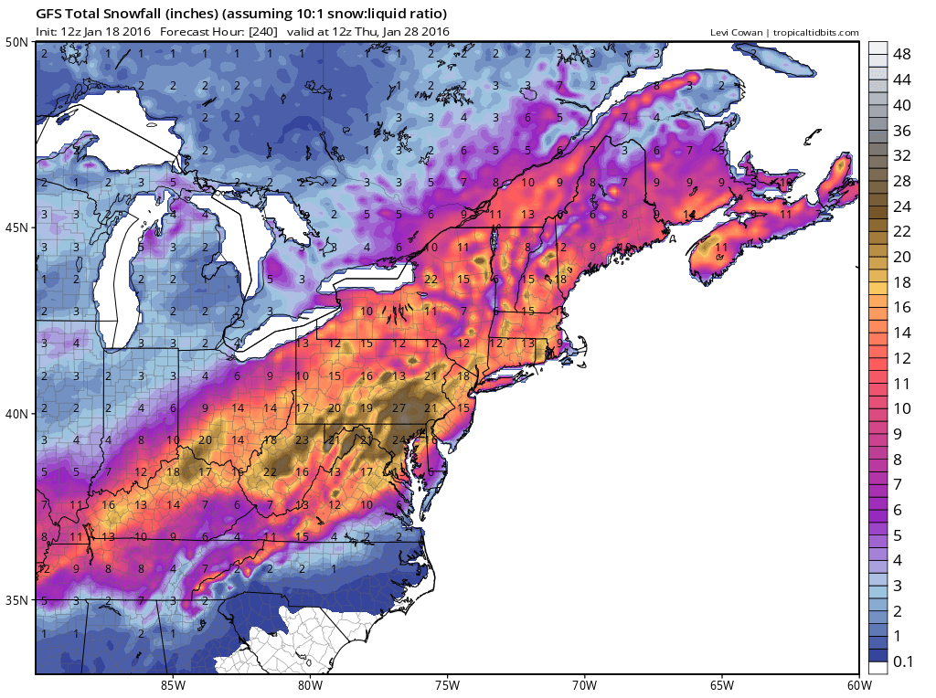
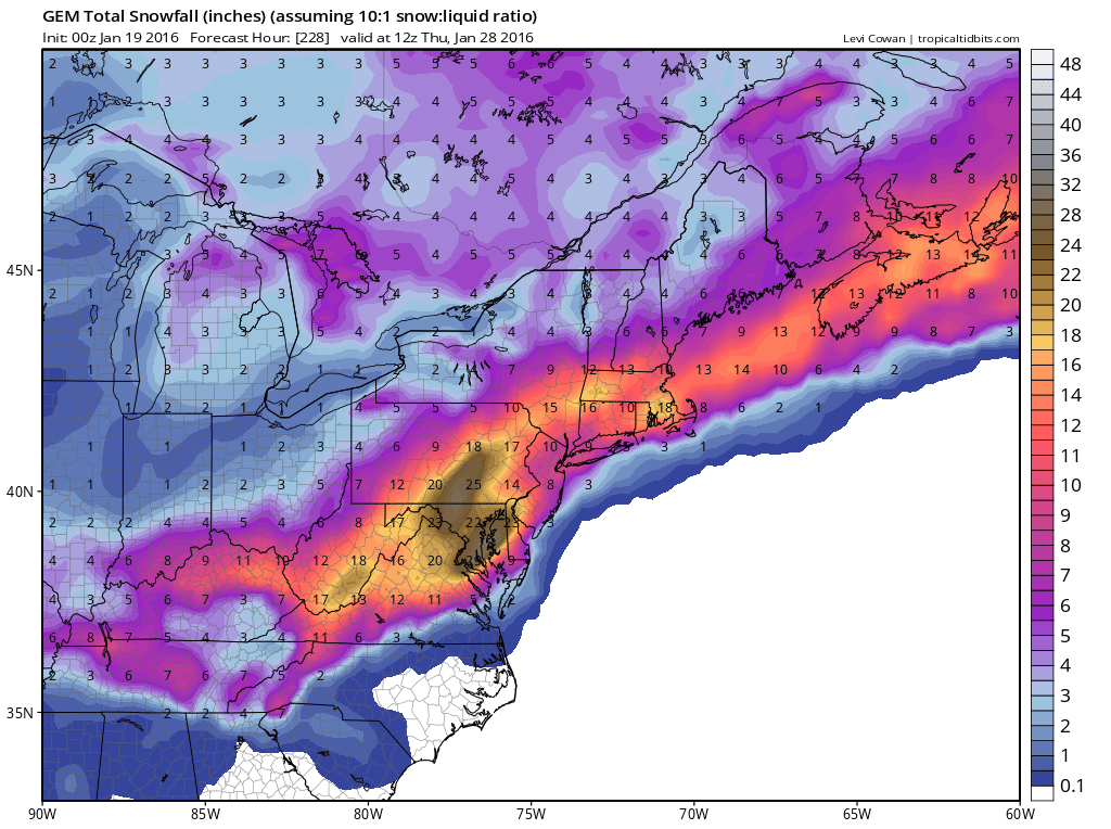
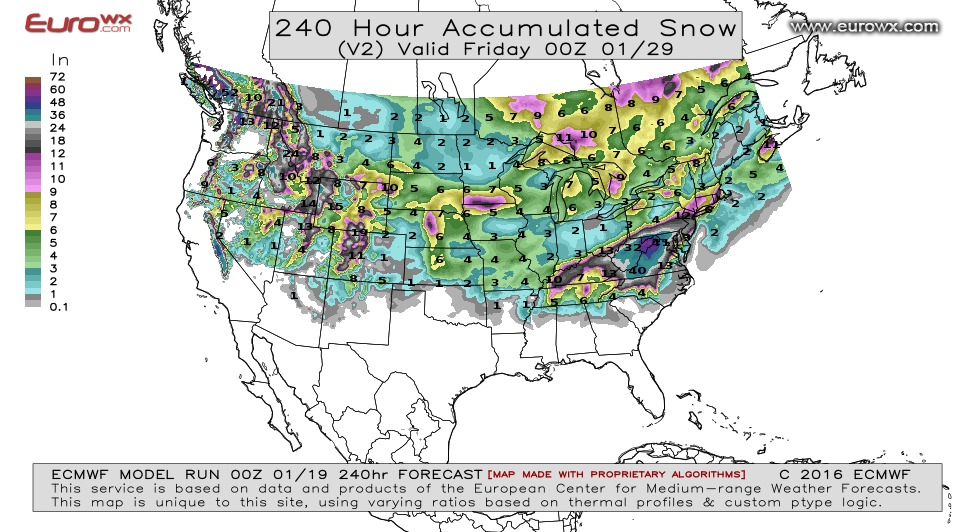
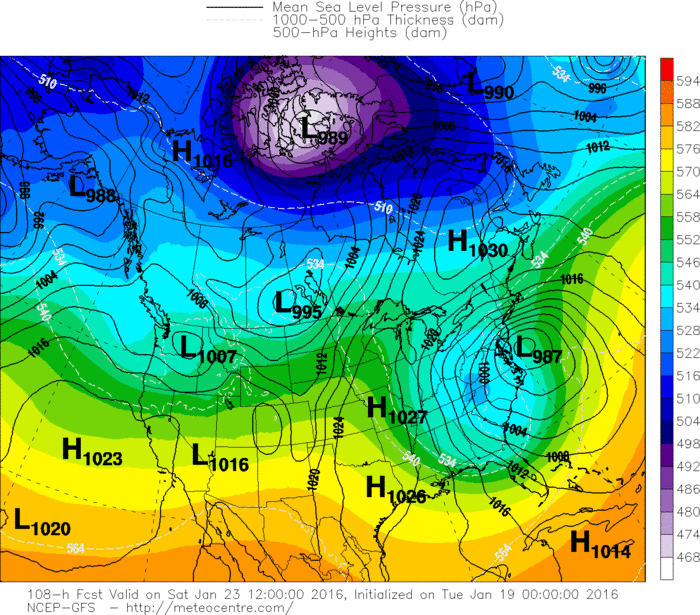
Above...snowfall totals projected first by Canadian, then GFS..lastly The Euro. Below...where the various models show
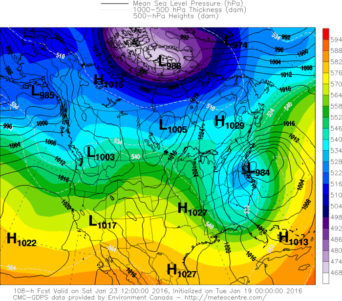
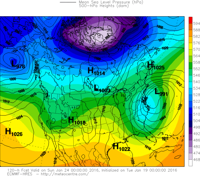
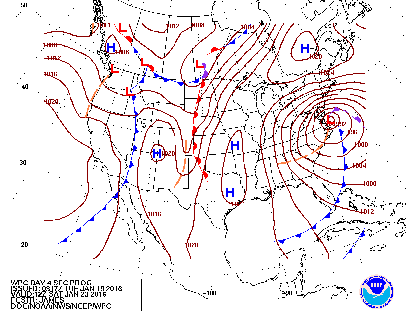
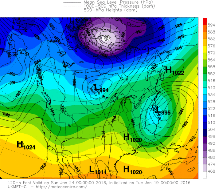
the storm on Saturday.
the storm on Saturday.
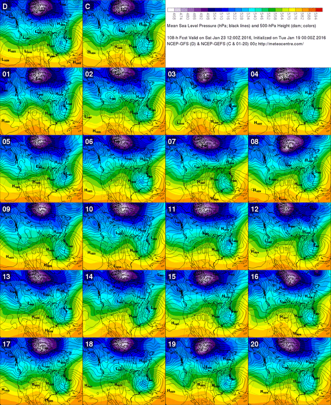
Finally...a look at one of the suites of the Ensembles....various computers show their projection for Saturday. Be safe.

 RSS Feed
