Even though it will be growing colder...don't see another arctic assault until next week. Models are all over the place along the East coast. Even though at this time - not depicting any big storms...pattern is changeable and has to be watched thru this weekend. Rain departs East tnte.... snow heads across Great Lakes and Ohio Valley today.
Below...satellite picture showing rain - east - and snow Midwest.
Below...satellite picture showing rain - east - and snow Midwest.

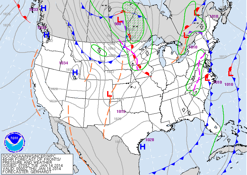
Map below is a forecast map for Saturday. You can see the mess of
lows in The East....none of which look organized so precip there will be varied and not steady.
lows in The East....none of which look organized so precip there will be varied and not steady.
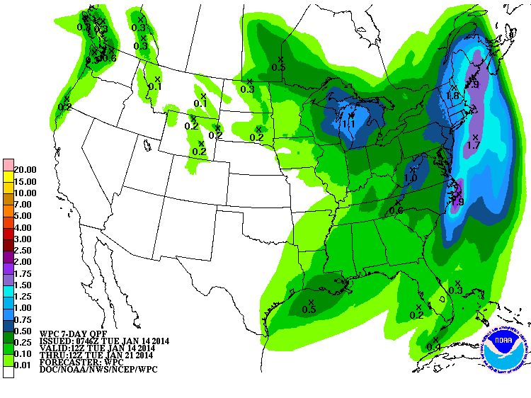
Below...a map depicting total amounts of precipitation to fall over the next 7 days....and as you can see...East is the target.
Below...you will find the European model for next week. Blue...indicates cold....and darker the blue...the colder the weather. Enough said. I think late January will be cold and we will have bouts of snow...but still leaning toward no big winter storms in East. Not storm-free...but no biggies. Can't say the same for The Southwest. It is there that storms will come east to begin the month of February. Later.

 RSS Feed
