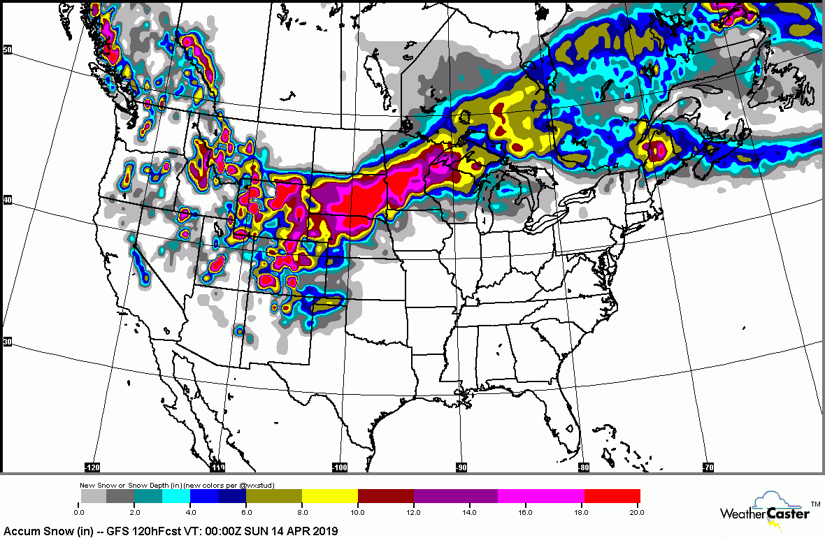
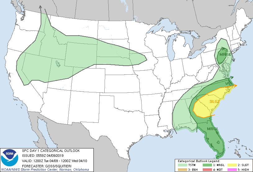
Above..snowfall map expected through Saturday. Red and purple = 1 to 2 ft...Nebraska..Dakotas - Minnesota...Wisconsin. Below...today's risk of severe thunderstorms in green and yellow.
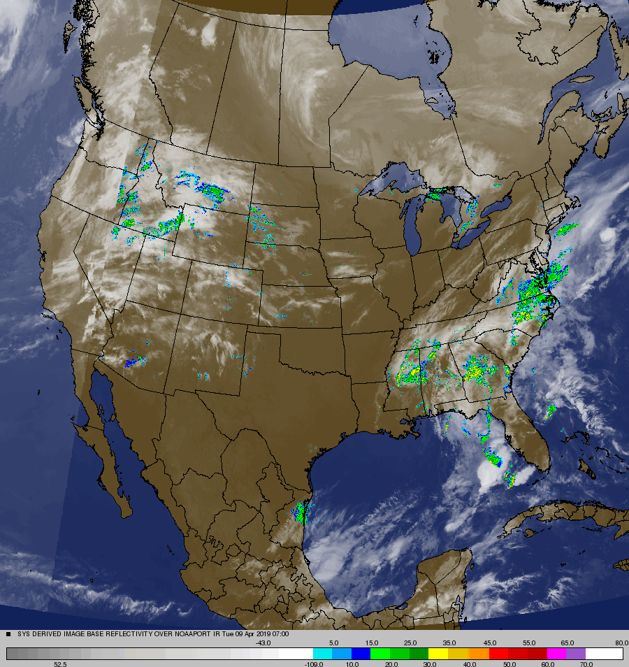
Below- radar and satellite picture showing storm brewing over Rockies. Following...animated maps showing how that storm will travel into Thursday bringing blizzard conditions to upper Plains.
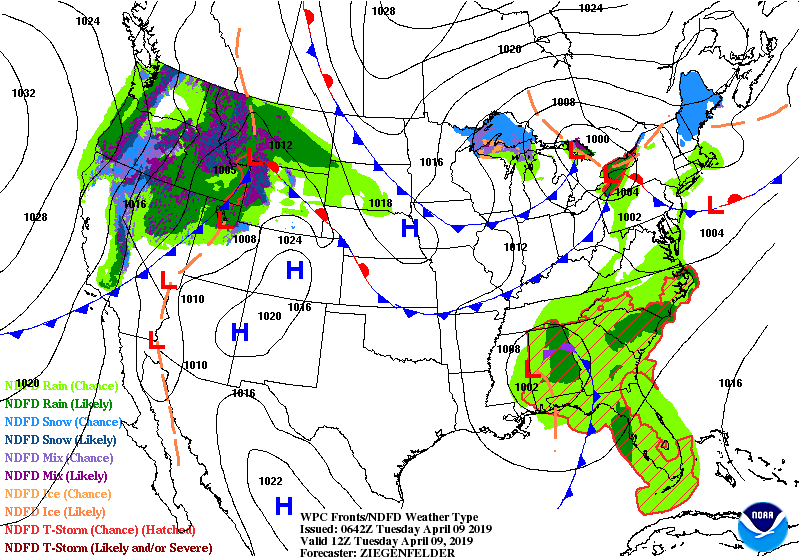
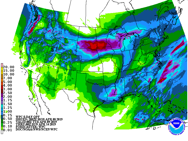
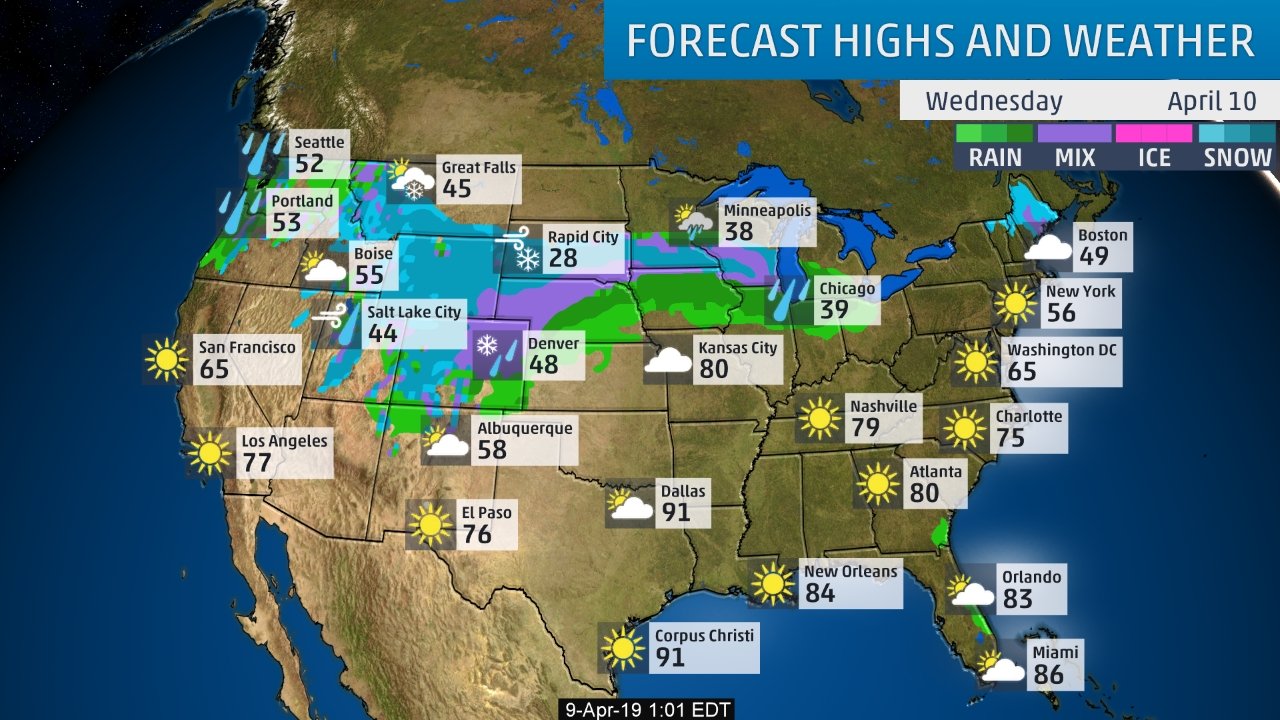
Lastly - rainfall expected through Saturday followed by high temps and conditions for Wednesday. Be safe.

 RSS Feed
