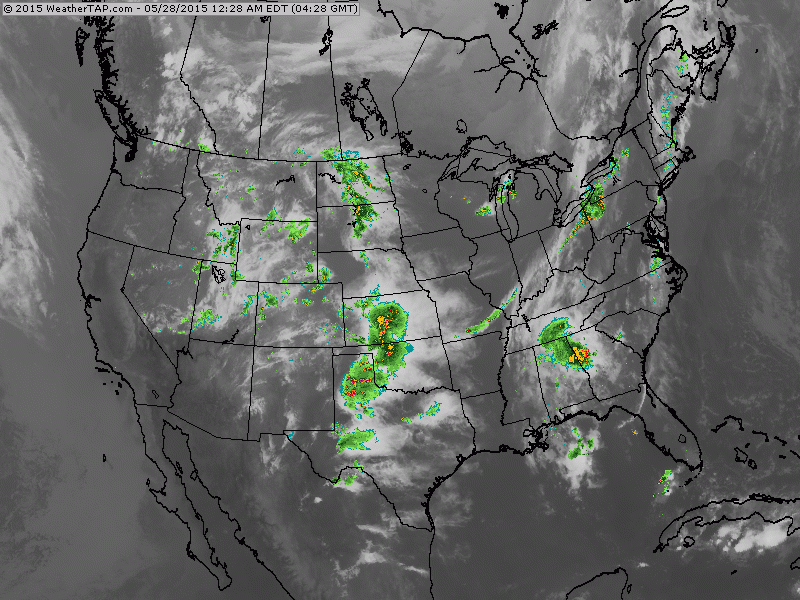
Satellite/radar overlay shows another band of moisture moving over Appalachians...and it will fire up to produce gusty storms this afternoon in Northeast. Southern Plains under the gun for ore rain and storms.
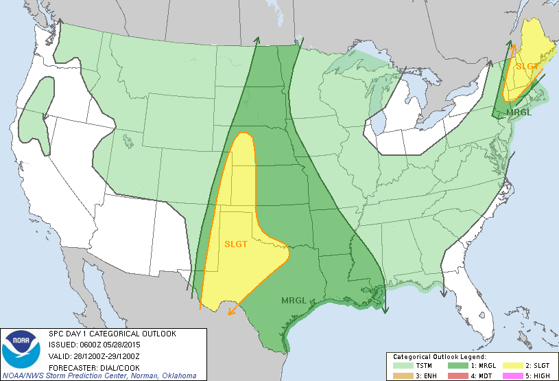
Best chance for severe weather in yellow today- tonight.
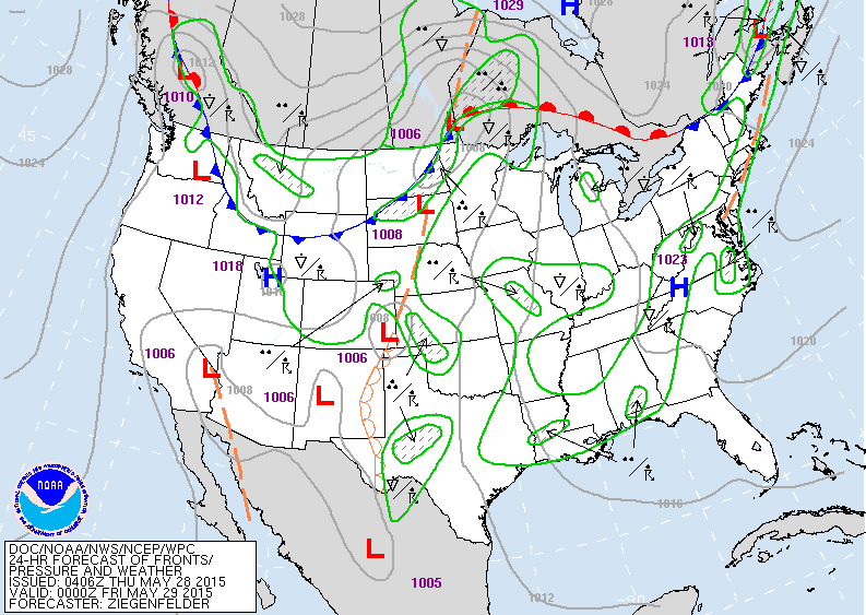
Map for Thurs. evening showers some storms in Northeast...Southern Plains....Dakotas.
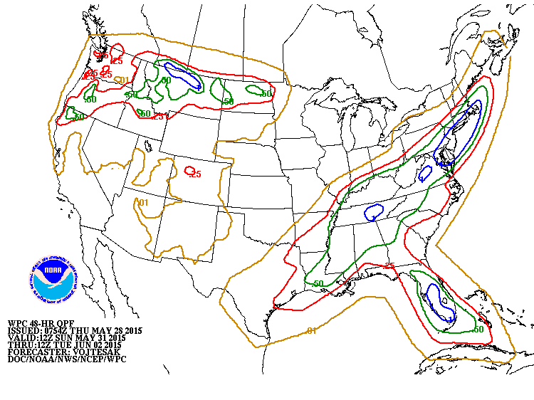
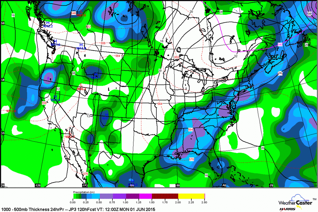
Amount of rain expected Sunday into Monday....target areas from Northeast to Tenn.Valley & Gulf States....as well as No. Rockies.
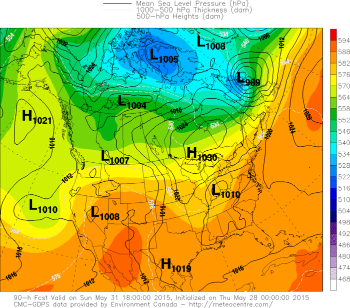


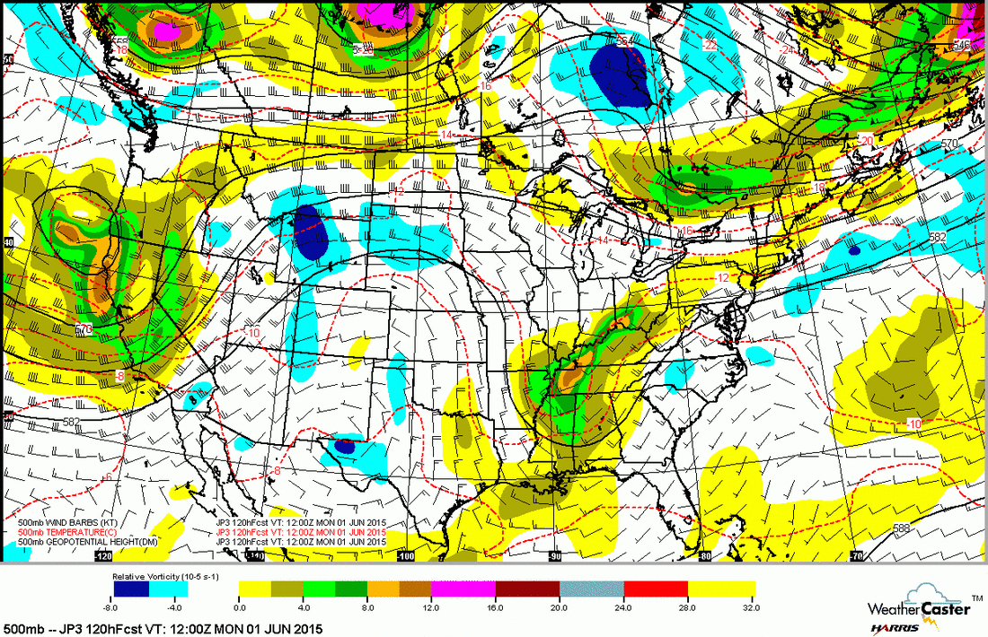
Above....4 models...Canadian...GFS...UK Met and Japan all showing the cold front in East to slow down and result in good rainfall there this weekend. Below....the 500 Mb - upper level flow for Sunday which shows the trof over Tenn. Valley as the instigator for this rain. Be safe.

 RSS Feed
