
Bertha is moving away from The Bahamas and should stay offshore...as winds approach hurricane force. A cold front in the upper Midwest will head east and move across The East Coast Wednesday.
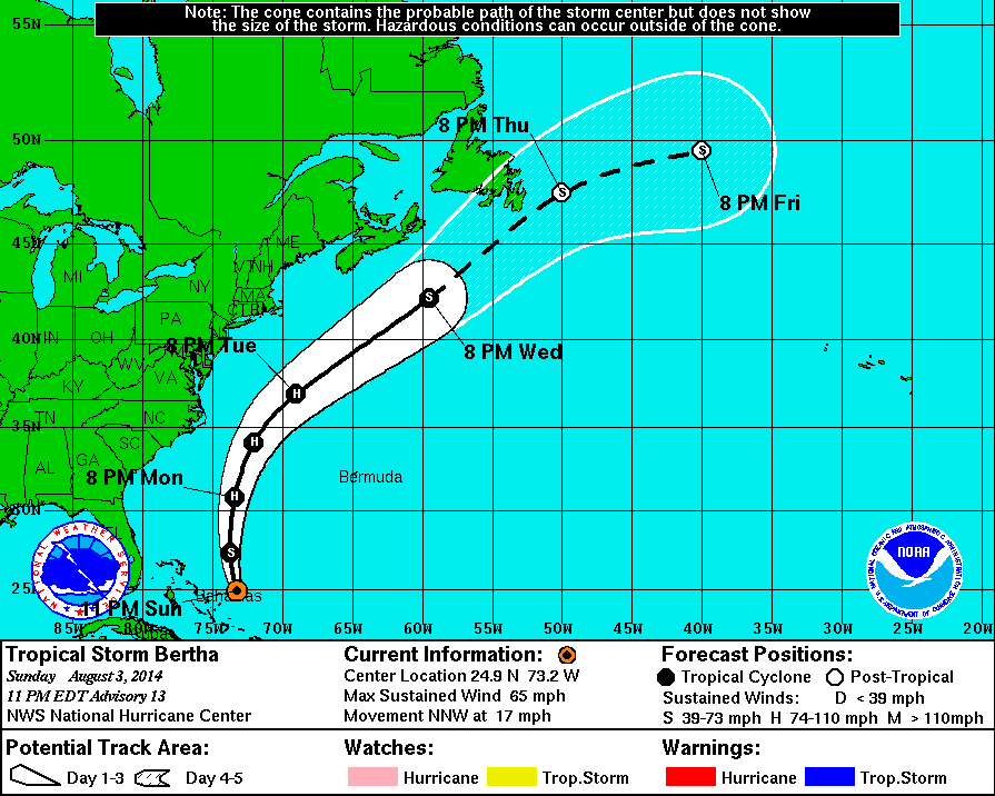
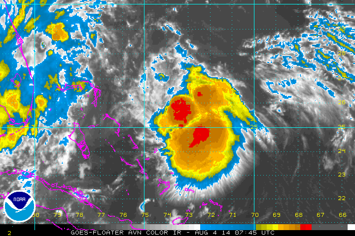
Above....track for Bertha. Below...close up satellite picture of Bertha.
Map valid for late today showing Bertha near Bermuda. Cold front over Great Lakes will stall over the south late week and bring heavy rains to Gulf States.
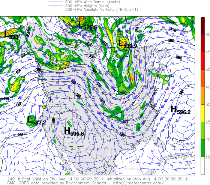
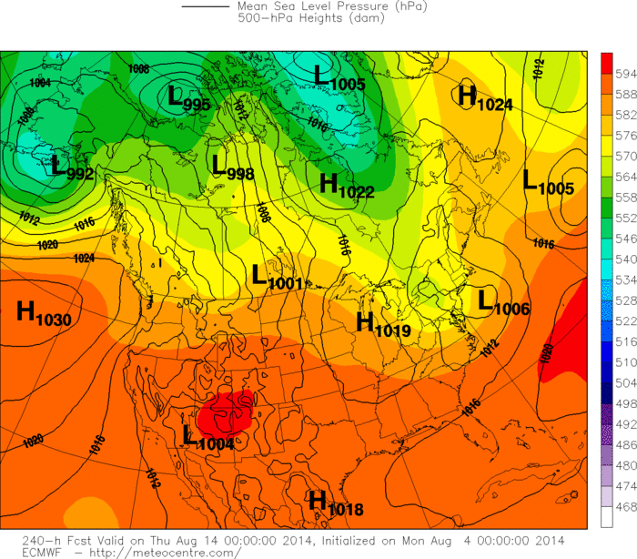
Above...Canadian Model showing upper air winds for next Wednesday...mid August. Once again..showing a strong trof over The Eastern Half of the Nation...meaning cooler than normal. Below...The Euro model for same time next week...but showing the surface reflection of low pressure East along with cooler air flooding the Eastern Half of The Nation. Such a pattern does not scream heatwave for The East. Fine with me. Later.

 RSS Feed
