A very potent and deep low pressure system passing across the eastern US will bring rain into Sunday, the first day of Astronomical Fall (Meteorological Fall began on September 1).
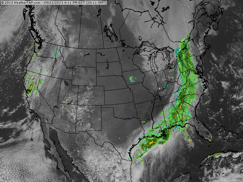
You can see on the below radar as of 4:11 PM EDT, the area of the precipitation wrapped around the cold front is quite extensive. Rainfall will be consistent and heavy at times through the night into Sunday...
You can see on the below radar as of 4:11 PM EDT, the area of the precipitation wrapped around the cold front is quite extensive. Rainfall will be consistent and heavy at times through the night into Sunday...
As rain showers wrap up on Sunday and we head into Monday, we will arrive at another prolonged period of beautiful weather, not just for the Northeast, but for much of the country as well.
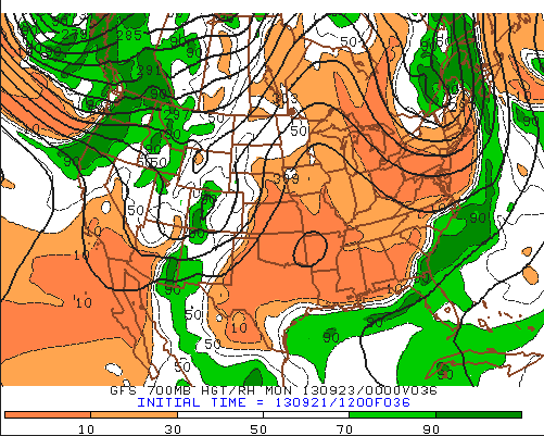
Sunday evening... Relative Humidity at 3000 meters above the surface.
The above image represents the relative humidity at 700mb (about 3000 meters above sea level) for Sunday evening. The more pumpkin looking colors (a nice Fall reference) represent air the is generally void of a sufficient moisture to produce clouds and precipitation. This overall pattern is expected to last well into next week as far as to next weekend for much of the country.
After we escape the hiccup of rainfall tonight, expect a beautiful start to the Autumn season!
- JL
After we escape the hiccup of rainfall tonight, expect a beautiful start to the Autumn season!
- JL

 RSS Feed
