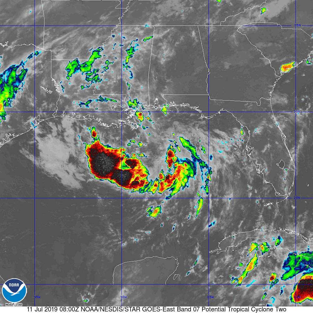
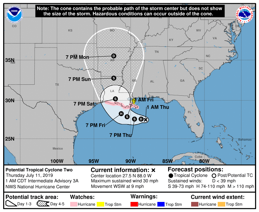
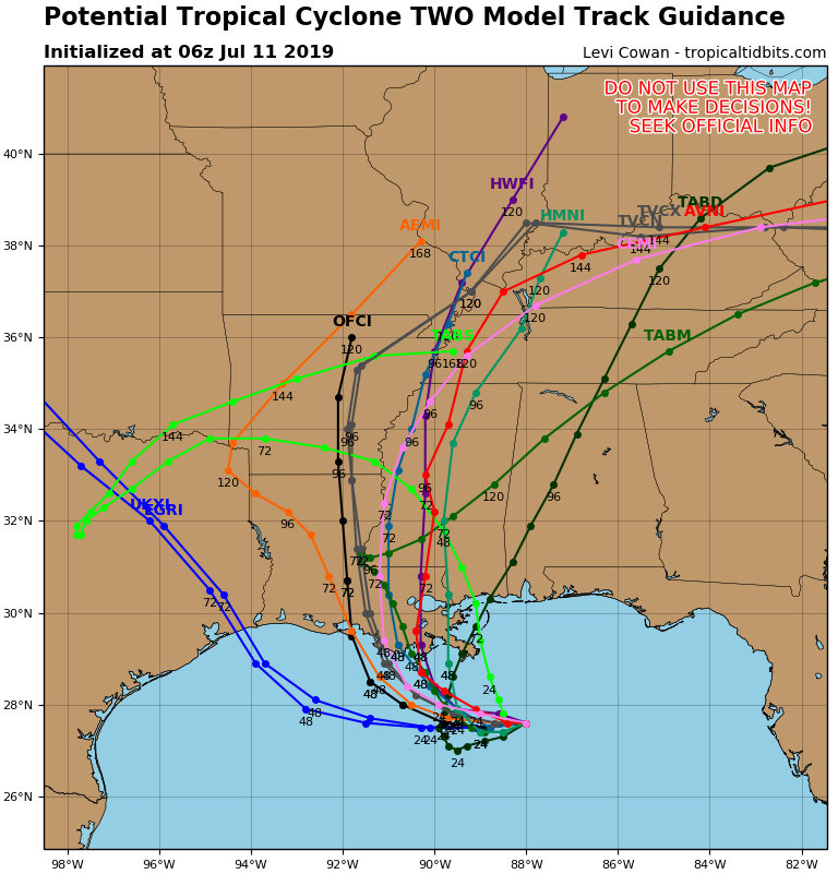
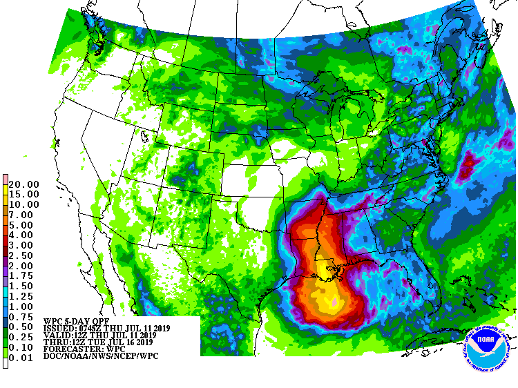
Above - satellite picture showing tropical disturbance in Gulf which will become a depression today and then Tropical Storm Barry or even a Hurricane Friday into the weekend. Following...hurricane center track followed by tracks of different models. Most agree...Louisiana....and since system is moving slowly....very heavy rainfall likely...over 10".
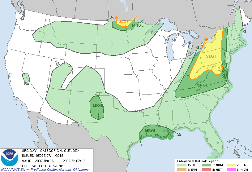
Below - today's risk of severe weather - dark green and yellow - followed by animated maps....and rainfall into MOnday.
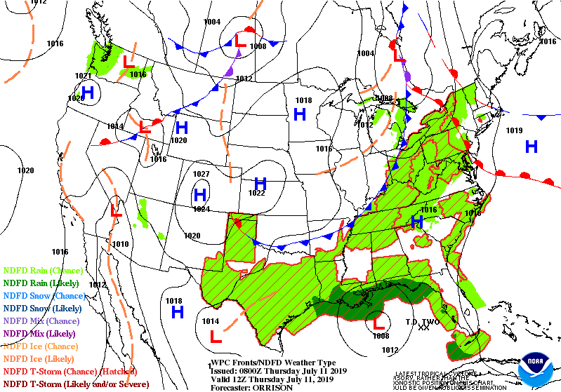
Below - satellite + radar showing cold front moving out of Gt. Lakes and into East today with showers and storms. Snapshot weather for Friday.
Be safe.
Be safe.


 RSS Feed
