
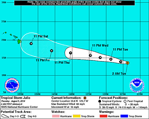
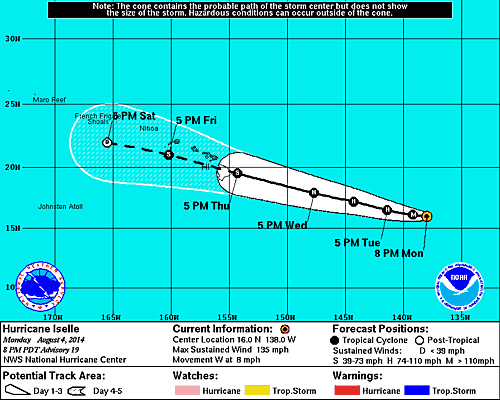
Above...Bertha near Bermuda...a tropical storm and very disorganized and moving out into Atlantic. Over Baja California...T.S. Julio - will become a hurricane and move on a similar track to Iselle...which may both affect Hawaii. Iselle is a strong hurricane headed toward Hawaii.
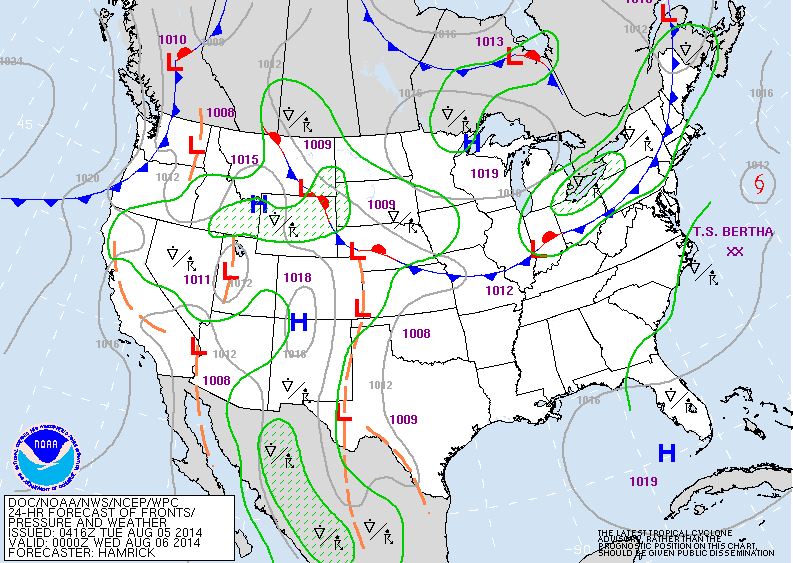
Today's map shows a cold front pushing thru Great Lakes. It will bring t-storms to Northeast then a few days of really nice August weather. Flooding rains will continue in the Sw and Rockies.
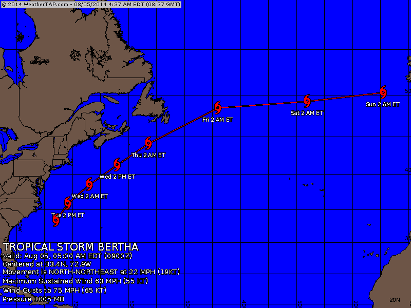
Above - track for Bertha. Below...track of Julio....then Iselle.
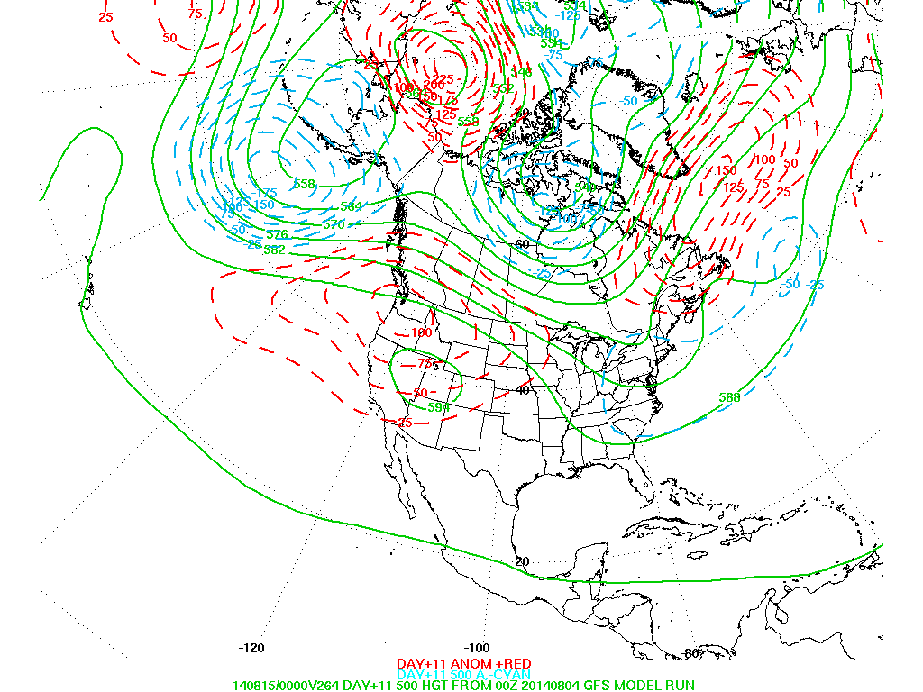
Above...upper air pattern expected for late next week. A ridge is noted over the west (red dashes indicate higher pressures)......while a trof is over The East. This is the pattern that has prevailed all Spring and Summer. Cooler air will cover the Eastern half of the Nation again by mid month. Be safe...later.

 RSS Feed
