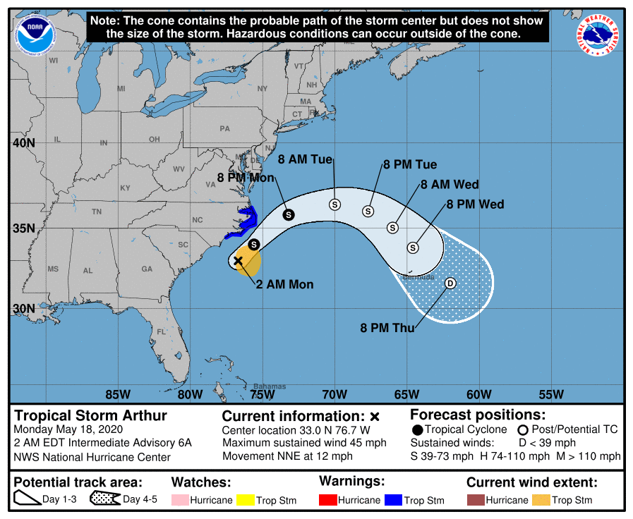
Tropical Storm Arthur with 45-50 mph winds will skirt N.Carolina with wind and rain and then turn east out into the Atlantic. Below- expected track.
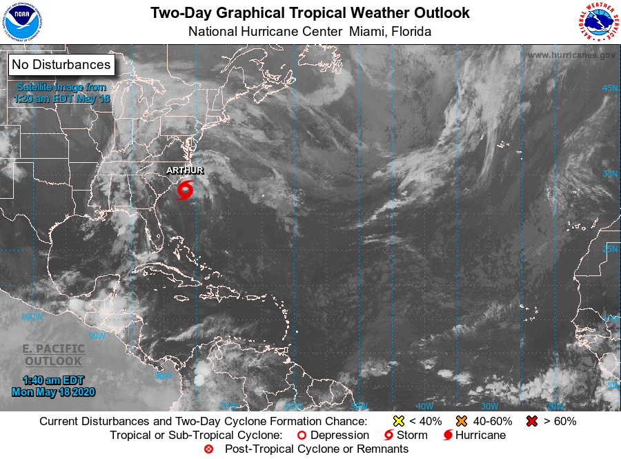
Below - satellite + radar for the Nation showing wet weather from Great Lakes south. That area will move southeast to affect the Mid Atlantic and Southeast keeping the Northeast mainly dry after today.

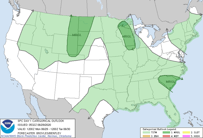
Below - today's risk of severe weather in dark green...animated maps...rainfall through Friday.


Below- snapshot weather for Tuesday. BE SAFE !!!!

 RSS Feed
