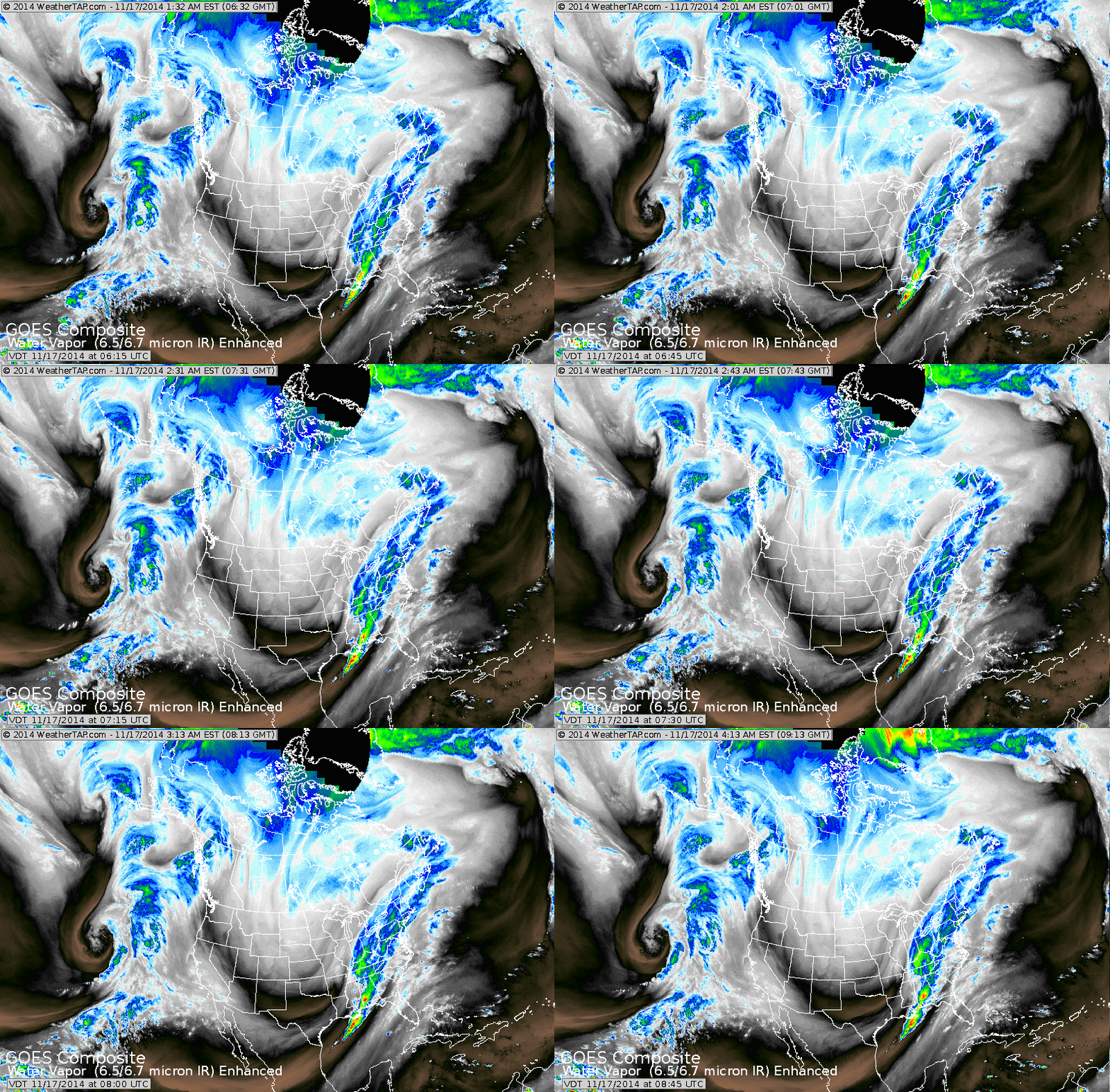
The black stripe from Pacific Northwest to Texas to Ohio Valley indicated the jet stream which is bringing down the next blast of arctic air...this one making it to the East Coast.
The array of colors in The East is rain....snow over Ohio Valley into Northern New England. Notice the storms swirling off the west coast. If any of those break through the ridge...it could be big trouble - winter-wise for the Nation.
The array of colors in The East is rain....snow over Ohio Valley into Northern New England. Notice the storms swirling off the west coast. If any of those break through the ridge...it could be big trouble - winter-wise for the Nation.
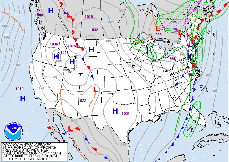
Map above - for late today. Arctic cold front moving off
East coast taking the rain with it. Lake effect snows will continue to fly downwind of the lakes...where a foot or more is possible over the next couple of days. Fair..cold..dry for the rest of the nation.
East coast taking the rain with it. Lake effect snows will continue to fly downwind of the lakes...where a foot or more is possible over the next couple of days. Fair..cold..dry for the rest of the nation.
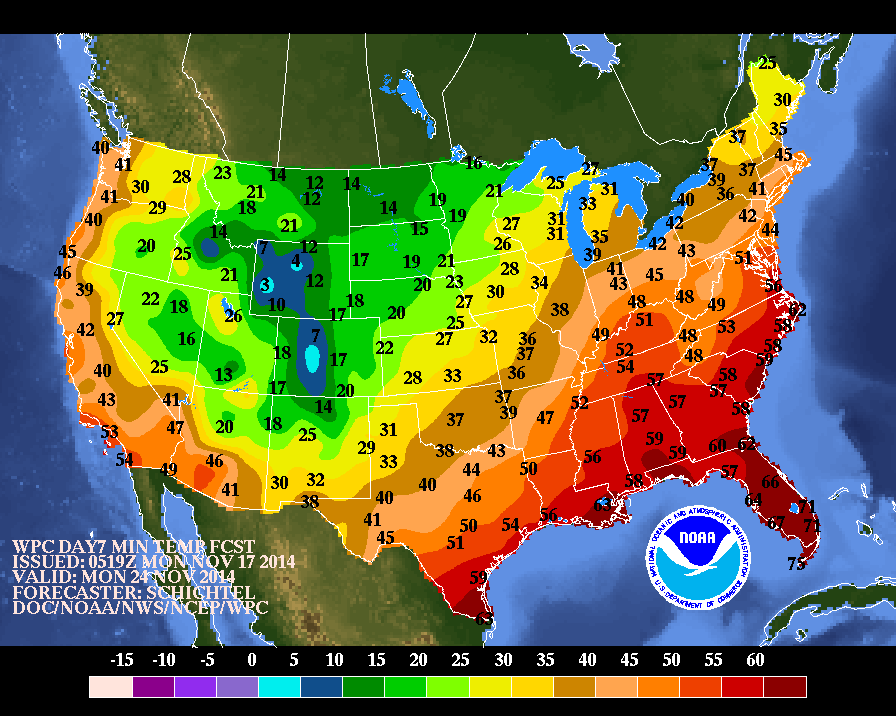
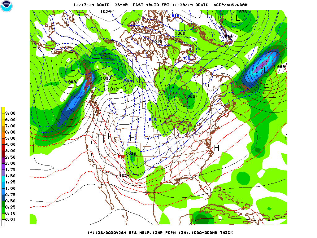
Above....low temperature for next Monday. Notice how it is getting warmer in the East as we move into Thanksgiving week. Long range....but our GFS model wants to make it sunny and mild for East by Thanksgiving ......could it happen...yes......will it happen, anyone's guess. Below...the GFS model for Thanksgiving Day.
Above - GFS Model - shows mild for West and East Coasts...but cold central. Snow for Upper Midwest and Great Lakes....rain Texas....Place your bets....! Could almost guarantee it will change. Be safe...late.


 RSS Feed
