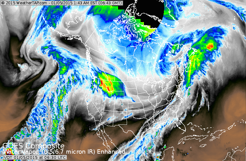
Cold front is moving off the East Coast introducing the BEGINNING OF ARCTIC AIR. Vibrant colors in Rockies is the next low moving rapidly eastward. It will drop 4-5" of snow in Midwest...but weaken by the time it gets to the East coast with only an inch or so on Tuesday.
Map above is for this evening. Lake effect snow in NYS.....
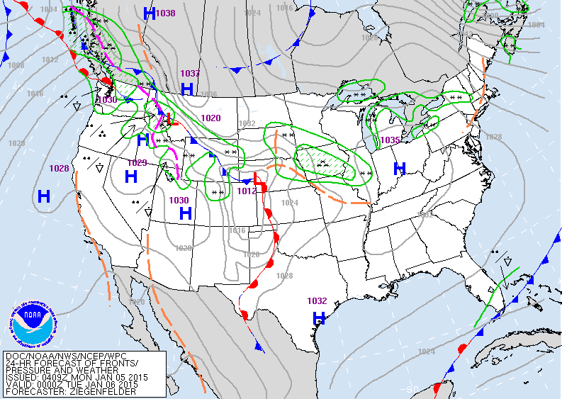
low coming out of Rockies spreads snow into the Midwest.
low coming out of Rockies spreads snow into the Midwest.
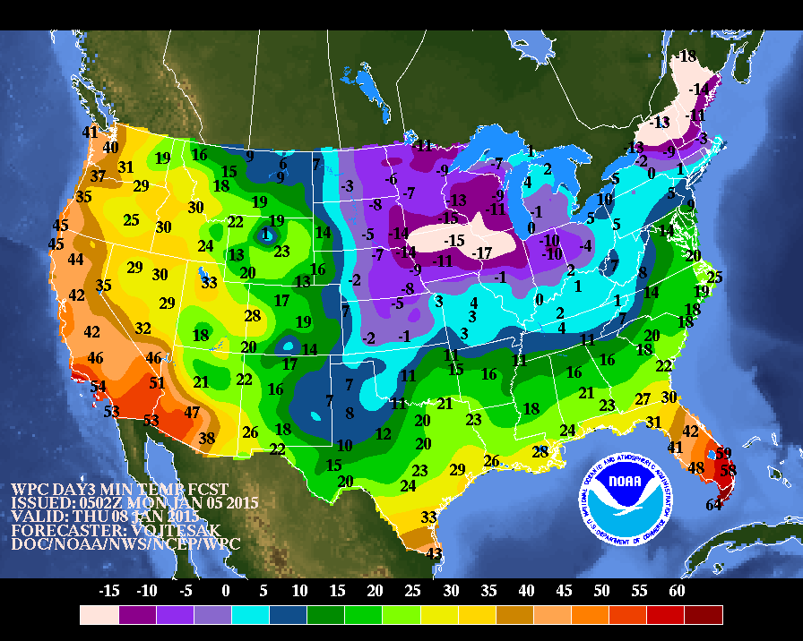
Above....morning lows for this Thursday....which is shaping up to be one of the coldest days in The East thus far. Below...high temperatures for this Thursday.

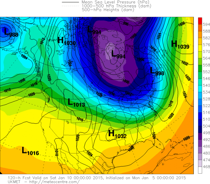
UK Met model showing the last in this series of arctic air this weekend. There should be a break thereafter...but another series of arctic air masses will resume thereafter.
It is January. Stay safe.
It is January. Stay safe.

 RSS Feed
