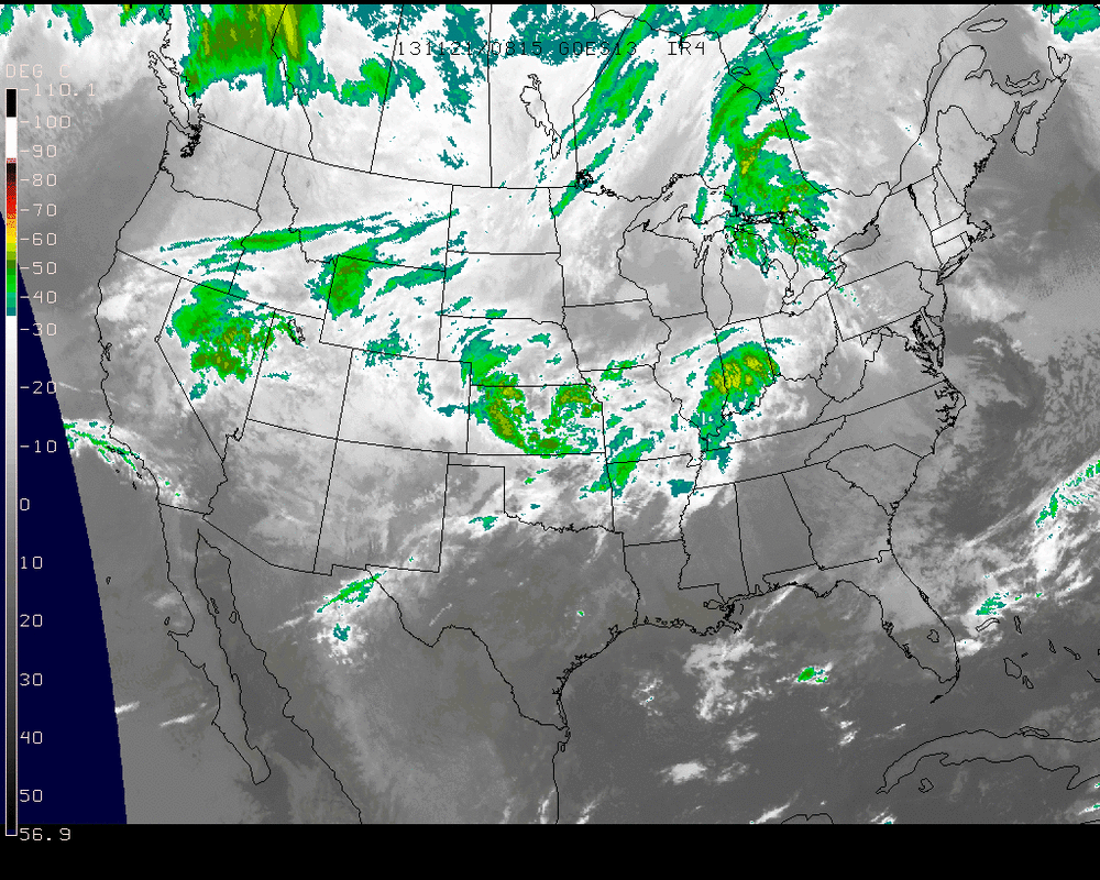
Satellite picture shows an area of rain from Gt.Lks to Ohio Valley...it will move into Northeast Friday. Snow in Rockies associated with arctic cold front...which swings south and east and invades much of the Nation this weekend.
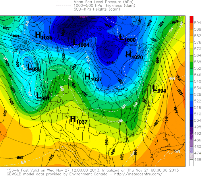
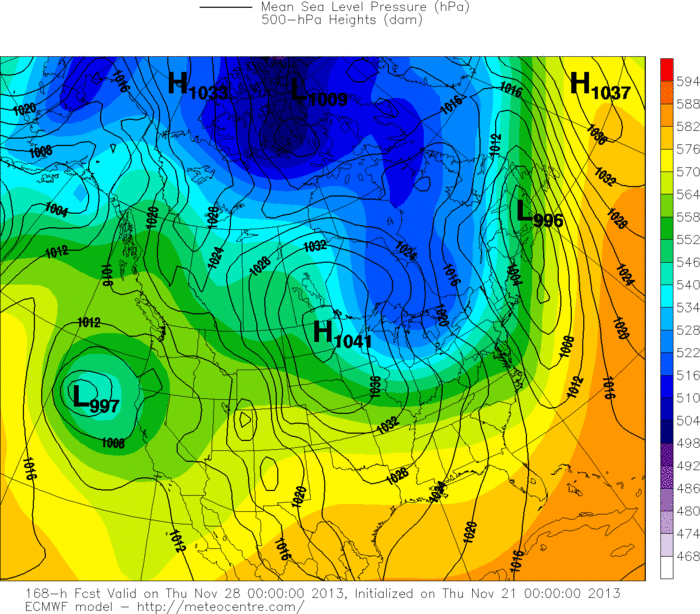
Above....The Canadian then The Euro Model for next Wednesday. Both models keeping storm offshore...but showing cold windy weather for Thnksving day much of the Nation. While it is too early to buy this
scenario now....the chances are not great for an East coast storm...but they are not that small either. One meteorologist did some research and found that almost this exact pattern existed in 1963...50 years ago...and the net result was a big coastal storm. That's what makes this field so interesting....not just the "unknown" but the "unknowns". The window for a storm in the East is anywhere from next Wednesday into
next Sunday.....so beware. Later

 RSS Feed
