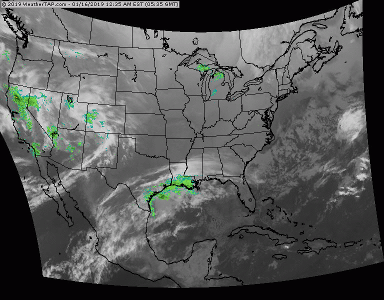
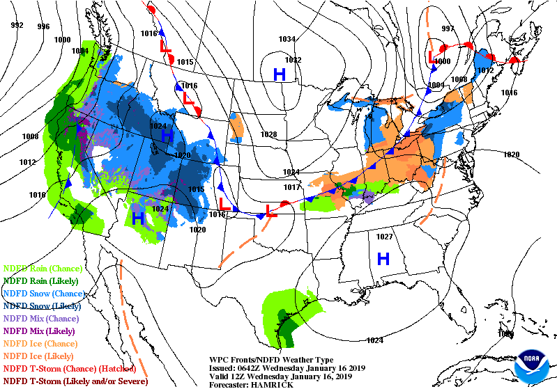
Satellite + radar shows disturbance # 1 moving out of Rockies and will bring light snow to Northeast by Friday. Storm # 2 just off West Coast should be a blockbuster as it moves across The Nation this weekend.
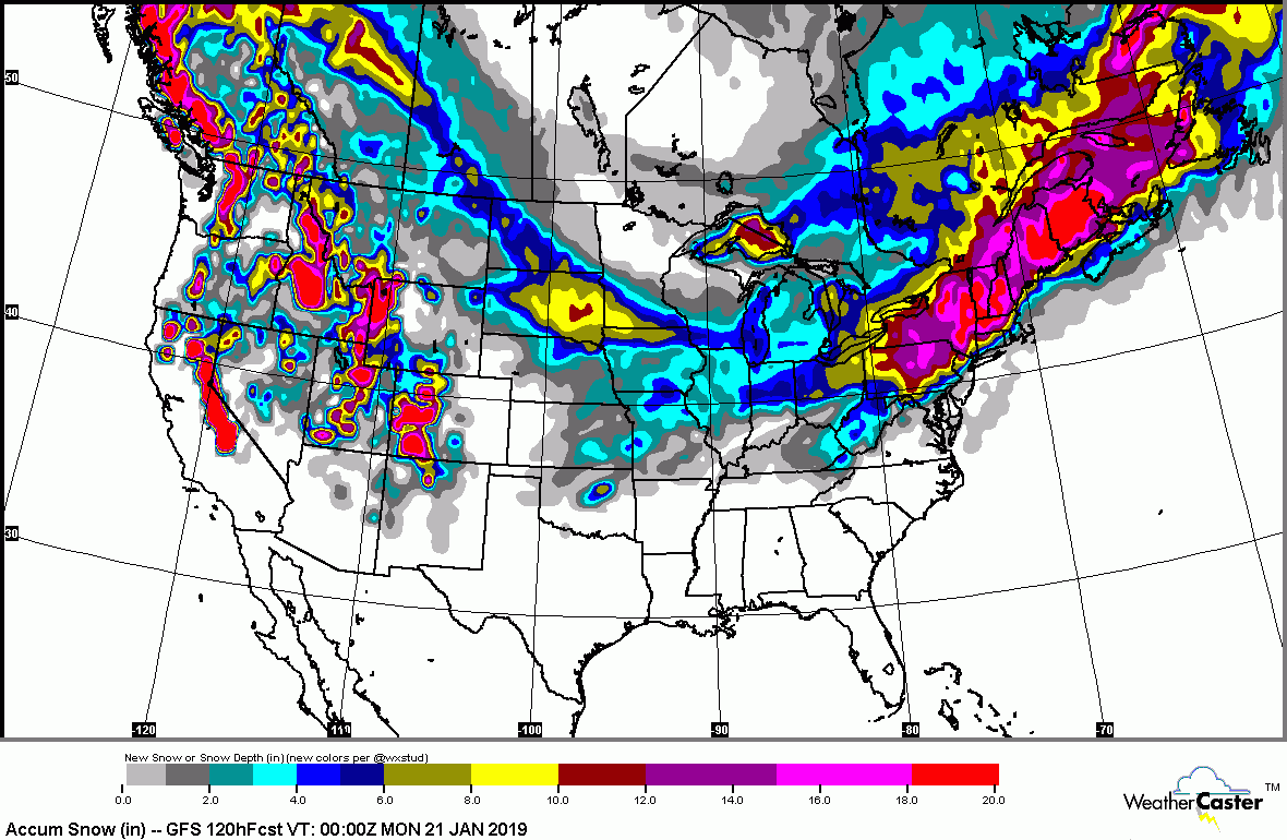
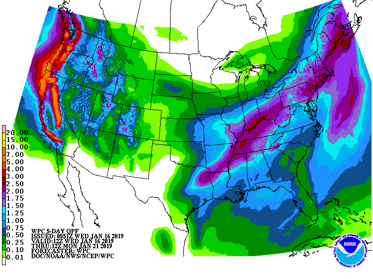
Chicago could see over 6" of snow....but from the No. Appalachians to New England - they will be measuring in feet. Big Cities along I 95 from Boston to Phily will see everything including flash freezing which will make travel hazardous on Sunday. Below - expected snowfall and rainfall through Monday.
Chicago could see over 6" of snow....but from the No. Appalachians to New England - they will be measuring in feet. Big Cities along I 95 from Boston to Phily will see everything including flash freezing which will make travel hazardous on Sunday. Below - expected snowfall and rainfall through Monday.
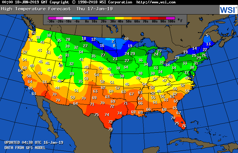
Below - high temperatures for Thursday and animated maps for next couple.
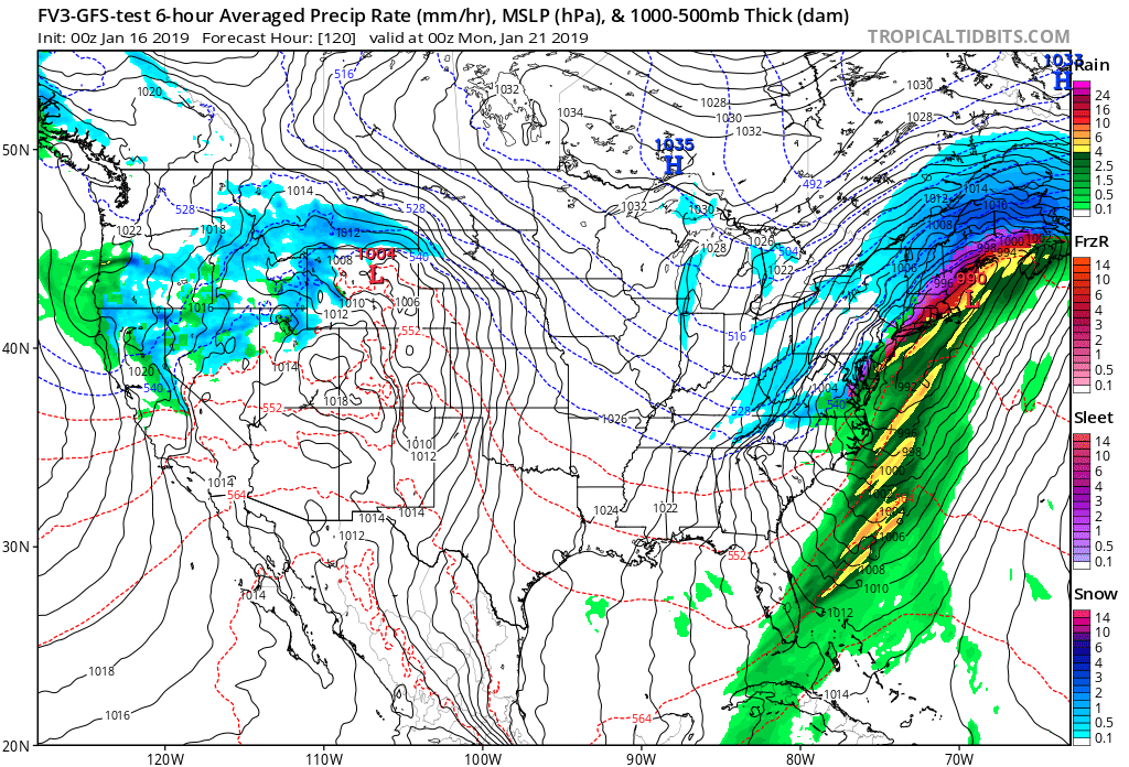
Above...GFS Model for Sunday afternoon. Zooming on East Coast....Blue is snow..purple is ice...yellow and green rain. Need I say anymore.
Be safe.
Be safe.

 RSS Feed
