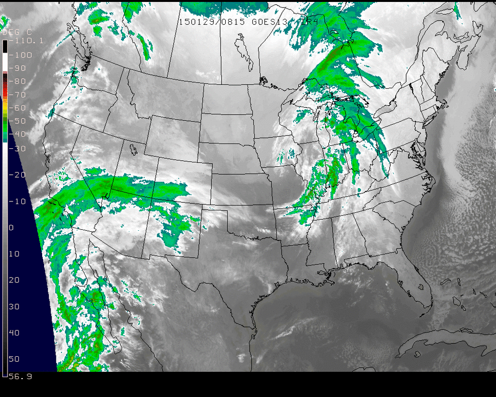
Satellite shows next clipper going thru Great Lakes. It will bring 1-3" of snow to Northeast/New England tonight into Friday followed by windy and cold weather into weekend.
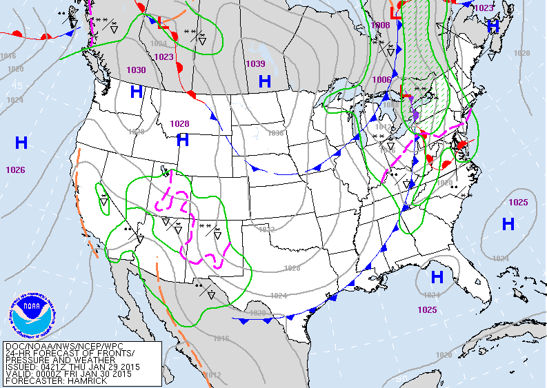
Moisture in the southwest could be a big player late weekend into early next week. Still not sure how this will interact with northern jet stream....and models are at odds.
Moisture in the southwest could be a big player late weekend into early next week. Still not sure how this will interact with northern jet stream....and models are at odds.
Map for this evening shows clipper low in Great Lakes.
It will move southeast to off Cape Cod on Friday. High over Northern Plains is pretty cold....it also moves east. System organizing in southwest is the trouble maker this weekend.
It will move southeast to off Cape Cod on Friday. High over Northern Plains is pretty cold....it also moves east. System organizing in southwest is the trouble maker this weekend.
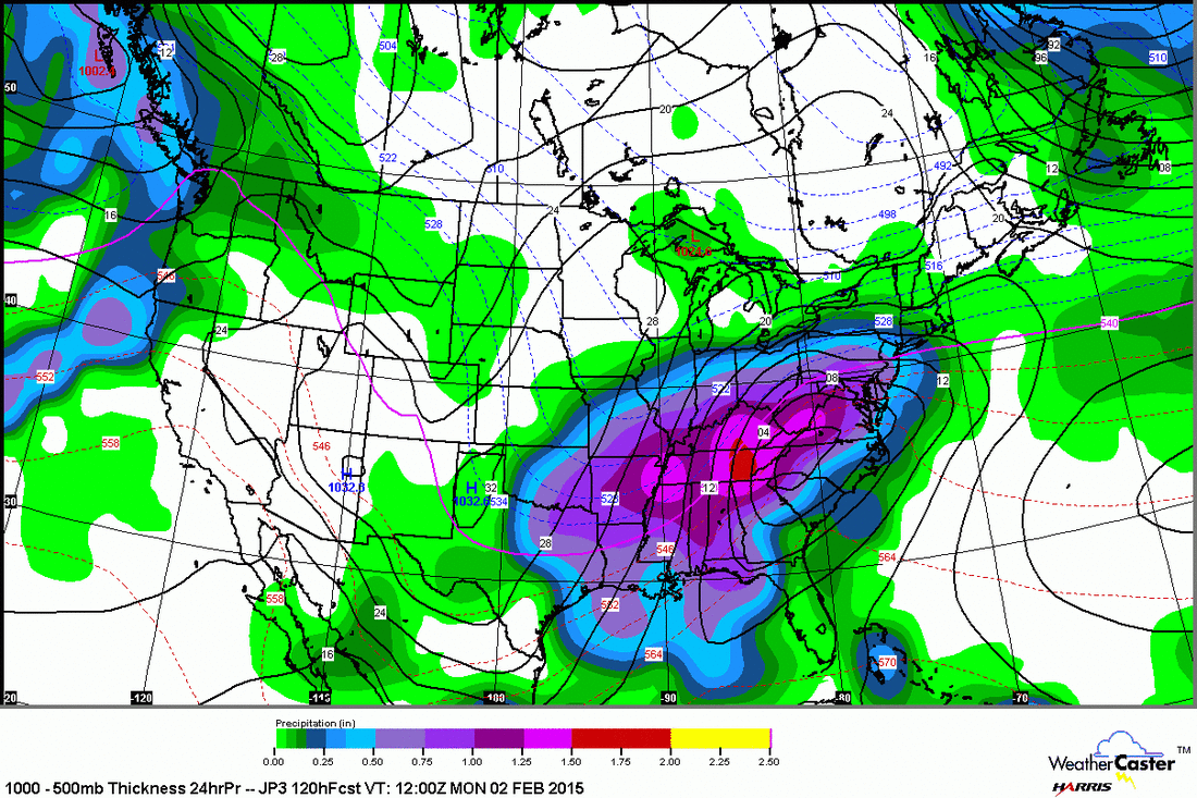
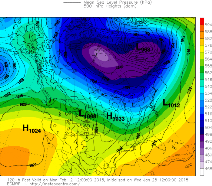
Above the is the Japan Model for Monday. It has the southwest storm over N.Carolina...and snow up to
NYC and Southern New England.
NYC and Southern New England.
This is the Canadian Model for Monday night. It continues to be the model that is slower and more intense...with the storm close to NYC.
This is the Euro for Monday. It continues to insist that
the low will stay far south and nothing to worry about ?
the low will stay far south and nothing to worry about ?
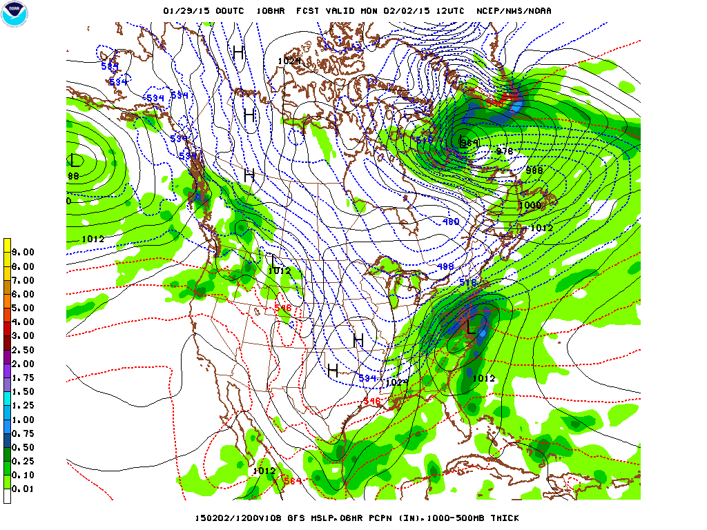
This is the GFS Model for Monday. This model was bombing the Northeast yesterday for Monday with an assortment of precip and then backed off yesterday afternoon. Overnight..it comes back with snow and icy
cold weather for places like NYC and north.
cold weather for places like NYC and north.
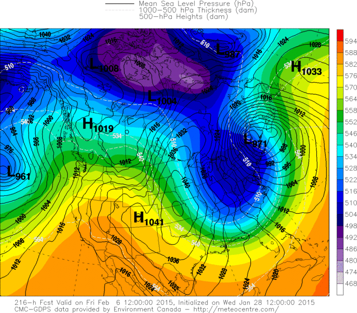
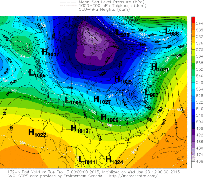
Finally...Canadian for late next week...showing a cold wave blasting down to Southeast on strong winds. So we have quite an array of what models think will happen from
late weekend into next week. Hopefully things will solidify tomorrow. Be safe.
late weekend into next week. Hopefully things will solidify tomorrow. Be safe.

 RSS Feed
