The Eastern US has has a relatively past few months but the changes are underway for an eventful conclusion to the weekend and an active next week as well... First as always, we take a look at the national map to dissect what we can see with the visible satellite imagery from Saturday afternoon.
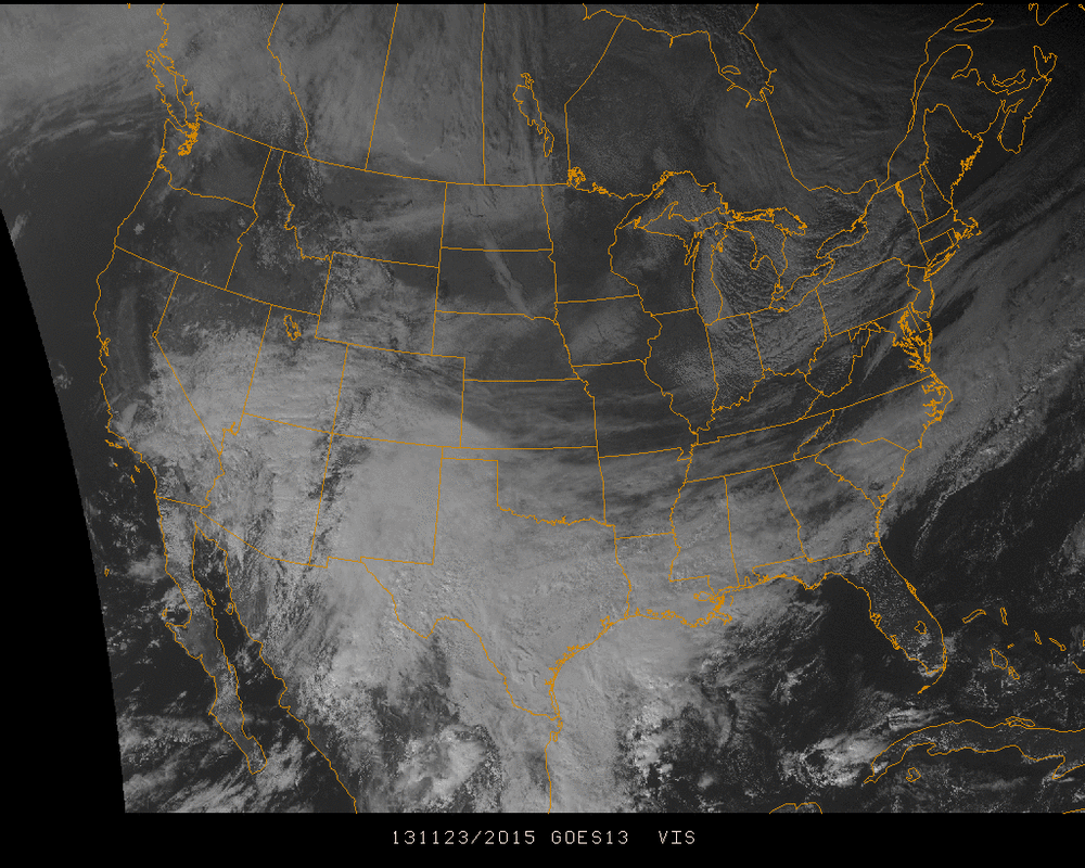
As winter approaches in the northern hemisphere, the jet stream moves further south, thus pushing colder air down with it. Another generic pattern we tend to see as a result in lamest terms are batches of moisture ride along the southern half of the country past the Rockie Mountains, then pick up steam along the Gulf of Mexico and quickly dash up the east coast.
This classic trend can already be seen in the satellite imagery to be in motion with rotation moving eastward, centered near Arizona/New Mexico. The exact path this system will take up the coast and how it will affect the northeast region is still uncertain. Snowfall is definitely a possibility further inland, with rain and a mix with snow probable towards the coast from Tuesday through Wednesday. More will be known Sunday and into Monday.
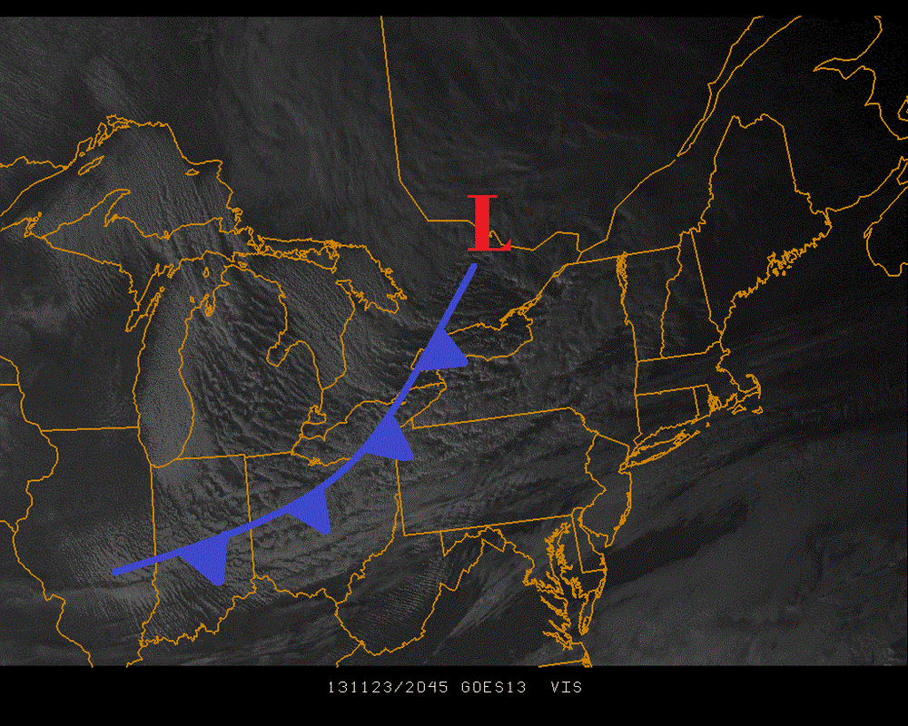
Just looking at Sunday though, the arctic blast that has brought single digits and lower to the upper midwest on this Saturday will hit the Northeast. The positioning of the cold front passing through this evening can also be seen in the movement of the clouds in the Northeast.
This classic trend can already be seen in the satellite imagery to be in motion with rotation moving eastward, centered near Arizona/New Mexico. The exact path this system will take up the coast and how it will affect the northeast region is still uncertain. Snowfall is definitely a possibility further inland, with rain and a mix with snow probable towards the coast from Tuesday through Wednesday. More will be known Sunday and into Monday.
Just looking at Sunday though, the arctic blast that has brought single digits and lower to the upper midwest on this Saturday will hit the Northeast. The positioning of the cold front passing through this evening can also be seen in the movement of the clouds in the Northeast.
This arctic blast will give a feeling of the middle of winter for many areas, with night time temperatures in the 10's and highs near 30 on Sunday. Take into account the gusty winds that have been discussed for the past few days, potentially 40+ mph, and it will feel like a very bitterly cold day.
Make sure you bundle up if you're heading out this evening as well with winds getting up to 30+ mph in wake of tomorrow! The wind advisory's will be issued in masses
- JL
Make sure you bundle up if you're heading out this evening as well with winds getting up to 30+ mph in wake of tomorrow! The wind advisory's will be issued in masses
- JL

 RSS Feed
