Metro Weather Inc. Services
Like us, follow us, link to us, contact us!
  • Home
    • Daily Weather Discussion
  • Weather Prepared for You
    • Film and TV Production
    • Radio & Television
    • Government and Industry
    • Forensic Services >
      • Weather Record Request Form
    • Metro Morning Monitor
  • About Metro Weather
    • Senior Staff
  • Your Weather Images
  • Contact Us

April 01st, 2015

4/1/2015

0 Comments

 
Picture
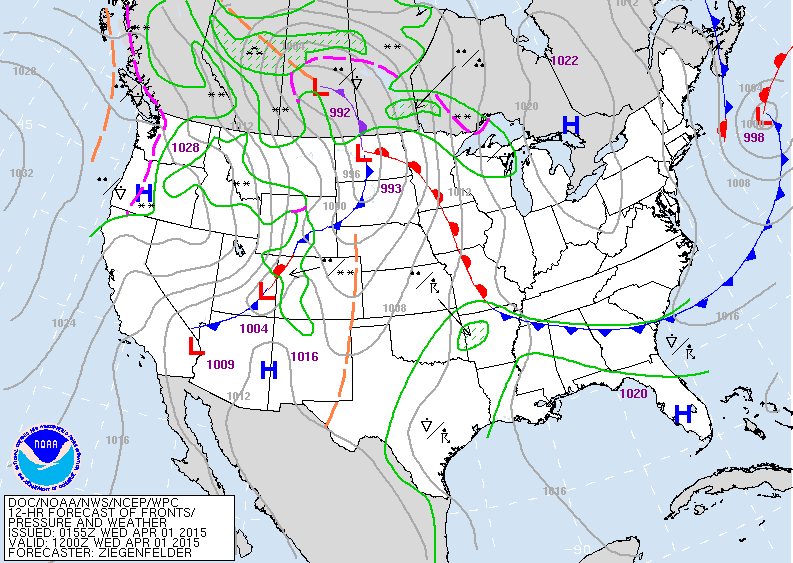
Today's map above shows high pressure over the east...so fair and dry. Storm and front moving out of Rockies will be responsible for rain and snow in Northern Rockies...and upper Midwest.  Showers and storms Gulf States and Texas. As the system heads east an outbreak of severe weather is possible.
Picture
Satellite shows system moving out of Rockies and that will be the weather maker until it reaches east coast on Saturday.
Picture
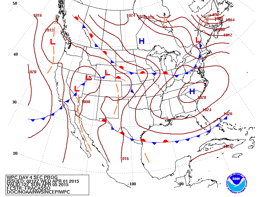
Map for Easter Sunday.  Basically fair and dry with the exception of the Pacific Northwest and Rockies.
Picture
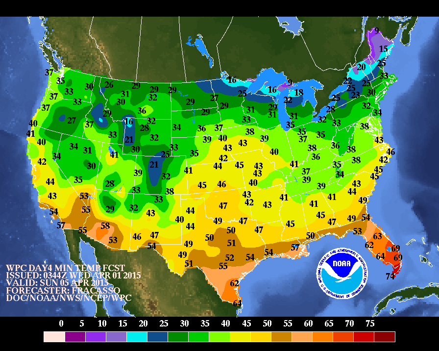
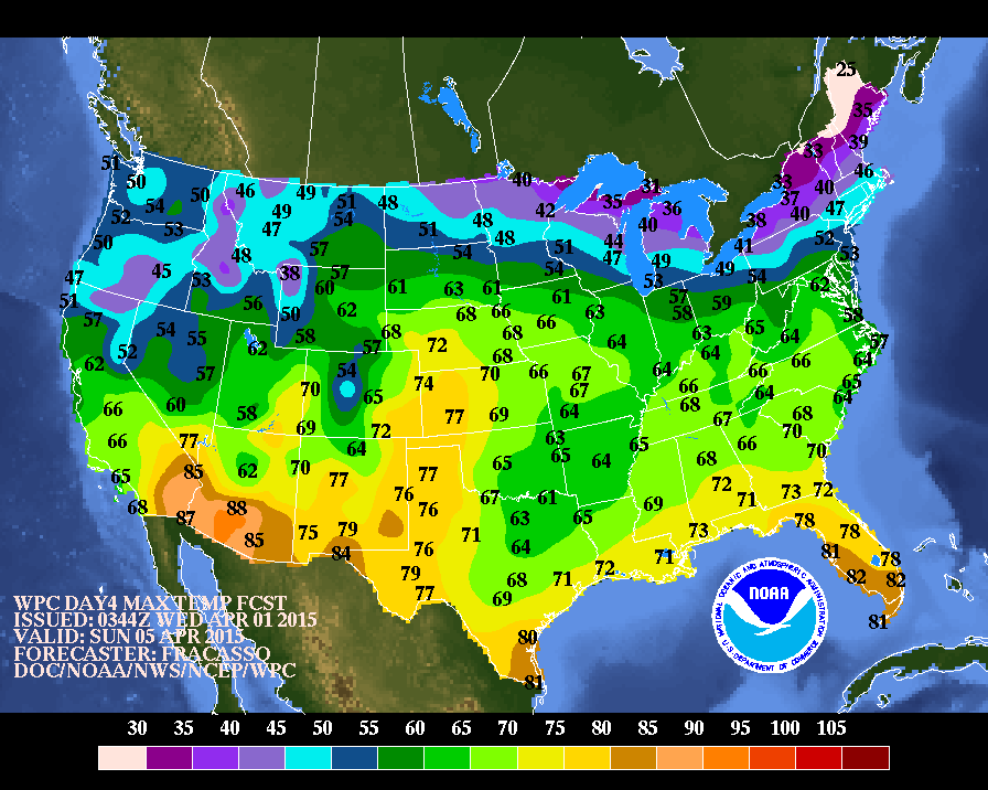
For those attending religious services Easter Morning...here are the expected early morning temperatures.  Below...expected daytime temperatures.
Be safe.
Picture
0 Comments


Leave a Reply.

    Genesis of a Tornado
    We'll have daily weather discussions, talking about major systems on the horizon along with anything noteworthy that pops up on our radar.

    Pat Pagano,
    Mike Merin

    Follow us on Twitter and like us on Facebook to get updates whenever we post a new entry!

    RSS Feed

Powered by Create your own unique website with customizable templates.