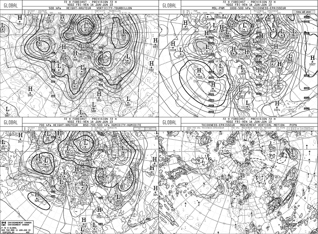
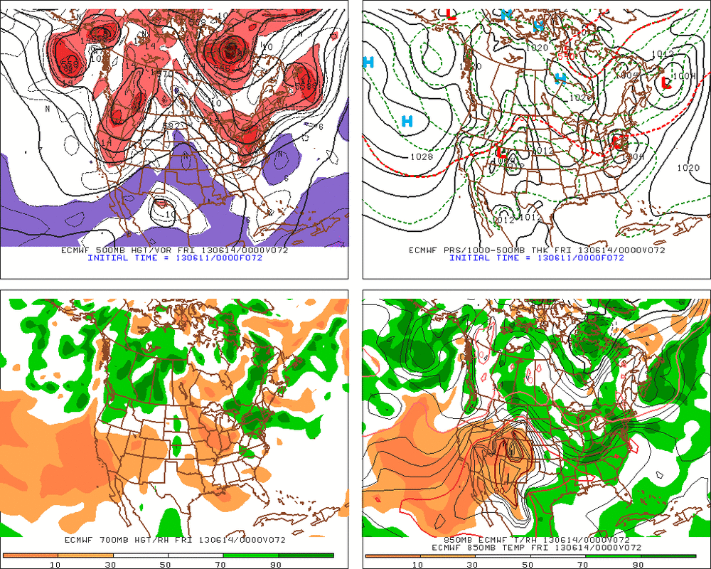
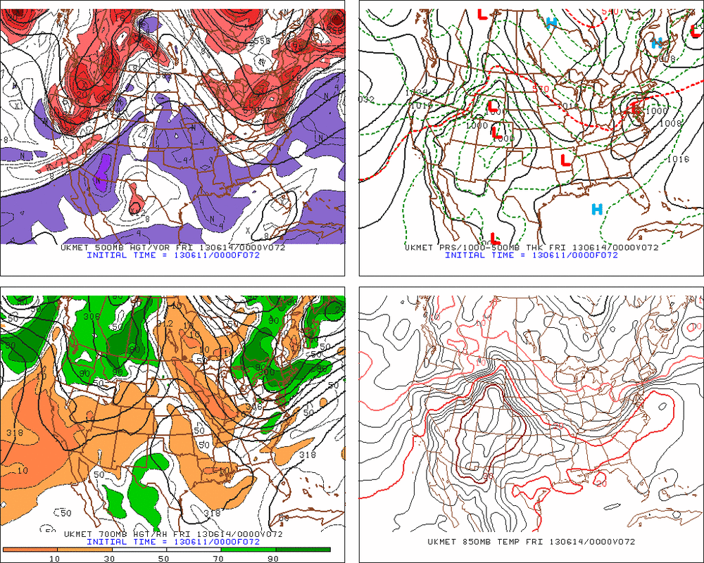
After record rains in NE yesterday....showers and some thunderstorms will still be in the picture today. The storm depicted by THE GFS last week is coming into focus true to form. SO GFS/ Canadian did very well so far on this one. Other models are now coming into play. The Euro which was far south..has moved north...and below you can see all of the models and how similar they are. Heavy precip expected...and this will turn out being one compact nor'easter by Thursday nite. Even after it moves out Friday...an upper trof will kick up a few more shwrs/t-storms before it dries out on Saturday. Warm front could produce more clouds..showers and t-storms late Sunday.
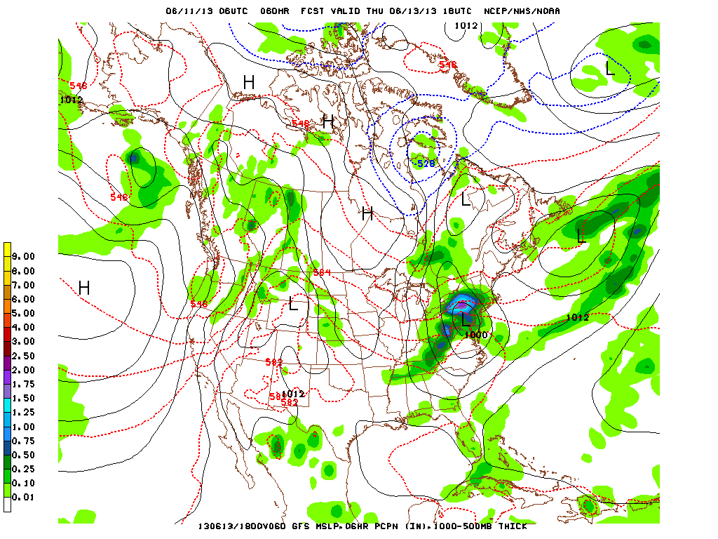
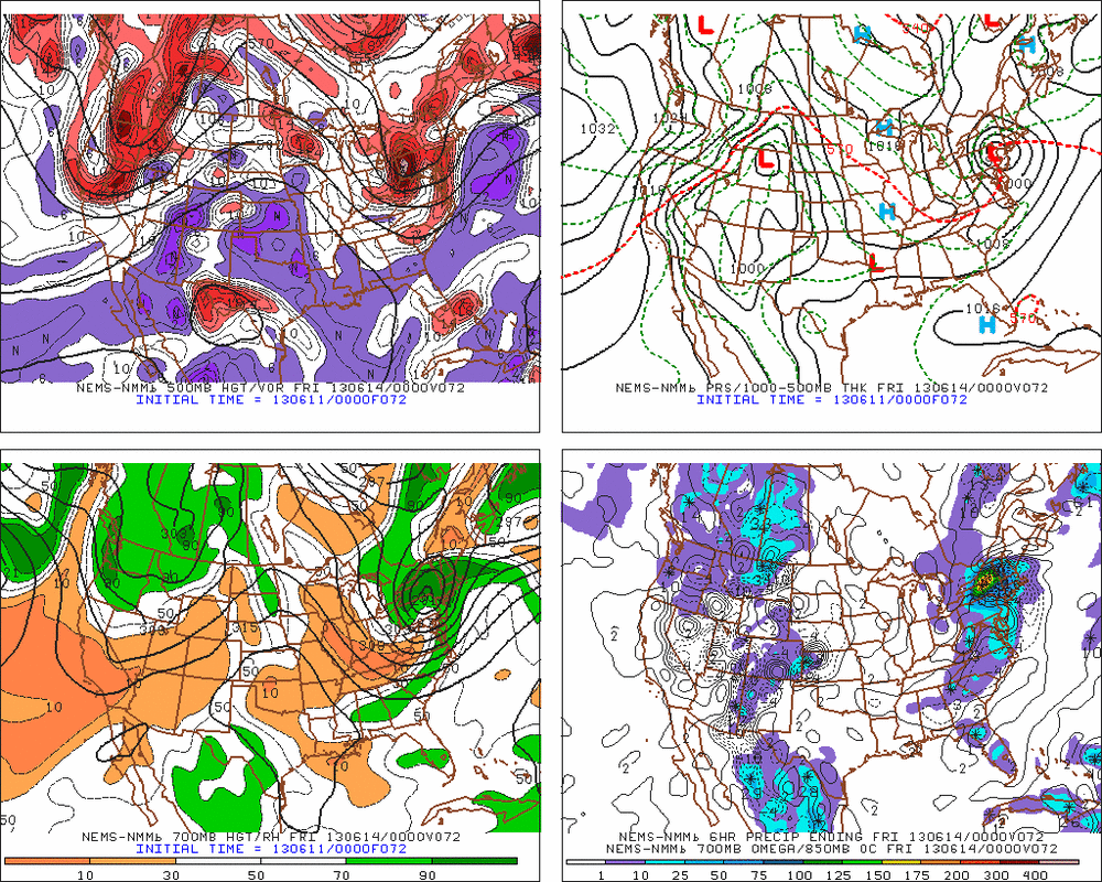
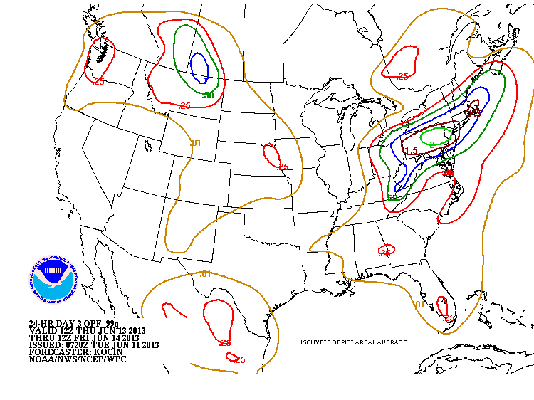
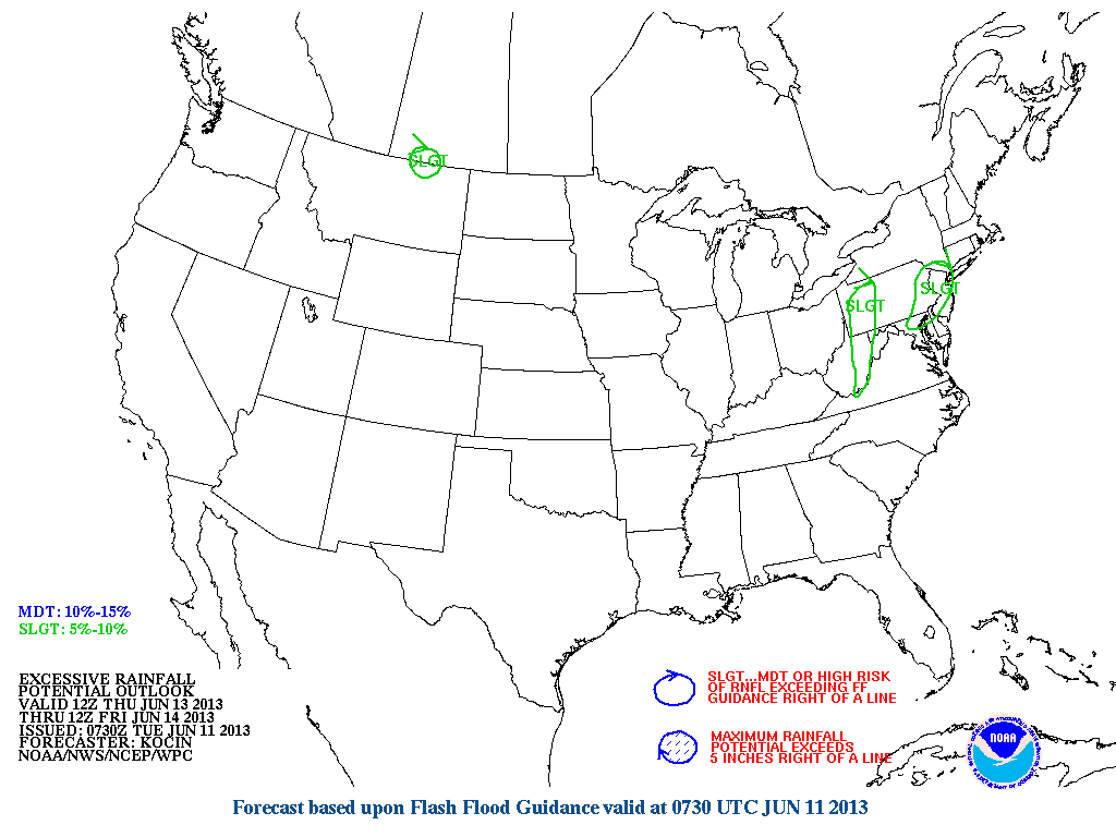
Below you can see the expected rainfall amounts....and below that chart is the outline...though faint.....of where rainfall could be excessive.
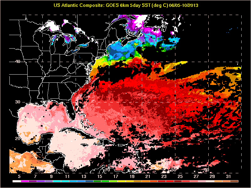
Finally.....here's a shot of just how warm the sea surface temps are in the Atlantic.....leading to believe this will be an active hurricane season. Be safe...later.

 RSS Feed
