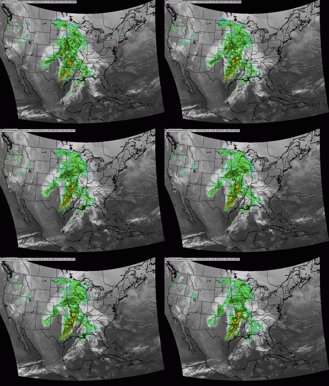
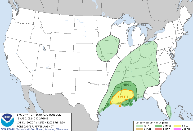
Satellite/radar - above - winter storm bringing blizzard weather to Northern Plains and Upper Midwest - up to 1 foot in many areas there..severe thunderstorms and tornadoes south. This system moves into the East late tonight through Friday with more heavy rains. Below- todays risk of severe weather in green....yellow and tan.
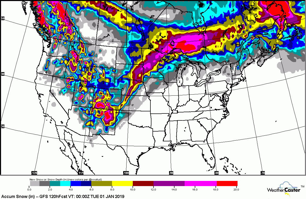
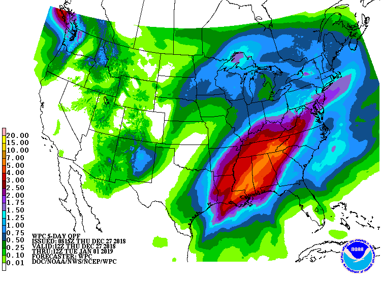
Below - snowfall predictions for next 5 days....followed by rainfall for next 5 days.
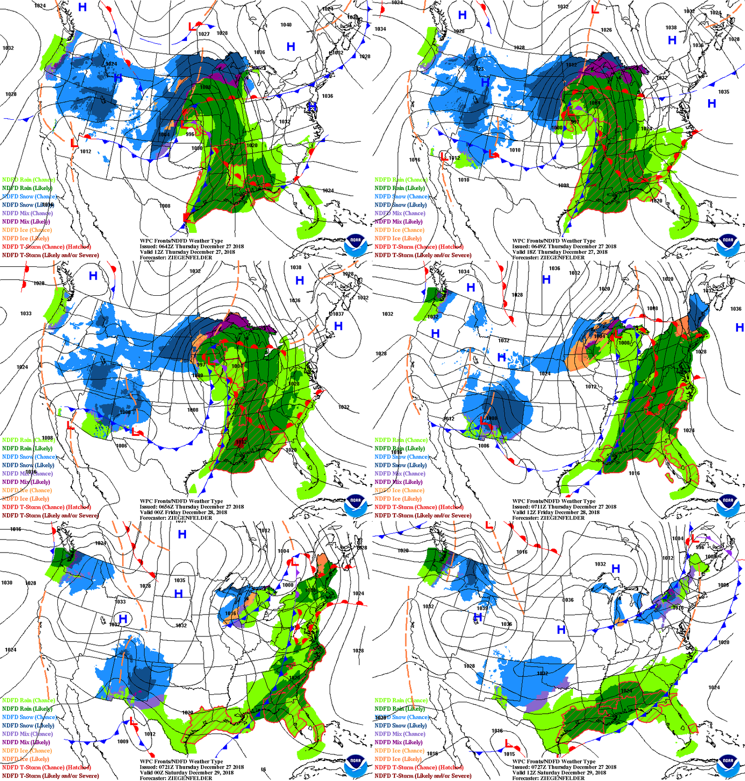
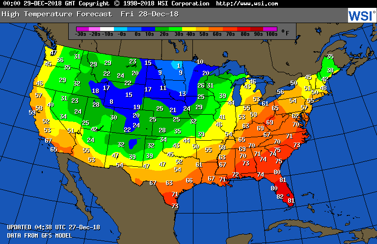
Below - animated maps for the next 2 days....followed by high temperatures for Friday. Be safe.

 RSS Feed
