Arctic air is well entrenched over the east. Moisture from the Plains will cause an expanding area of precipitation this weekend...reaching the east by Saturday night.
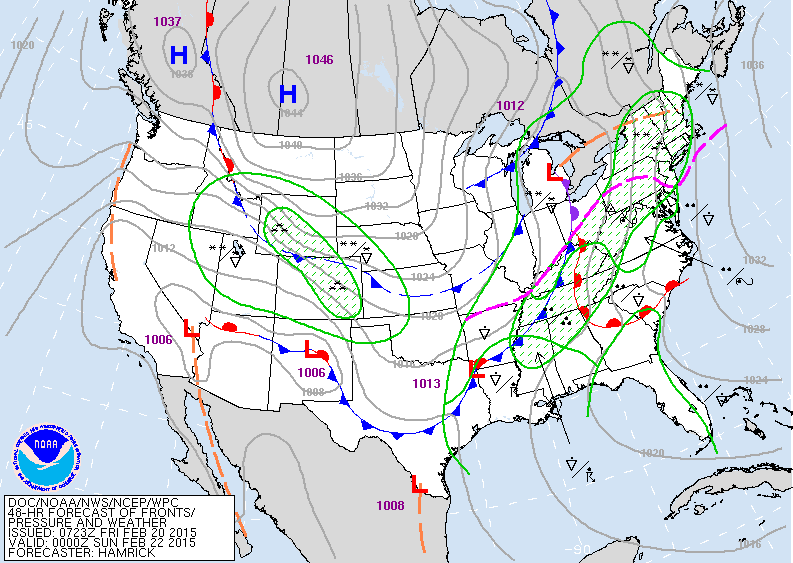
Map above is valid for Sat.nite. Widspread precip in the east with the dashed pink line representing snow and ice to the north and west....rain to the south. More snow over The Rockies and yes....that high is Canada...next brutal arctic air mass.
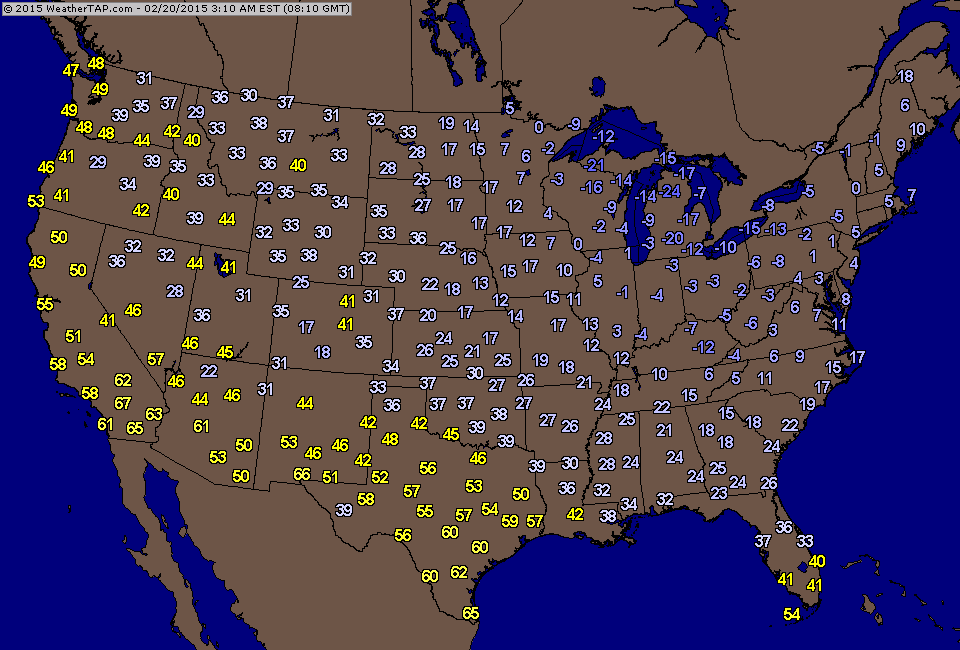
Above...Friday 4am temperatures. Notice Ft. Lauderdale at 41...they will dip to 30s before heading into the 50s. Models are not on the same page come next Wednesday. The Euro and UKMET models want to hit the Northeast with another coastal storm...while The GFS - Canadian do not. I opt for the latter....but in case you would like to see...they are below.
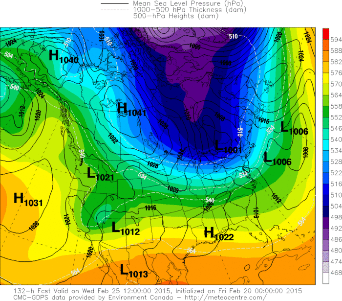
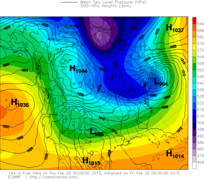
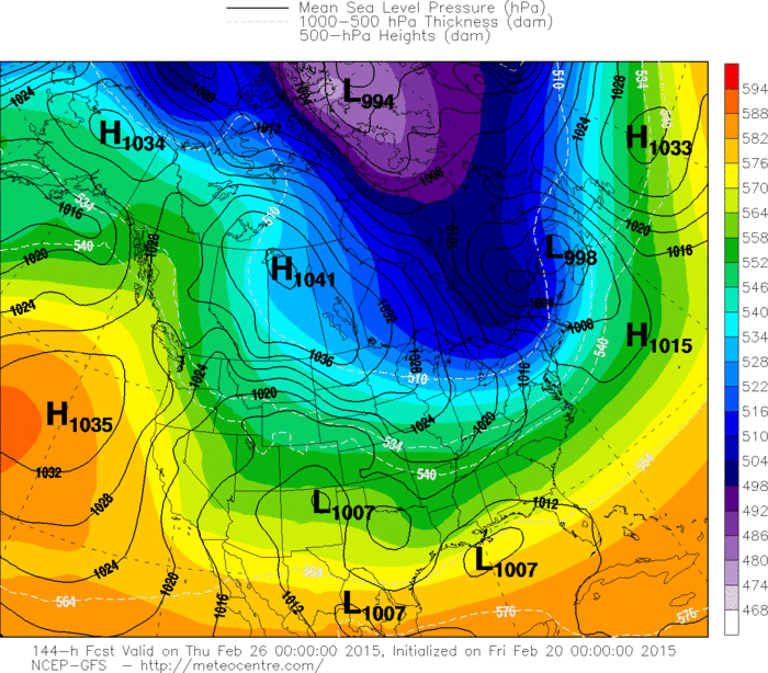
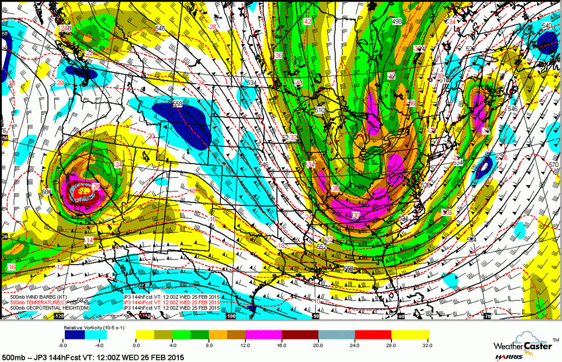
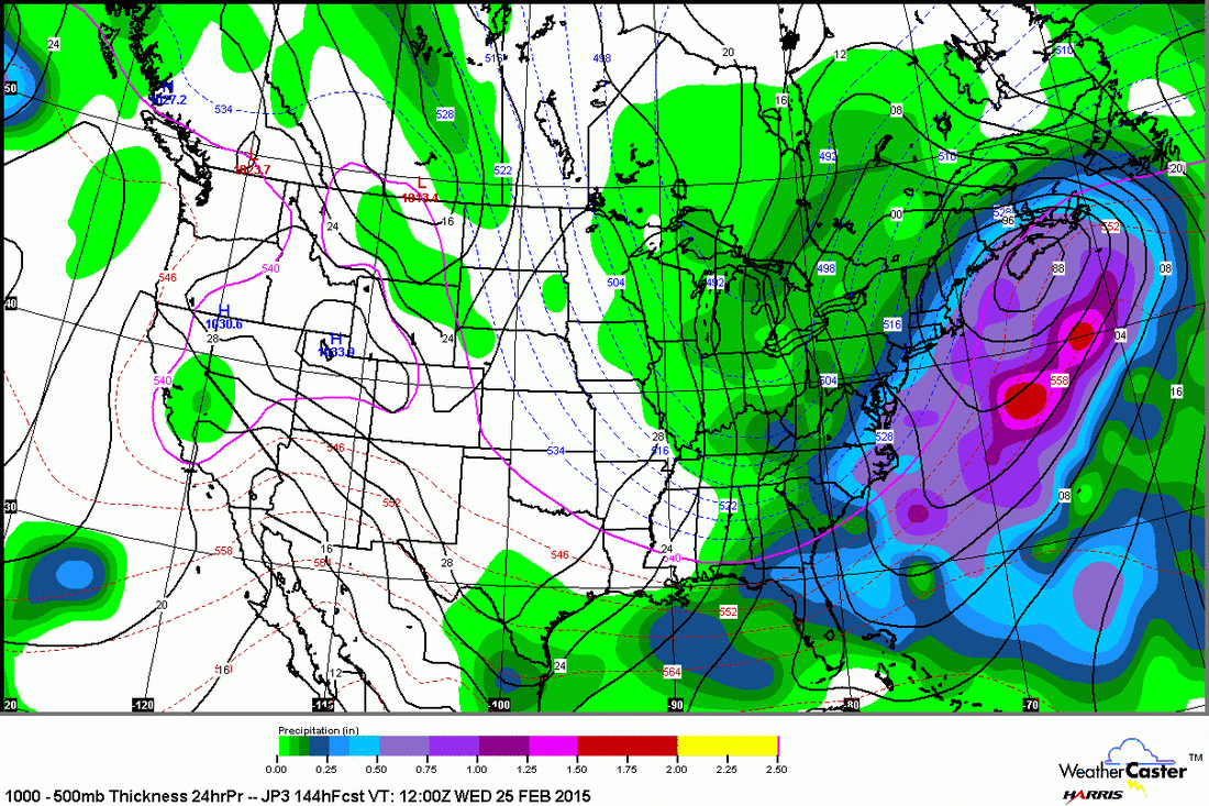
Below is the Japan Model. This model not used widely but is pretty good. It indicates a strong trof at 500 mb....first panel....reflecting a large storm just offshore - 2nd panel. Obviously this is in the camp of The Euro and Ukmet....so will be interesting to see who turns out right on this one.
Be safe over the weekend.
Be safe over the weekend.

 RSS Feed
