Metro Weather Inc. Services
Like us, follow us, link to us, contact us!
  • Home
    • Daily Weather Discussion
  • Weather Prepared for You
    • Film and TV Production
    • Radio & Television
    • Government and Industry
    • Forensic Services >
      • Weather Record Request Form
    • Metro Morning Monitor
  • About Metro Weather
    • Senior Staff
  • Your Weather Images
  • Contact Us

Another Active Front......

11/17/2017

0 Comments

 
Picture
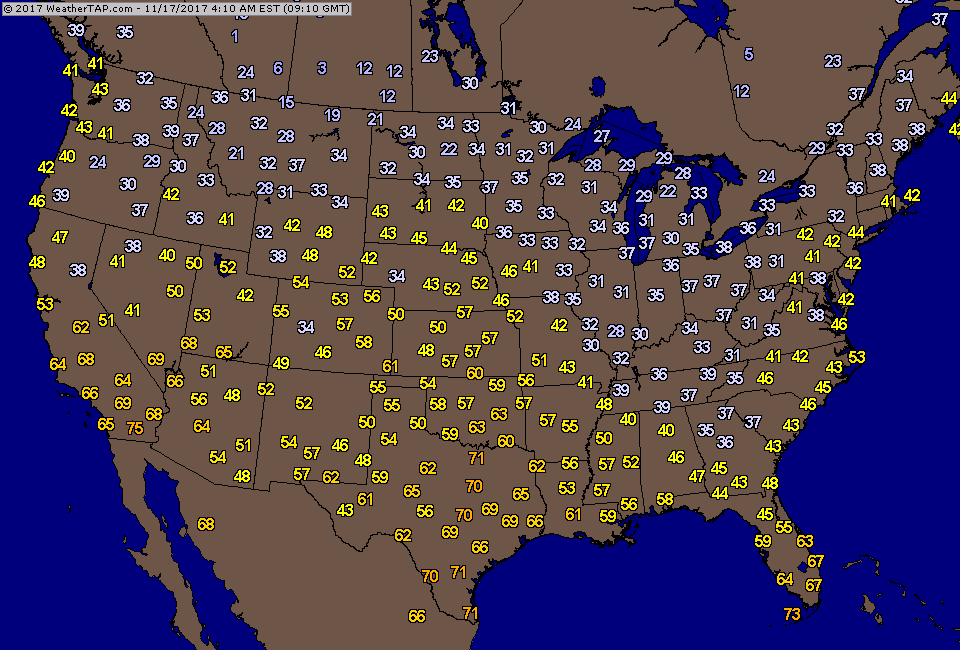
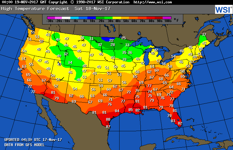
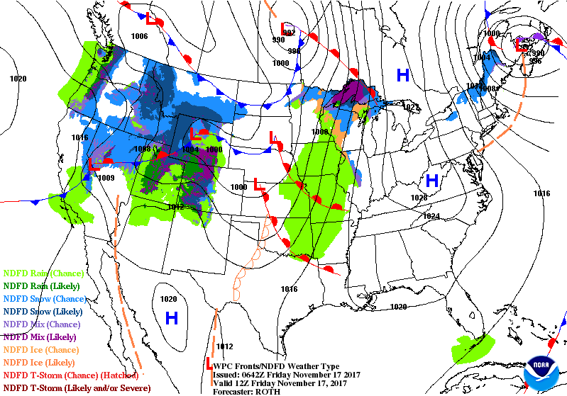
Front from Upper Midwest to West Coast will head east and bring wet weather to The East Saturday into Sunday. Behind it...lake effect snows Sunday into Monday.  Odds favor mainly quiet weather moving into Thanksgiving week.  Below - current morning temperatures followed by expected highs for Saturday.
Picture
Picture
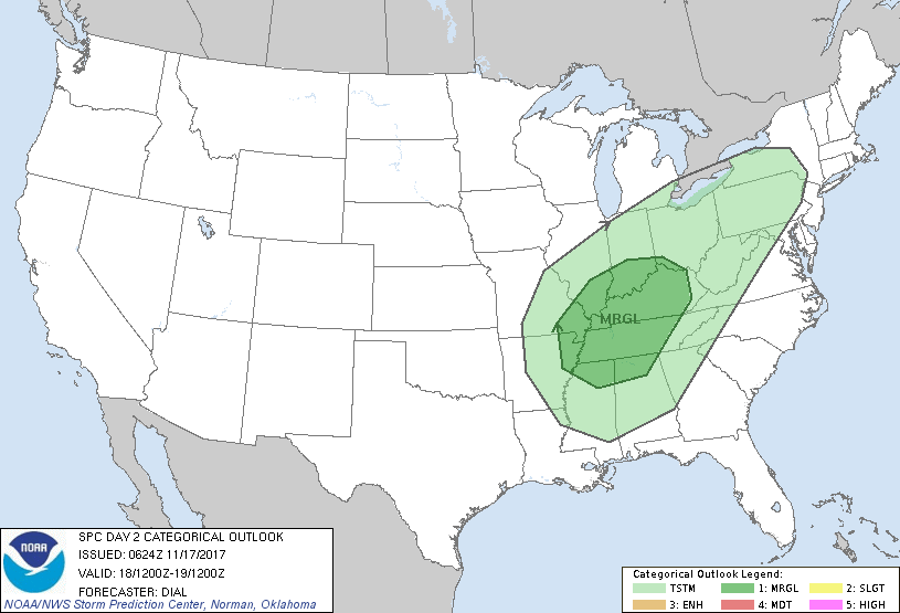
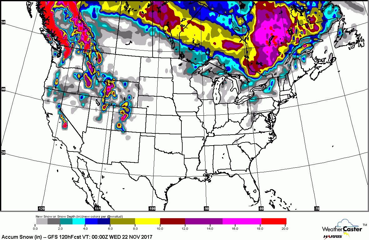
​Below - chances for severe weather on Saturday in dark green...although marginal..needs to be watched. Below that - expected snow in the next 5 days.
Picture
Picture
​Lastly...animated maps for the weekend. Be safe. 
Picture
0 Comments


Leave a Reply.

    Genesis of a Tornado
    We'll have daily weather discussions, talking about major systems on the horizon along with anything noteworthy that pops up on our radar.

    Pat Pagano,
    Mike Merin

    Follow us on Twitter and like us on Facebook to get updates whenever we post a new entry!

    RSS Feed

Powered by Create your own unique website with customizable templates.