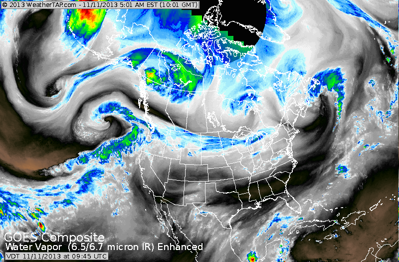
Infrared satellite shows the leading edge of cold air extending from Great Lakes to Pacific Northwest. It's moving south and will chill a good part of The Nation this week....but quiet.
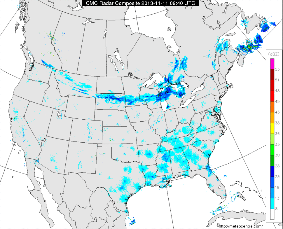
This Nat'l radar shows a band of rain from Great Lakes to Montana. It is the cold front...and it will result in rain changing to flurries over the
Gt Lks and Northeast tnte and Tuesday a.m.
Gt Lks and Northeast tnte and Tuesday a.m.
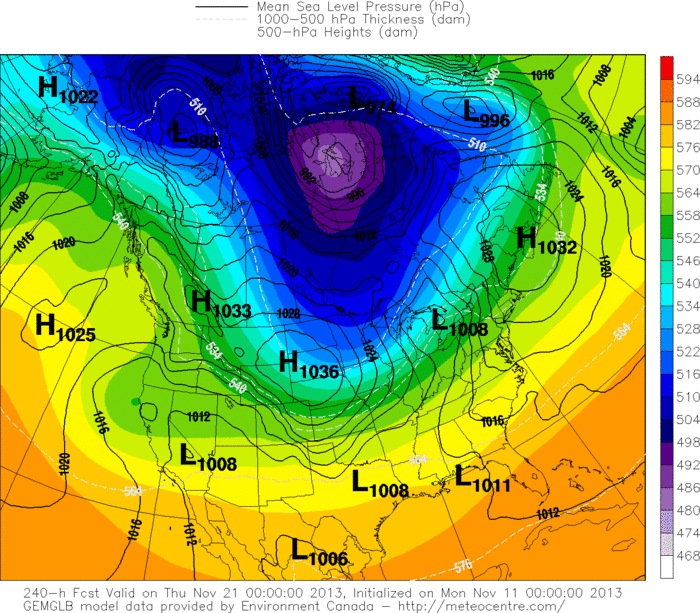
This model is for 10 days out...Next Thursday. The darker the colors the colder the weather. We can clearly see this cold air seeping south
again and by end of next week...more wintry weather. Thank you
Veteran's for protecting us and our great Country. Later.
again and by end of next week...more wintry weather. Thank you
Veteran's for protecting us and our great Country. Later.

 RSS Feed
