Satellite picture shows a speck of blue in New York State...that's lake effect. Aside from that....the mass of blue and green out west is the next front which will press only slowly east allowing a mild up. By Sunday..temps could approach 70 away from the shore along the East Coast...with showers...and snowmelt ! Colder weather thereafter.
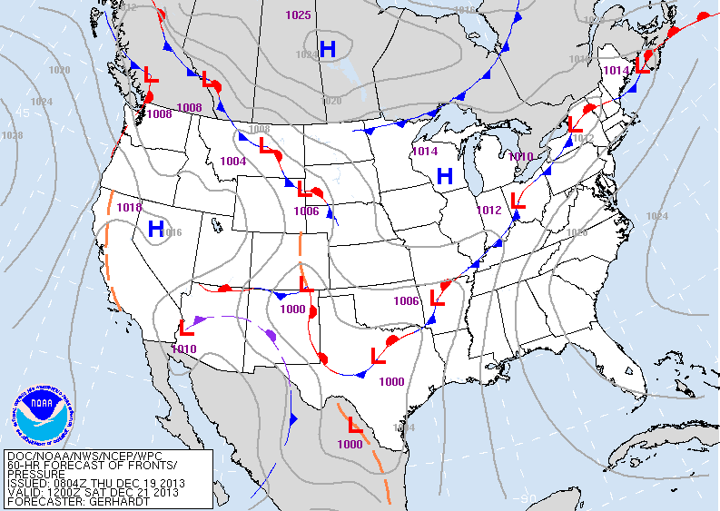
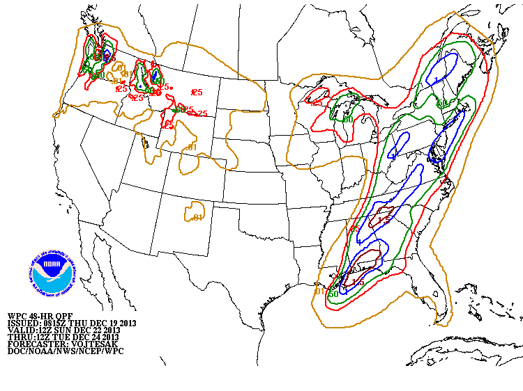
This map valid for Saturday. You can see the front wiggling from NYS to Texas. East of front...mild..and sometimes wet....in back of the front colder with some mixed precip. Below....generous amounts of rain with and ahead of front thru weekend. Places that have snowpack..will not only have fog to deal with but melting and flooding.
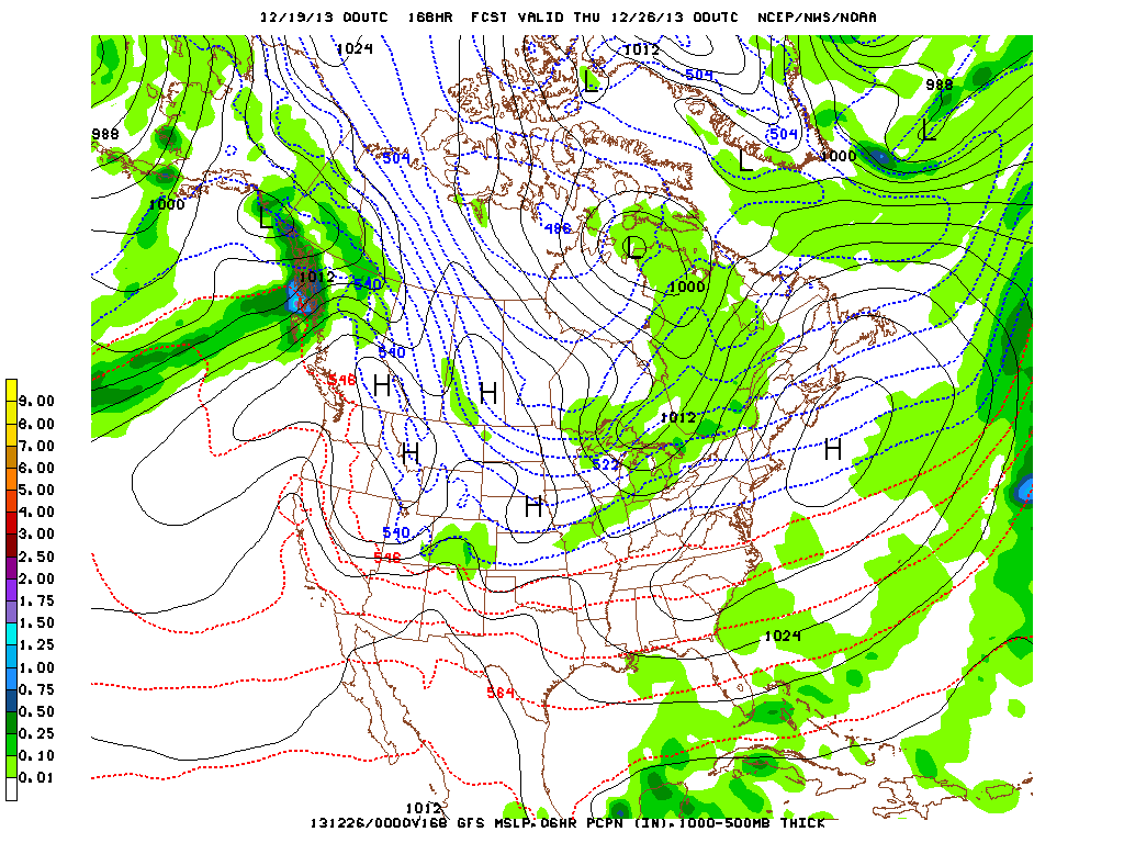
Lastly...this is the GFS for Wednesday...Christmas Day. IT shows a front through the Gt Lakes with some snow...so from Wisconsin to Michigan and even Chicago...some snowshowers will fall making it a true White Christmas there. Colorado will have some snow...and so. Florida will have some rain. Trivia Christmas question: What is the most watched Christmas movie ? Answer tomorow.


 RSS Feed
