
Above - satellite picture showing Arthur. Even though he is gaining strength ...his image is still not as a well formed tropical system...but expected to become a category 1 hurricane and it moves north.
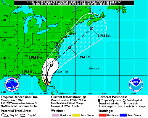
Track expected to move it across outer banks of N.C. Friday morning and then well south of Cape Cod. N. Carolina will experience the worst of Arthur.
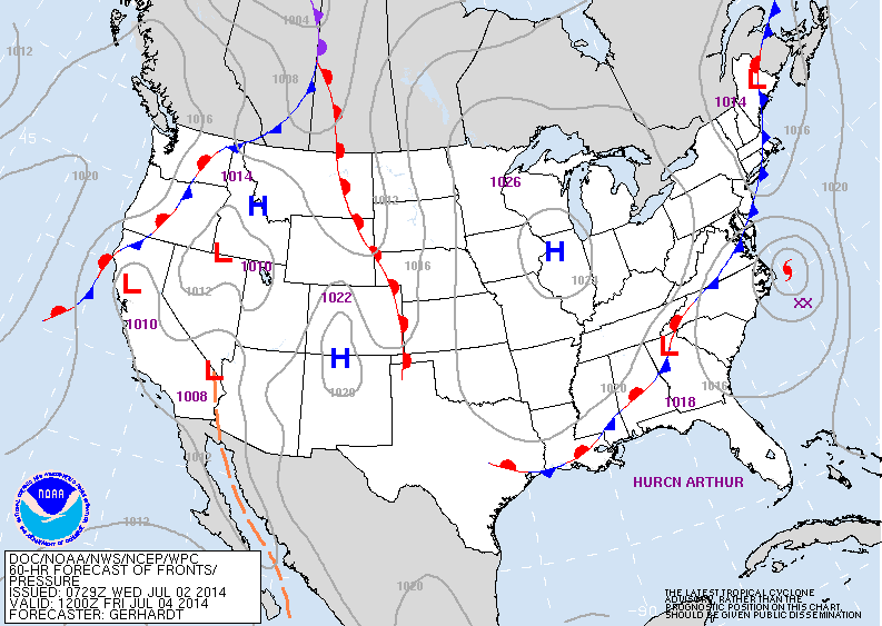
Map above - Friday- 4th July a.m. showing Arthur near Cape Hateras N.C. High pressure over Chicago will bring nice weather to much of The East...especially Saturday and Sunday.
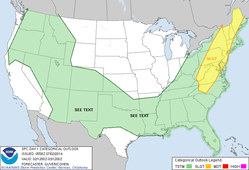
Today's severe outlook in yellow...covers NYC...Phily, Washington DC and Baltimore .
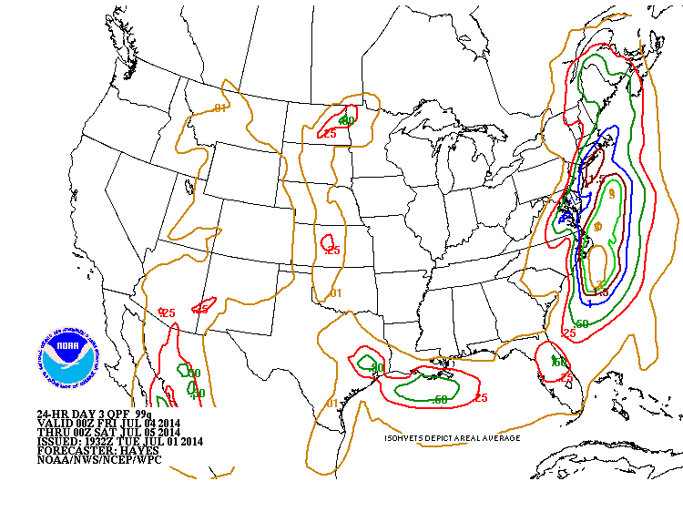
Amounts of rainfall predicted through Friday evening. Heaviest rain along the coast from N. Carolina to Southern New England. We can only hope this is wrong. Later.

 RSS Feed
