Most of the country is dry today with the mildest temperatures of the month continuing into the weekend before the cold air moves back into place. The water vapor and infrared imagery below both show how dry the air is today.
After a weak trough brings widely scattered and light precipitation to the eastern US into Sunday night, the cold winter air will return for next week for the eastern US.
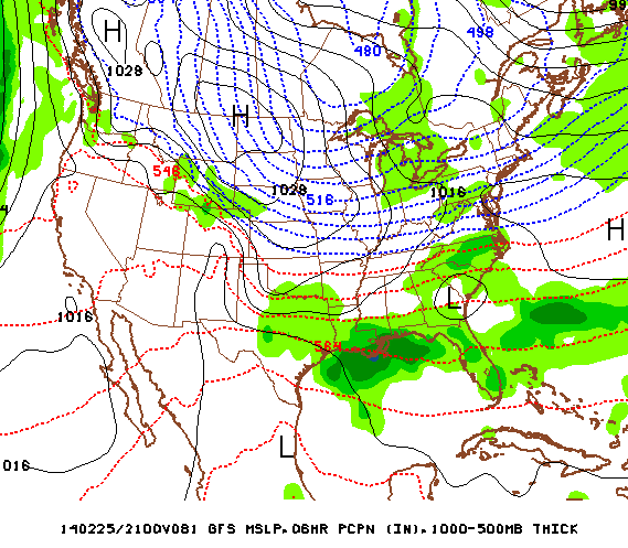
Tuesday into Wednesday the next low pressure system develops along the Gulf Coast and then run up the eastern seaboard. The below image shows the position of the developing storm late Tuesday. The uncertainty currently lies in the exact track once it makes its move northeast. Whether it be far enough out to seas or not and thus avoid a classic nor'easter will be determined in future model runs.
Enjoy the rest of the mild weekend.
- JL
- JL

 RSS Feed
