Metro Weather Inc. Services
Like us, follow us, link to us, contact us!
  • Home
    • Daily Weather Discussion
  • Weather Prepared for You
    • Film and TV Production
    • Radio & Television
    • Government and Industry
    • Forensic Services >
      • Weather Record Request Form
    • Metro Morning Monitor
  • About Metro Weather
    • Senior Staff
  • Your Weather Images
  • Contact Us

Active weather from coast to coast

7/21/2014

0 Comments

 
Picture
Satellite shows several areas of wet weather: 1 - over The Southeast, another of The Southwest, Pacific Northwest into Upper Midwest. 
Picture
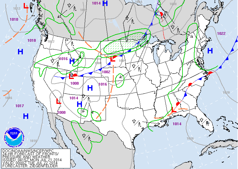
Map above is valid for early this evening. Cold front in upper Midwest is focus for today's severe weather in upper Midwest. That front will reach The East Thursday. Until then much of the Nation has warm - humid weather.
Picture
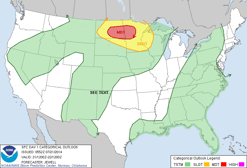
Above - today's threat of severe weather in yellow. Red shows a higher risk from N.Daktoa into Minnestoa....late today and into tonight. Tornadoes are possible in the red area.
Picture
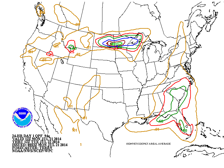
Above...amounts of rain through tonight.  Carolinas into Florida will have moderate rain. Heaviest rain coincides with severe risk from North Dakota to Minnestoa...where 1"-3" of rain are possible in t-storms late today and tonight. Be safe..stay cool.
0 Comments


Leave a Reply.

    Genesis of a Tornado
    We'll have daily weather discussions, talking about major systems on the horizon along with anything noteworthy that pops up on our radar.

    Pat Pagano,
    Mike Merin

    Follow us on Twitter and like us on Facebook to get updates whenever we post a new entry!

    RSS Feed

Powered by Create your own unique website with customizable templates.