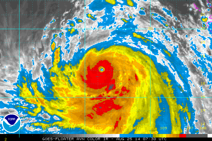
Hurricane Marie...sw of Southern tip of Baja California is a major hurricane with winds of 165 mph. Marie is moving west...and no threat to land but could bring waves over 10ft to So. California.
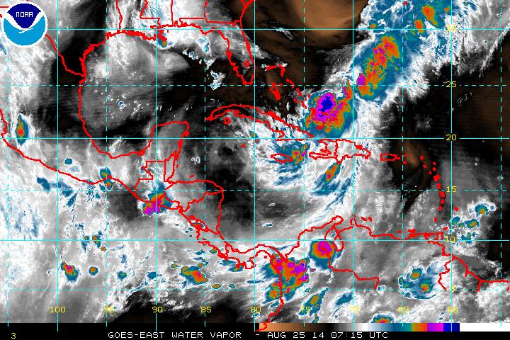
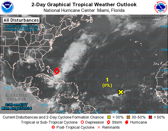
Tropical Storm Cristobal over Bahamas....moving north...no threat to land.
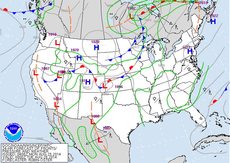
Cold front over upper Midwest will head east and move off the East Coast by Thursday. Aside from that feature...warm and more humid East....cool and fall-like west.
Today's map shows cold front moving thru Great Lakes but not a big rain producer. Warm ahead of the front...cool behind it.
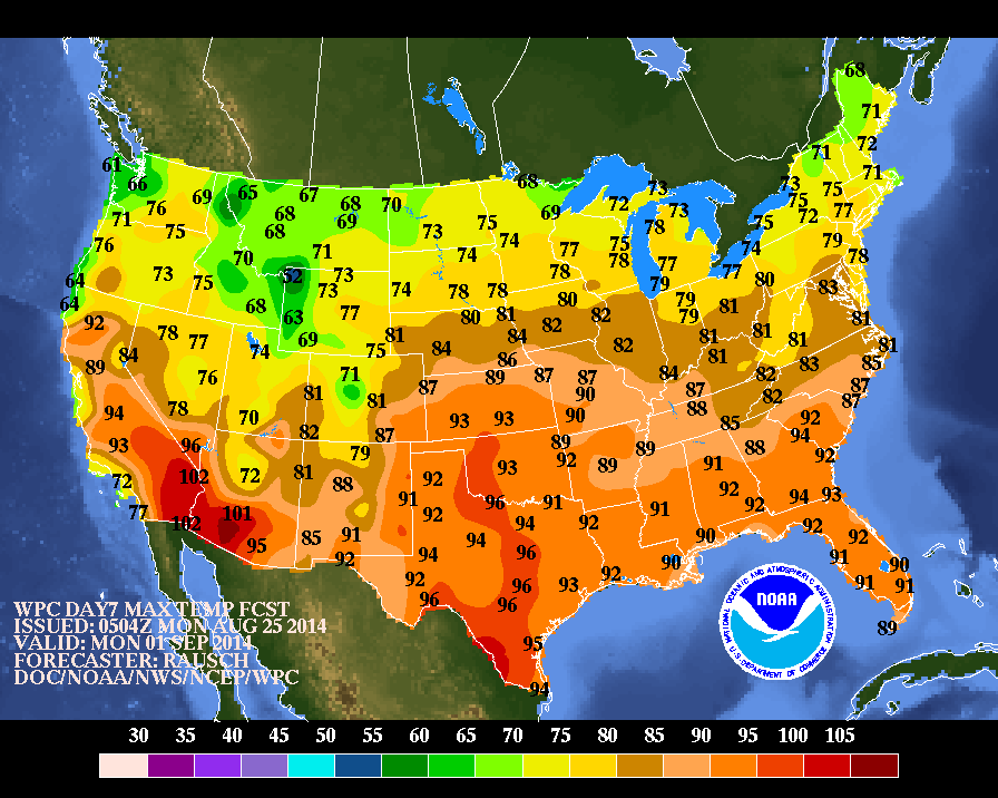
Above...high temperatures projected for next Monday...Labor Day. Some of those cool temperatures are a result of clouds and wet weather...more on that later this week.
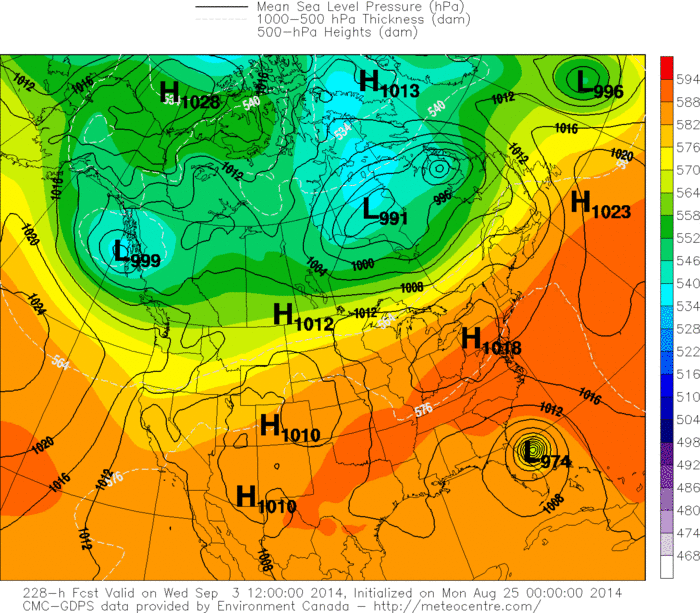
Hurricane center picking up another disturbance on Central Atlantic - noted by yellow x. The Canadian Model grabs this system and brings it into Florida as a hurricane next Wednesday...after Labor Day. This is a long range projection...but they were the first model to pick up on Cristobal. Originally they had him moving off East coast and then targeted Florida.....so caution advised. Below is the
Canadian model. Stay safe.
Canadian model. Stay safe.


 RSS Feed
