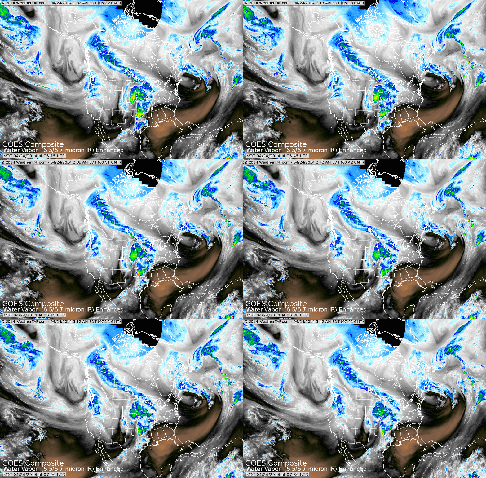
Satellite shows storm off New England...which will still bring wind to The Northeast today. Next system in Midwest may cause severe weather in south today...and then head east to bring a shot of rain
Friday nite. Next system is Pacific Northwest will become a major
major weather much of next week. The storm will not only bring
snow in the north...but heavy rains and severe weather south.
Friday nite. Next system is Pacific Northwest will become a major
major weather much of next week. The storm will not only bring
snow in the north...but heavy rains and severe weather south.
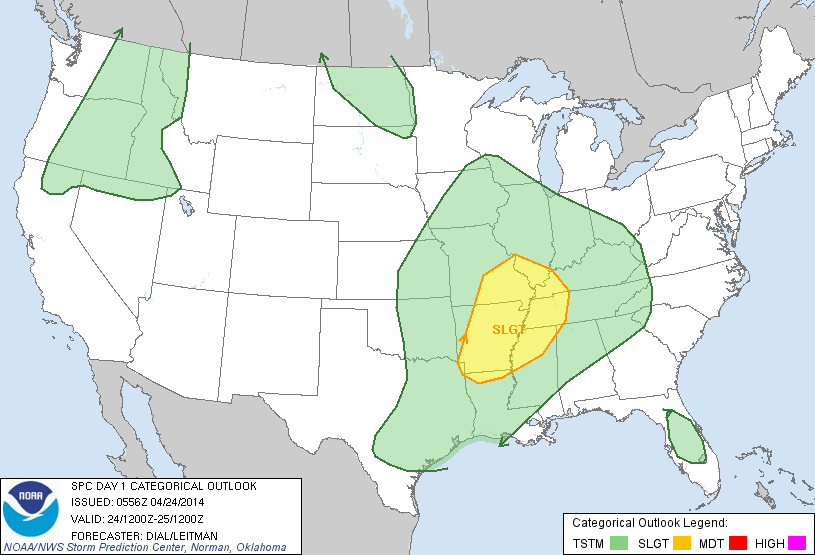
Above....yellow indicates risk of severe weather today.
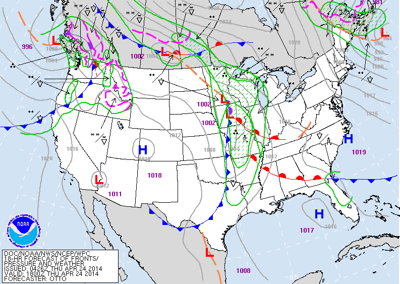
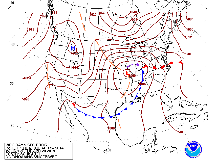
Above..today's map showing the Midwest system....and then the more potent system in The Pacific Northwest. As the Nation goes into a blocky type pattern ...the system out west will become a massive storm covering plenty of real estate. Below...weather map for mid part of next week....notice how that one storm covers much of The U.S.
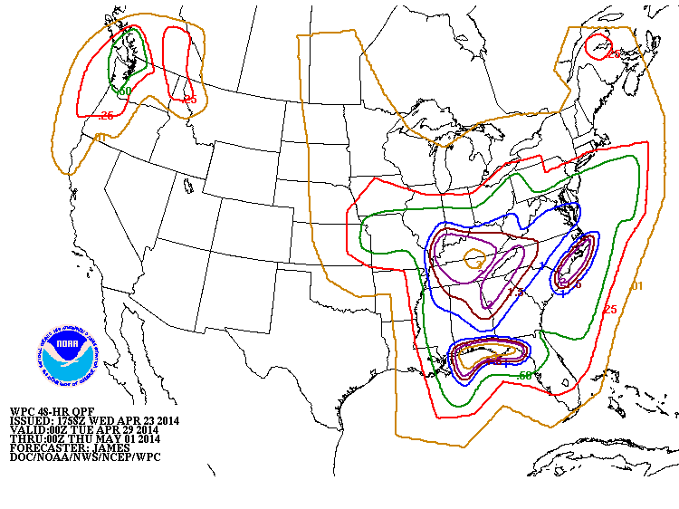
Above...amounts of precip. projected for Tuesday/Wed next week. Some places getting 5" of rain....and it will push northward.
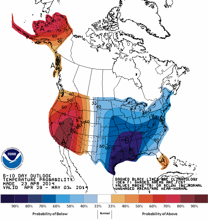
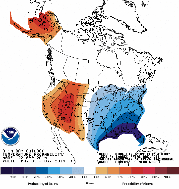
Below...maps showing how temperatures will average through the first week of May. The East continues to be below normal...deep south..well below. What else is new ? Later.
Below...maps showing how temperatures will average through the first week of May. The East continues to be below normal...deep south..well below. What else is new ? Later.

 RSS Feed
