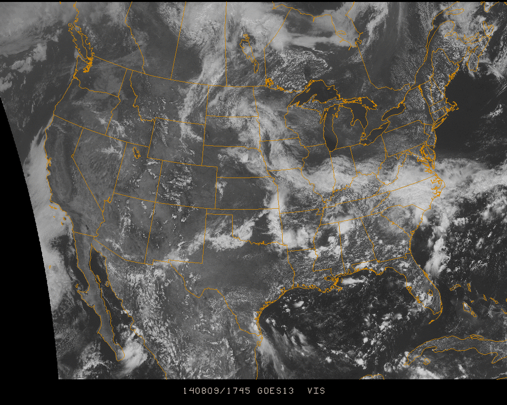
High pressure is keeping the Northeast sunny and dry. However, towards the south and Midwest, the weekend is a bit wet with the promise of more in the coming days...
Plenty of clouds showing the path of the stationary front splitting through the upper portions of the Southeast are spurring up showers & thunderstorms for the region. Meanwhile, towards the Midwest, low pressure is building as the center crosses the Mississippi near Kentucky and Tennessee. The will be the rain-maker into the midweek for the Great Lakes, Mid-Atlantic, & Northeast. Expect rain showers to reach said areas Tuesday, extending into Wednesday towards New England.
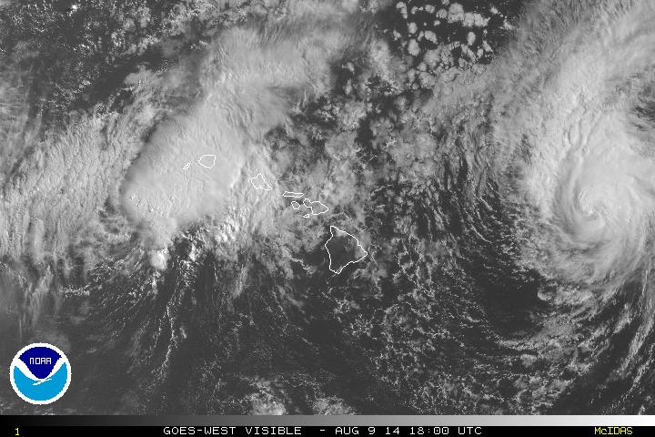
As for Hurricane Julio, its movement is taking the center well north of the Big Island of Hawaii. At this point, the beach waters could see a bit of choppiness, but there's no real threat against Hawaii right now with Julio.
Enjoy your weekend!
- JL
Enjoy your weekend!
- JL


 RSS Feed
