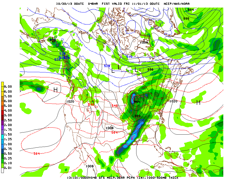
The above map is valid for 8pm Thursday...so halloween day and night will be quite soggy from Great Lakes down to Gulf...and over to
the northeast.
the northeast.
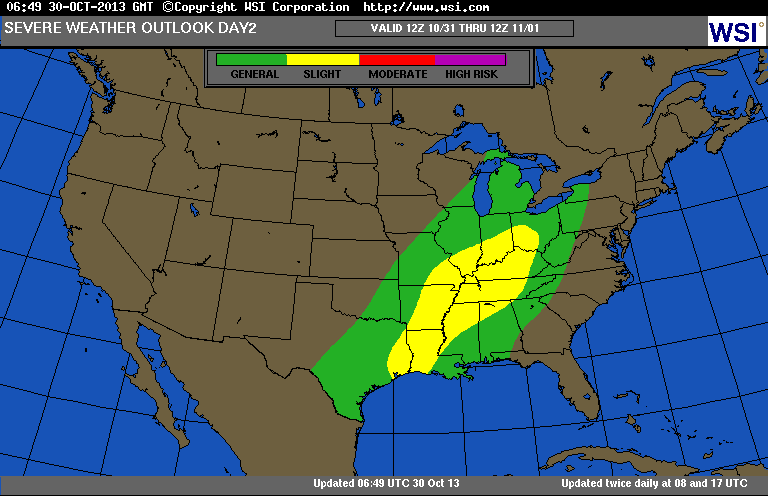
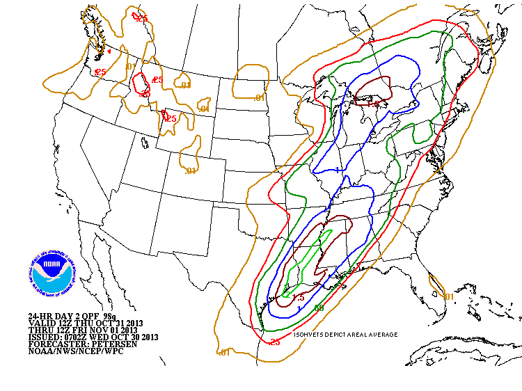
This chart shows the area of thunderstorms in green...with severe
possibility in yellow....all valid for Thursday. The chart below shows expected amounts of rain for Thursday's trick or treaters. Blue equals at least 1".....brown - 1 1/2 "........light green.....2"
possibility in yellow....all valid for Thursday. The chart below shows expected amounts of rain for Thursday's trick or treaters. Blue equals at least 1".....brown - 1 1/2 "........light green.....2"
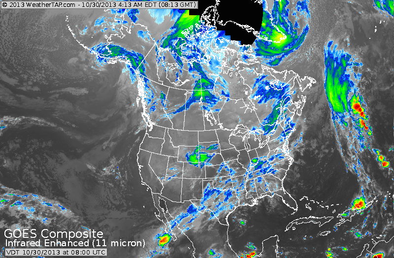
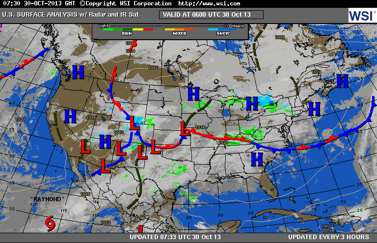
Below...satellite shows how Tropical system Raymond in the Pacific is sending moisture into the Plains....thus the reason for this storm to produce locally heavy rains as it moves across The Nation. Last picture is our weather map...showing extensive clouds across the Nation. Later.

 RSS Feed
