
Early morning satellite - radar shows snow over the Mid Atlantic and it will push north and bring snow to New England today...most of which will be light. Snow changes to a wintry mix this evening and then all rain in the Northeast. Western NY
and PA will not be as lucky where they can see up to 8" of snow.
and PA will not be as lucky where they can see up to 8" of snow.
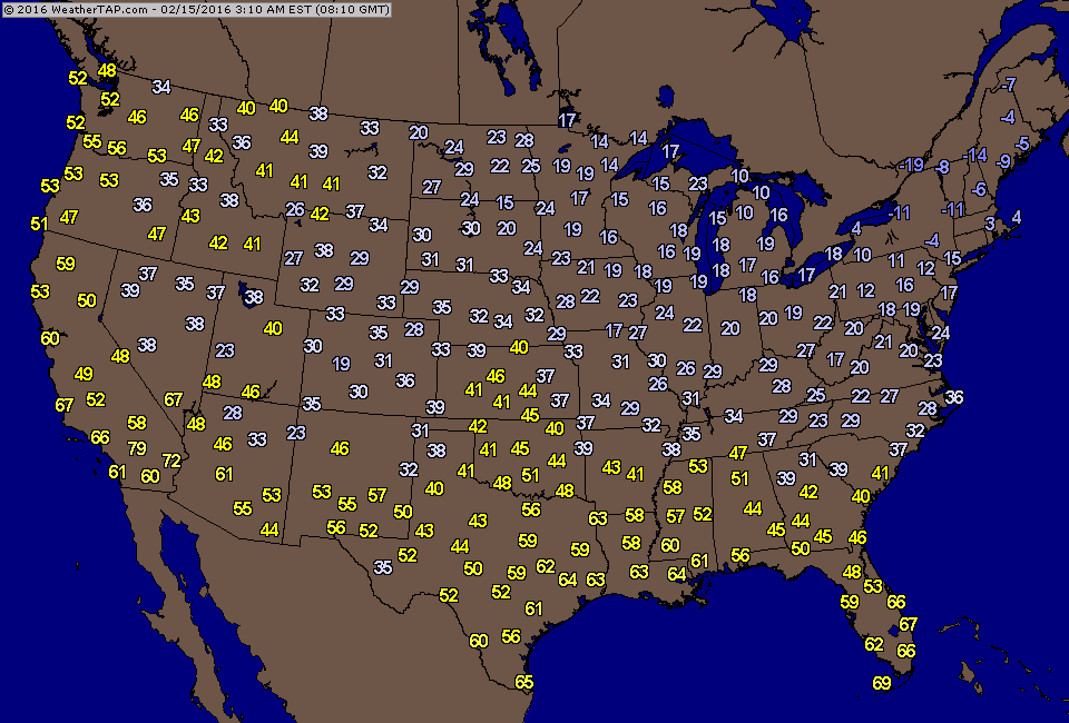
Early morning temperatures are still very cold in New England....thus reason for snow there and now in Mid Atlantic followed by ice.
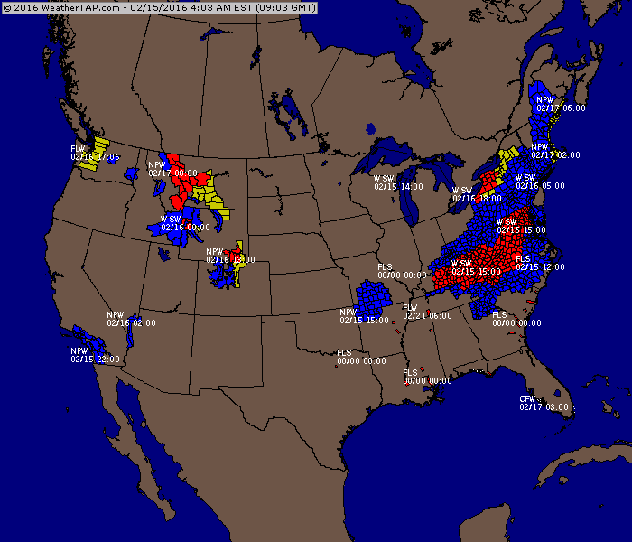
Above...current watches and warnings. Below....map for this evening explaining why there are so many.
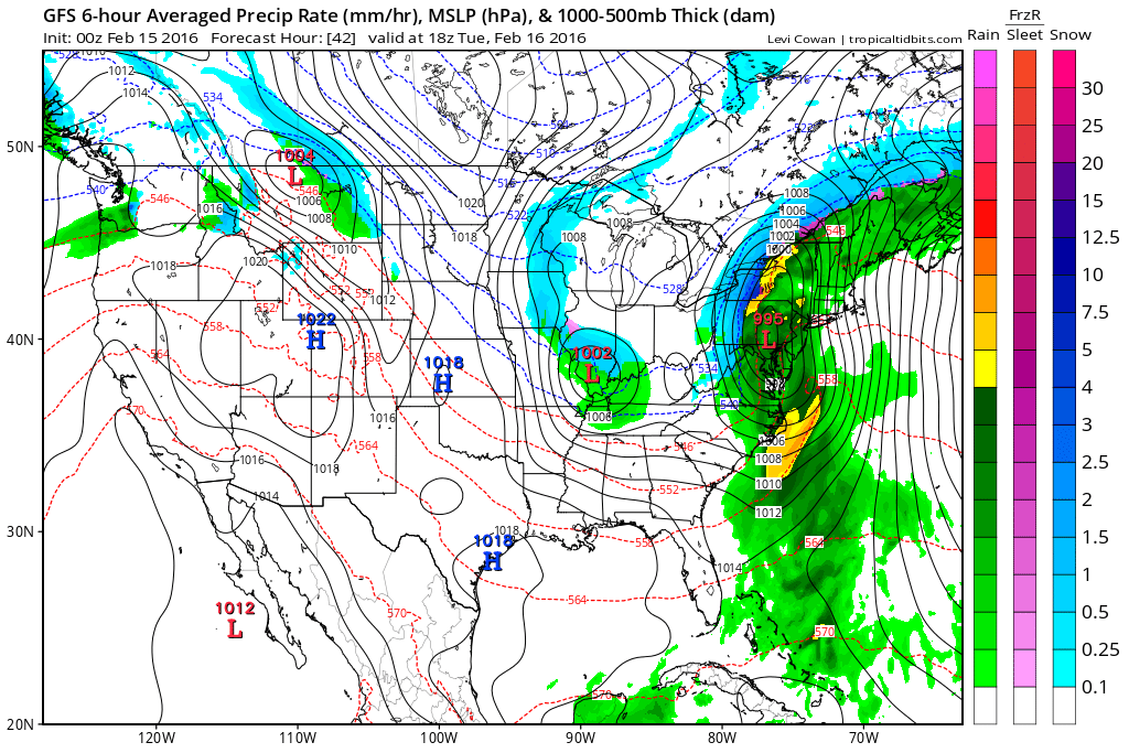
Tonight...winter storm is in Alabama and moving northeast.
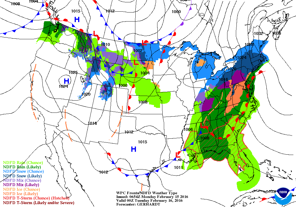
Below....map for Tuesday afternoon....showing the storm moving up through the Northern Appalachians.
Below....map for Tuesday afternoon....showing the storm moving up through the Northern Appalachians.
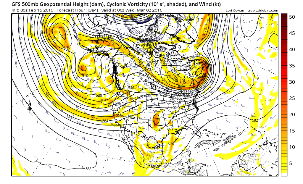
Below...map depicting the expected upper air flow for the start of March. This is called a split flow...with a trof sliding underneath a ridge. Not a good pattern. The ridge supplies cold air on the ground....while the trof supplies the movement of
warmer moist air up and over the cold air. For now...be safe today.
warmer moist air up and over the cold air. For now...be safe today.

 RSS Feed
