Today's unsettled weather in The East will ease but a new system will bring a swath of snow to Mid Atlantic and Southern New England Tuesday. Washington DC....PHily...NYC.....can all see 2-3" of snow
Tuesday before cold air returns and stays most of the work/school week.
Tuesday before cold air returns and stays most of the work/school week.
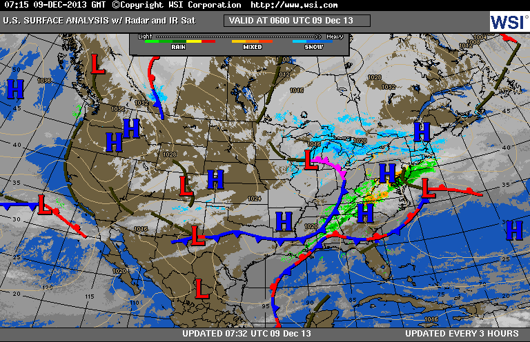

This water vapor shows the band of moisture affecting the East...but as the next jet streak comes in from the Plains...a low will eject from the
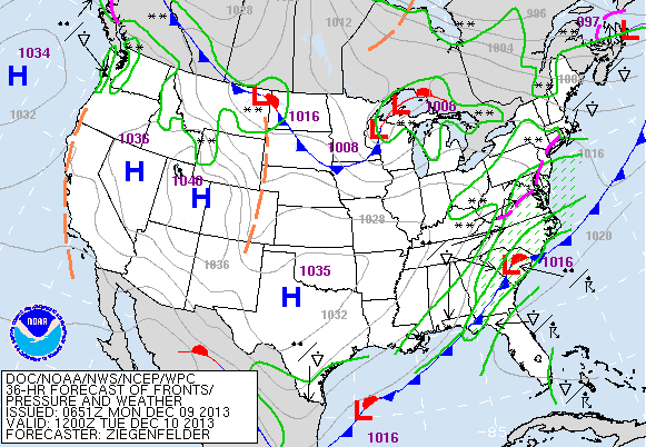
Southeast and bring that snow mentioned above. Arctic cold continues in Rockies and Plains. Below you will see weather map for Tuesday...
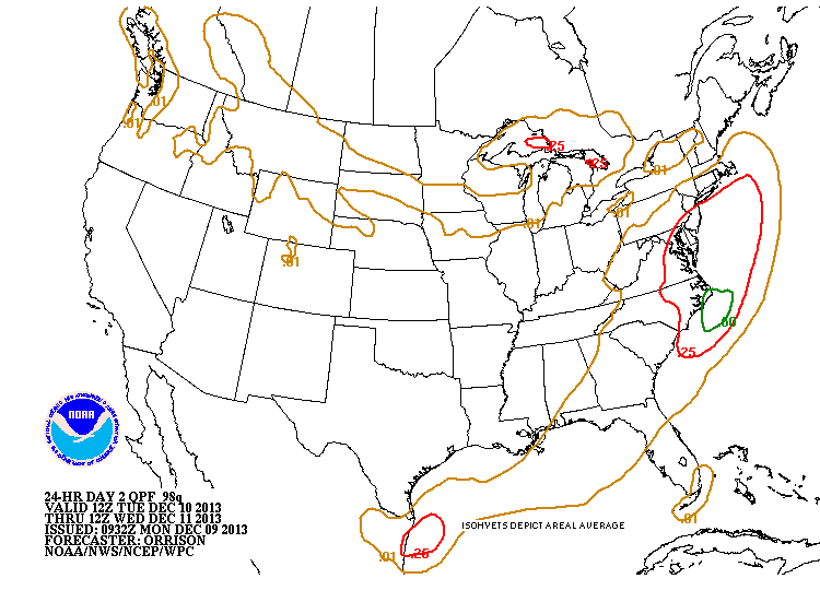
as well as amounts of liquid .....which converted to snow...would
equal 1"-3". Stay warm and safe. Later
Southeast and bring that snow mentioned above. Arctic cold continues in Rockies and Plains. Below you will see weather map for Tuesday...
as well as amounts of liquid .....which converted to snow...would
equal 1"-3". Stay warm and safe. Later

 RSS Feed
